The Croix des Oyardoux

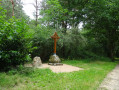
This walk, starting from Prémilhat church, is particularly well suited to Nordic walking, thanks to the quality of the paths. Along the way, you’ll come across the Croix des Oyardoux, restored in 2013 by Robert Perrot, which marks the junction of three former dioceses: Quinssaines, Teillet and Prémilhat.

Details

657659
Creation:
Last update:
Last review:
  • Walking
    Activity: Walking
  • ↔
    Distance: 6.22 mi
  • ◔
    Average duration: 3h 15 
  • ▲
    Difficulty: Moderate

  • ⚐
    Back to start: Yes
  • ↗
    Ascent: + 466 ft
  • ↘
    Descent: - 453 ft

  • ▲
    Highest point: 1,417 ft
  • ▼
    Lowest point: 1,086 ft
  • ⚐ Country: France
  • ⚐ City: Prémilhat (03410)
  • ⚑
    Start/End: N 46.313466° / E 2.53469°
  • ❏
    IGN map(s): Ref. 2328E, 2428SB
  • Hour-by-hour weather

Photos

Description of the walk

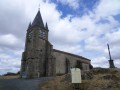
Car park and start of the walk: Place de l’Église in Prémilhat.

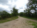
(S/E) As you leave the car park, take the road on the right, then first turn right then left as you pass the town hall. Continue along the street, which turns into a good track. Carry on along this track, ignoring the small paths to the right and left.
Further on, ignore the track branching off to the right and carry on straight ahead for about 150m.

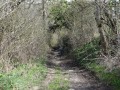
(1) Turn left onto the lovely track that leads into the woods. After a very slight left-right bend, carry on straight ahead through the woods along the path.

(2) At the end of the forest track, turn right onto a wide forest avenue. Cross the whole of the woodland until you come to a lovely track.

(3) Take this lovely track on the left until you reach a large crossroads (Carrefour des Moutons).

(4) Take the path on the right. Continue along this path until you come to a wide dirt track after crossing the Ruisseau du Mont.

(5) Turn right onto this track. Ford a tiny stream (the source of the Ruisseau du Mont) and, immediately afterwards, look out for the path on the left which climbs between woodland and meadows.

(6) Turn left and continue uphill through the woods until you come to a wide stony track.

(7) Take this track to the right. Carry on, ignoring the side paths to the right and left, until you reach a large crossroads.

(8) At the crossroads, take the path on the right which leads down towards Prémilhat (signpost). Pass the Croix des Oyardoux on your right and carry on straight ahead.

(1) Follow the same path straight on as on the way out until you reach the finish (S/E).

Waypoints

  1. S/E : mi 0 - alt. 1,086 ft - Prémilhat Church Square
  2. 1 : mi 1.34 - alt. 1,299 ft - Forest track
  3. 2 : mi 1.72 - alt. 1,345 ft - Forest avenue
  4. 3 : mi 2.26 - alt. 1,391 ft - Exit from the woods
  5. 4 : mi 2.71 - alt. 1,302 ft - Sheep Crossroads
  6. 5 : mi 3.13 - alt. 1,316 ft - Crossroads
  7. 6 : mi 3.24 - alt. 1,309 ft - Uphill path along the edge of the woodland
  8. 7 : mi 3.65 - alt. 1,398 ft - Gravel track
  9. 8 : mi 4.27 - alt. 1,398 ft - Major crossroads
  10. S/E : mi 6.22 - alt. 1,086 ft - Prémilhat Church Square

Reviews and comments

4.2 / 5
Based on 4 reviews

Reliability of the description
4.3 / 5
Ease of following the route
4.3 / 5
Route interest
4 / 5
visionrandonnées
visionrandonnées

Overall rating : 4 / 5

Date of your route : Jan 22, 2024
Reliability of the description : ★★★★☆ Good
Ease of following the route : ★★★★☆ Good
Route interest : ★★★★☆ Good
Very busy route : No

In these last few days of the year, I haven’t come across any other walkers. The route is easy, pleasant and well signposted.
Thank you.

Machine-translated

Serge_Augusta
Serge_Augusta

Overall rating : 4.7 / 5

Date of your route : May 03, 2021
Reliability of the description : ★★★★★ Very good
Ease of following the route : ★★★★★ Very good
Route interest : ★★★★☆ Good
Very busy route : Yes

A really lovely walk. The paths are in good condition, well-maintained and very easy to walk on.
An excellent family walk for all ages.
It’s particularly lovely when the weather’s really fine:

Machine-translated

jeannette vallet
jeannette vallet

Overall rating : 4 / 5

Date of your route : Jul 01, 2020
Reliability of the description : ★★★★☆ Good
Ease of following the route : ★★★★☆ Good
Route interest : ★★★★☆ Good
Very busy route : No

Some really good paths for this lovely walk. Between points 1 and 2, the little ‘right-left’ turn isn’t straightforward, but the GPS guides us well.
Thank you for sharing this route with us!

Machine-translated

anvtt
anvtt

Overall rating : 4 / 5

Date of your route : Aug 24, 2017
Reliability of the description : ★★★★☆ Good
Ease of following the route : ★★★★☆ Good
Route interest : ★★★★☆ Good

Hello
A lovely walking route, partly through woodland. There are also some lovely views between point 1 and Prémilhat
There’s a slight discrepancy between the map and GPX routes and the actual terrain; between points 1 and 2, there isn’t a break in the path – just follow the path straight on.
Thank you to the club for sharing the routes.

Machine-translated

Other walks in the area

For more walks, use our search engine .

The GPS track and description are the property of this route's author. Please do not copy them without permission.