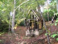
The Chapel of Saint-Étienne, the King of Rome and the Rudi Beech in the Eawy Forest

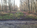
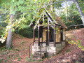
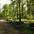
A circular walk through a beech forest, passing four notable sites in the Eawy Forest. The Limousins Forest Road at the Carrefour des Saules, the Roi de Rome Arboretum in Les Ventes-Saint-Rémy, on the hills above Rosay, the Rudi Beech and the little Saint-Étienne Chapel. This route suggests setting off in one go towards the northernmost point and exploring the four sites on the way back.

Details

n°2835015
Creation:
Last update:
Last review:
  • Walking
    Activity: Walking
  • ↔
    Distance: 6.90 mi
  • ◔
    Average duration: 3h 45 
  • ▲
    Difficulty: Moderate

  • ⚐
    Back to start: Yes
  • ↗
    Ascent: + 623 ft
  • ↘
    Descent: - 650 ft

  • ▲
    Highest point: 679 ft
  • ▼
    Lowest point: 410 ft

Photos

Description of the walk

Head to Rosay and leave Rosay via the D97, the ‘Route de la Forêt’, towards Pommeréval. At No. 12 Rue de la Forêt, take the Chemin de la Chapelle to enter the forest via the Route Forestière de Missy and continue up to the car park at the Chapelle Saint-Étienne.

(S/E) Leave the car park via the Route Forestière de Missy, heading east-north-east. Pass the Route Forestière d’Haussez on your right.

(1) At the crossroads (elevation 198), without going as far as the Route Forestière des Limousins, turn diagonally left to reach the Carrefour des Saules to the north via the Chemin Vert.

(2) When you reach the Carrefour des Saules, don’t linger; cross the Route Forestière des Limousins. Leave theGR® on your right and take the steepest path, heading north, until you reach its end, which is a lovely avenue: the Route Forestière des Ventes-Saint-Rémy.

(3) Turn right and head up the Route Forestière des Ventes-Saint-Rémy. Keep up a good pace until you reach the next small path.

(4) Look for the small path on your right which climbs up onto the plateau and follow it due south (elevation 169).

(5) Turn left, heading east, to make a detour to the arboretum via the Route Forestière de l’Eglise. A sight well worth a visit.

(6) Visit the King of Rome’s arboretum. Retrace your steps.

(5) Carry on straight ahead along the Route Forestière de l’Église. Then turn left and head downhill along the Route Forestière des Saules.

(2) Back at the Route des Saules junction, take a moment this time to have a look at the sign describing the flora, and, once you reach the Route Forestière des Limousins, enjoy being on this historic and unusual road.
Cross the Route Forestière des Limousins and head south-south-west along the Chemin Vert to the end, continuing straight on past point 1 until you reach the Route Forestière de Haussez.

(7) At the junction, turn left heading due south, following the Route Forestière de Haussez (elevation 164).

(8) About 300 metres further on, just before the end of the climb, you’ll find a path on the right – the Ligne Perrier – and turn onto it, heading west. Carry straight on along this path until you reach the Hêtre Rudi.
Take a moment to admire this remarkable tree before heading back towards the chapel.

(9) About 300 m past the Hêtre Rudi, leave the Ligne Perrier on the right by taking a path that turns back and then descends towards the Route Forestière du Fond Saint-Etienne (elevation 151). Head north.
Once on this track, turn left and follow it down towards Rosay, heading west.

(10) At the gate marking the entrance to the forest, look for a small path on the right which climbs up onto the plateau and follow it.

(11) Once you reach the chapel, the walk is almost over. The car park is 5 mins away. Enjoy the surroundings.
To return to the car park, leave the chapel at the back and continue uphill. Once you reach the plateau, turn left and head back to the car park (S/E).


Waypoints

  1. S/E : mi 0 - alt. 525 ft - Chapel car park
  2. 1 : mi 1.03 - alt. 646 ft - Junction for both outward and return journeys
  3. 2 : mi 1.42 - alt. 568 ft - Carrefour des Saules. Commune A/R
  4. 3 : mi 2.1 - alt. 459 ft - Route des Ventes-Saint-Rémy (downstream)
  5. 4 : mi 2.64 - alt. 564 ft - Route des Ventes-Saint-Rémy (upstream)
  6. 5 : mi 3.16 - alt. 666 ft - Junction for both outward and return journeys. Route forestière de l’Eglise
  7. 6 : mi 3.52 - alt. 679 ft - Arboretum
  8. 7 : mi 5.32 - alt. 541 ft - Five-way junction
  9. 8 : mi 5.53 - alt. 607 ft - Perrier route, towards Hêtre Rudi
  10. 9 : mi 5.95 - alt. 594 ft - T-junction. Turn right
  11. 10 : mi 6.7 - alt. 410 ft - Saint-Etienne ramp
  12. 11 : mi 6.75 - alt. 459 ft - Saint-Etienne Chapel
  13. S/E : mi 6.9 - alt. 525 ft - Chapel car park

Notes

An easy route with a map and compass; more difficult without a map or compass.
Can be completed in 3 hours by experienced walkers equipped with walking poles and walking boots. A 4-hour walk including a break at the arboretum.

Please note! Access to one of the paths is sometimes obscured. You must be vigilant and count your steps.

The car park is accessible via a forest road suitable for vehicles and can accommodate several cars. On foot, it takes around 30 minutes to reach the chapel car park from the edge of the woods, just outside Rosay.

All shops are in Saint-Saëns, including a chemist’s and a petrol station.

Worth a visit

Nearby:
- The ‘Chemin des Écoliers’ in Les Ventes-St-Rémy
- The Apple Museum in Rosay, also known as the Cider Museum
- The Val de Bures goat farm in Rosay

Always be cautious and plan ahead when you're outdoors. Visorando and the author of this route cannot be held responsible for any accidents occurring on this route.

The GR® and PR® markings are the intellectual property of the Fédération Française de Randonnée Pédestre.

Reviews and comments

4.2 / 5
Based on 2 reviews

Reliability of the description
4 / 5
Ease of following the route
4 / 5
Route interest
4.5 / 5
brunodufays
brunodufays

Thank you for your message. It is true that the EAWY forest has changed over the past six years. The ONF carries out logging there on an ongoing basis using heavy machinery. This work alters the course of the footpaths.

Machine-translated

User 26646152

Some sections are in poor condition and impassable.
At landmark no. 4, do not turn right (impassable path); it is preferable to continue straight ahead to make a detour and reach landmark no. 6.
Wear good shoes, waterproof if possible, as some of the paths are waterlogged.
The hike takes 2½ hours at a normal walking pace.

Machine-translated

massouille 06
massouille 06

Overall rating : 5 / 5

Date of your route : Nov 02, 2020
Reliability of the description : ★★★★★ Very good
Ease of following the route : ★★★★★ Very good
Route interest : ★★★★★ Very good
Very busy route : No

A walk we went on during the summer that introduced us to a stunning part of this forest. We’ll definitely be doing it again!

Machine-translated

brunodufays
brunodufays
• Edited:

Thank you for this feedback on this hike, which is indeed long and more challenging than others in the Eawy Forest. That said, when I read on Visorando about routes in the Alps described as ‘easy’ even though they take 6 hours and include sections ‘off the marked trail’, I cannot describe this route as ‘difficult’.
That said, yes, the route is tricky in a few places. Did you have a map and a compass with you? Because, in truth, in the Eawy Forest, without a map and a compass, it’s tricky. I’ve done the route several times myself and I doubt I could improve the description. But I’ll give it another go
As for the state of the ground, well, I suppose you just have to make do with it. Between September 2019 and March 2020, the Eawy Forest received a year’s worth of rainfall in a single season, when the vegetation isn’t absorbing any water and the sun isn’t evaporating any. So, yes, the ground in the Eawy Forest is waterlogged. You’ve witnessed the start of this forest’s likely transformation. Paths that are rutted because they’re waterlogged, trees planted in mud rather than firm ground – and therefore ready to topple at the slightest gust of wind, which are now often far more violent than they used to be. Let’s make the most of this forest whilst it still exists . With a map, a compass and good walking boots.

Machine-translated

BOLINGUE Daniel
BOLINGUE Daniel

Overall rating : 3.3 / 5

Date of your route : Mar 03, 2020
Reliability of the description : ★★★☆☆ Average
Ease of following the route : ★★★☆☆ Average
Route interest : ★★★★☆ Good

With the recent spate of bad weather, it is very difficult, if not impossible, to go on this walk (fallen trees, too much water on the paths, etc.); furthermore, the directions provided for this route are inadequate, as it is a forest trail and, at times, there are several paths starting from the same point.

Machine-translated

Other walks in the area

For more walks, use our search engine .

The GPS track and description are the property of this route's author. Please do not copy them without permission.