The ‘Roi de Rome’ circular route to the ‘Puits merveilleux’

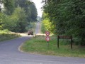
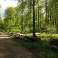
A four-hour walk through the forest, forming a large circular route around the village of Les Ventes-Saint-Rémy, taking in three points of interest: the Arboretum du Roi de Rome; the memorial to airmen who fell during the Second World War; and the ‘Trou du Puits Merveilleux’.

Details

n°2838074
Creation:
Last update:
Last review:
  • Walking
    Activity: Walking
  • ↔
    Distance: 7.59 mi
  • ◔
    Average duration: 3h 45 
  • ▲
    Difficulty: Moderate

  • ⚐
    Back to start: Yes
  • ↗
    Ascent: + 279 ft
  • ↘
    Descent: - 279 ft

  • ▲
    Highest point: 741 ft
  • ▼
    Lowest point: 486 ft

Photos

Description of the walk

Head to the Arboretum du Roi de Rome, in the village of Ventes-Saint-Rémy, on the Route Départementale 12.

(S/E) Leave the arboretum car park via the Route Forestière de l’Église (west), with your back to the village and leaving the arboretum on your left.

(1) This is the westernmost point of the circular loop. Turn right onto the path heading due north until you reach the Route Forestière des Ventes-Saint-Rémy. Turn right onto this road and, a little further on, turn left towards the north onto a path, crossing the Chemin Forestier du Faîte and joining the tarmac Route Forestière de l’Épinette.

(2) This is the northernmost point of the circular route. Once on the road, turn right, head south-east, cross the departmental road and carry on straight ahead, east-south-east, along the Route Forestière des Longs Vallons.
Join the Route Forestière du Gros Chêne and follow it straight on, heading south-east. Cross the departmental road and continue south-east until you reach the Route Forestière de la Commission.

(3) Turn left to make a detour north-east and head for the memorial via the Route Forestière de la Commission.

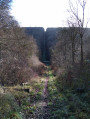
(4) This memorial stone is the easternmost point of the circular route. Retrace your steps.

(3) Take the Commission Forest Road, heading south-west, to the Puits Merveilleux path.

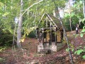
(5) Look for the path on the right and follow it westwards. Discover the Puits Merveilleux. Continue along the path, still heading west, until you reach the small car park at the Puits Merveilleux.

(6) This car park is the southernmost point of the circular route. Take the Route Forestière des Limousins towards Les Ventes-Saint-Rémy, heading north-west.

(7) Leave the Route Forestière des Limousins a little further on, turning right onto the Chemin des Écoliers.

(8) Leave the nature trail on your right and head north-west towards the village. Pass the picnic area and the ‘Hêtre des Écoliers’. Walk straight through the village to the arboretum, passing in front of the church and then crossing the D12 (S/E).


Waypoints

  1. S/E : mi 0 - alt. 679 ft - Arboretum
  2. 1 : mi 0.29 - alt. 666 ft - Due north
  3. 2 : mi 1.51 - alt. 486 ft - Longs Vallons
  4. 3 : mi 3.95 - alt. 732 ft - Crossroads by the memorial stone
  5. 4 : mi 4.02 - alt. 732 ft - Access to the memorial stone
  6. 5 : mi 5.22 - alt. 679 ft - The ‘Puits Merveilleux’ Trail - Le puits Merveilleux
  7. 6 : mi 5.67 - alt. 663 ft - Puits Merveilleux car park (Maucomble)
  8. 7 : mi 6.01 - alt. 656 ft - Schoolchildren
  9. 8 : mi 6.79 - alt. 702 ft - Schoolchildren’s beech
  10. S/E : mi 7.59 - alt. 679 ft - Arboretum

Notes

Alternative route with a more leisurely start:
(S/E) Leave the arboretum via the D12, heading towards Pommeréval (north). On leaving the village, leave the D12 and take theGR® northwards. Follow the GR®.
(2) Rejoin the rest of the route at the start of the Route des Longs Vallons.

All shops are in Saint-Saëns, including a chemist’s and a petrol station.

Worth a visit

Saint-Saëns
Maucomble and its remarkable boxwood

Always be cautious and plan ahead when you're outdoors. Visorando and the author of this route cannot be held responsible for any accidents occurring on this route.

The GR® and PR® markings are the intellectual property of the Fédération Française de Randonnée Pédestre.

Reviews and comments

3.4 / 5
Based on 3 reviews

Reliability of the description
3.7 / 5
Ease of following the route
4 / 5
Route interest
2.7 / 5
Spartiate76
Spartiate76

Overall rating : 3 / 5

Date of your route : Mar 15, 2022
Reliability of the description : ★★★☆☆ Average
Ease of following the route : ★★★☆☆ Average
Route interest : ★★★☆☆ Average
Very busy route : No

The map shows the names of paths that are not signposted on the ground. We were unable to find the correct turn-off at point 1 and had to settle for reaching the sewage treatment works via the ‘Route forestière des trois saules’. We then followed the ‘Route du Val des Grés’ up to the 208-metre mark before descending to the 161-metre mark at Les Longs Vallons. The ‘Puits Merveilleux’ is not very easy to find but is well worth a visit. The ‘Chemin des Écoliers’ is not signposted when leaving the Route des Limousins; you need to pass between plots 367 and 368. Alternative route: Set off from the town hall in Les Ventes-Saint-Rémy via the Route de l’École and the Impasse de la Chapelle, climb to elevation 208, then descend to Les Longs Vallons at elevation 161. This shortens the circular route by approximately 2 km.

Machine-translated

brunodufays
brunodufays

It’s true that winter walks in the Normandy forests don’t always keep you dry. The Eawy Forest is, in fact, muddy outside those wide, well-trodden paths.

Machine-translated

hubsm
hubsm

Overall rating : 3.3 / 5

Date of your route : Feb 20, 2022
Reliability of the description : ★★★★☆ Good
Ease of following the route : ★★★★☆ Good
Route interest : ★★☆☆☆ Disappointing
Very busy route : No

Do not undertake this in winter.
The cross-country paths at the start are rather difficult to navigate.
I’d chosen this route because it features plenty of forest tracks, which are safer in winter.
But the start of the walk along the cross-country paths was a bit of a mess.

Machine-translated

brunodufays
brunodufays

Yes, indeed, plot numbers are the only reliable way of finding the cross-country paths. I’ll correct that. However, as far as forest tracks are concerned, I believe they’re unavoidable in the Eawy Forest. Personally, when I decide not to use them, I go off-track using a compass.

Machine-translated

Eric Manné
Eric Manné

Overall rating : 4 / 5

Date of your route : May 21, 2020
Reliability of the description : ★★★★☆ Good
Ease of following the route : ★★★★★ Very good
Route interest : ★★★☆☆ Average
Very busy route : No

We were looking for a fairly long route through the woods.
The route is well described and the map is accurate, but the side paths to take are poorly marked as they are rarely used. You have to keep track of the metres to be sure you’re on the right paths. Using the forest plot markers would provide reliable directions.
The start is very pleasant, but you soon come to wide, main tracks that lack charm, and despite being in the forest, we would have preferred to be on dirt tracks rather than stone or tarmac ones.

Machine-translated

Other walks in the area

For more walks, use our search engine .

The GPS track and description are the property of this route's author. Please do not copy them without permission.