Country:
 City:


Start/finish: car park in front of the abbey on Rue des Leups, on the left as you go up Rue du Chamiteau.
(S/E) From the car park, turn right and head up Rue des Leups. When you reach the junction in the hamlet, take the road on the left until the next junction.
(1) Leave the tarmac road and take the forest track to the right after the last house (sign: Route de l’Abbaye vers l’Étoile). Continue to the hamlet of Chamiteau.
(2) Do not take the tarmac road leading into the hamlet, but instead head straight ahead onto the path that enters the forest; after a few dozen metres, you’ll reach a Fork in the road: take the left-hand path, which leads into a forest track. When you reach a forest track, turn right, and at the next junction (at the top of the slope) turn left. This Route Forestière de l’Étoile may look straight and monotonous on the map, but on the ground it is a pleasant path that undulates with ups and downs through a beautiful mixed forest.
(3) You’ll reach the Carrefour Charles, with its imposing monument: “Three days to save our honour”. Take the educational trail which starts behind the monument, visit two blockhouses, and returns to the Route Forestière de la Prise Milot. Follow the road to the first junction (Route Forestière du Conservateur).
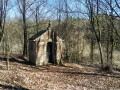
(4) Turn left to visit the blockhouse, return to the junction and turn left for about 100 m.
(5) Turn left onto a small tarmac road. The features shown on the IGN map are not visible. Follow this small road until you reach another tarmac road. Cross it and continue straight ahead on the tarmac road, which has been covered with humus over time and has become a very pleasant path through vegetation that is sometimes overgrown.
This track is lined with military installations, alternating on the right and left. These are concrete-paved half-moons, protected by earthen embankments 2 to 3 metres high. You’ll come to a forest track, which you cross.
(6) Head a few metres to the right before entering a track almost directly opposite. You’ll reach an earthen track (Laie du Cara). Turn left until you reach the Route Forestière du Conservateur, then turn right. At a blockhouse on the left, the path begins to descend and, about fifty metres before a culvert, look out for a path that branches off diagonally to the right.
(7) Follow an anti-tank trench eastwards and then southwards; it is signposted (dark green arrow) and lined with blockhouses and information boards: this is the most significant section of this ‘open-air museum’ of the Maginot Line. After a few strategic zigzags along the trench, you’ll reach a junction with a forest road, marked by another blockhouse.
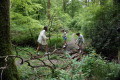
(8) Take this road on the right, heading south, passing two blockhouses on your right-hand side. You’ll reach a crossroads.
(9) Turn left onto the Route Forestière de Gratte-Pierre, a lovely tarmac road. When you reach the bridge over the Artoise, you’ll find an open shelter on the left in a lovely picnic spot: a potential refuge in case of bad weather. Continue along the forest road, which climbs uphill and leads to the large Charme Baudet roundabout with its two picnic tables.
(10) Two options:
- either go directly from point 10 to point 13. The blockhouses and information are somewhat similar to what you’ve seen previously.
- or follow the route description and head east along the Route Forestière Isaïe,the third Maginot Line discovery trail. Continue to the junction with the Route Forestière de Cendron.
(11) Turn right, then immediately left onto the forest track that winds its way up. After 800 m, take the Route Forestière des Colonies – a lovely tarmac road – to the Watigny roundabout.
Note: the picnic area indicated is in very poor condition; one of the tables is almost completely destroyed and overgrown with brambles, whilst the other is badly damaged and barely usable.
(12) At the roundabout, follow the path westwards down towards a slightly damp gully, which is passable via some conveniently placed stones and branches. Head back up and join the lovely Laie Nicaise. Turn left onto this path, then leave it via the first path on the right. This will take you to the Route Forestière du Milieu.
(13) Turn left as you descend to a bridge, then head uphill and descend a little further.
(14) Leave the forest road and head right, following a path clearly marked by vehicle tracks leading down towards the Grand Riaux. This track turns right before reaching the stream, and gradually becomes a quad bike track, then a motorbike track. The track continues but then tends to fade away (an area used for baiting game with salt blocks). If this happens, head back up to the left to reach a track that is clearly marked by vehicle tracks.
Follow this track; the path becomes a good footpath, which veers left to follow the stream slightly above it. You’ll reach a junction of forest tracks that cross the stream via a ford, but a footbridge allows pedestrians to cross the Grand Riaux without getting their feet wet.
(15) Cross the footbridge and follow the Gland along its right bank. After 500 m, you’ll reach another footbridge. Cross it to reach the left bank of the Gland. There’s a large, pleasant picnic area here, which also has a car park.
(16) Immediately turn right onto the correct path which follows the left bank of the Gland and leads to another footbridge that takes you back to the right bank.
(17) Do not take the track heading north, but take the north-westerly path which gradually moves away from the Gland. This path turns due west, climbing up the hillside before reaching a tarmac road which leads up to the forest house on the right.
(18) Head left along the road for a few metres, cross the culvert, then turn right onto the path that climbs into the woods just before the first house. Then head due north.
As you approach the ridge and the houses, take a fork in the path leading towards two large reservoirs. Go round them on the right. You’ll come to a fork in the road.
(19) Turn left and immediately head down to the right, along Rue Cocréaumont. Then turn right twice, following Rue de Rochettes. At the next junction, turn left onto Rue Jean Jaurès, which leads to the Maison du Prévost.
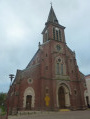
(20) Then head right towards the abbey and return to the car park (S/E).



 Association / Club / Walk leader
 Easy

 Visorando Member
 Moderate

 AONB