The Fourchet d'Orival circular trail in the Eawy Forest

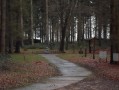
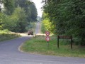
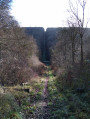
Circular hike in the Eawy Forest between Orival and Le Châtelet, following beautiful, well-marked forest tracks. Beech trees, more beech trees, but one of the most beautiful beech forests in France. Ideal for a short outing for experienced hikers or a longer hike for beginners. Very easy access via the wide and pleasant D154 country road.

Details

670677
Creation:
Last update:
Last review:
  • Walking
    Activity: Walking
  • ↔
    Distance: 4.16 mi
  • ◔
    Average duration: 2h 15 
  • ▲
    Difficulty: Easy

  • ⚐
    Back to start: Yes
  • ↗
    Ascent: + 377 ft
  • ↘
    Descent: - 377 ft

  • ▲
    Highest point: 617 ft
  • ▼
    Lowest point: 240 ft

Photos

Description of the walk

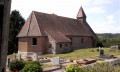
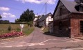
(S/E) Set off from the chapel and, on the other side of the D154 road, take the street known as Chemin du Fourchet d’Orival, a tarmac road that climbs towards the forest (north-east), with houses on the right. The route consists of a sloping tarmac road followed by a flat dirt track.

Follow the Chemin du Fourchet d’Orival to the Orival fork in the road.

(1) At the Orival fork in the road, there is a signpost. Leave the Route Forestière de la Loge on your right – this will be your return route – and turn left and downhill onto the Route Forestière du Fourchet d’Orival (north-east).

(2) Caution! The Route forestière du Fourchet d’Orival crosses the Route forestière du Grand Maître. At this point, the track changes character and becomes less passable. To stay on the Route forestière du Fourchet d’Orival, you must take a sort of double bend, first turn right then left (north-east). Tip: head into the forest between plot no. 151 on the left and plot no. 177 on the right. Do not take the Route forestière du Grand Maître, as this is very well-maintained. You’ll arrive at the Route des Limousins, a tarmacked road.

(3) Turn right (south-east) along the pond. Take a moment to look at the Saint-Paterne pond. Follow the Route des Limousins to the Châtelet crossroads, where five lovely roads meet.

(4) The Route des Limousins continues straight on for some distance through the forest. At this junction, it changes from a tarmac road to a dirt track. Turn right onto the forest track at a right angle: the Route du Châtelet (south-west). Do not take the Route du Grand Maître.

(5) At the start of the Route Forestière de la Loge, about 900 metres from the Châtelet crossroads, leave the Route Forestière du Châtelet by turning right to head down towards the Orival Fork in the road via the Route Forestière de la Loge (west).

(1) At the Orival fork in the road, the circular loop ends. Continue straight ahead, veering slightly to the left, to head back towards the Orival chapel via the same path as on the way there, the Chemin du Fourchet d’Orival.

At the end of the path, leave the forest, come out onto the small tarmac road, then onto the D154, and finally back to the starting chapel (S/E).

Waypoints

  1. S/E : mi 0 - alt. 240 ft - Orival Chapel
  2. 1 : mi 0.81 - alt. 387 ft - Fourchet d’Orival
  3. 2 : mi 1.64 - alt. 525 ft - The Grand Master’s Trap
  4. 3 : mi 1.91 - alt. 577 ft - Mare Saint-Paterne
  5. 4 : mi 2.15 - alt. 604 ft - Carrefour du Châtelet
  6. 5 : mi 2.72 - alt. 591 ft - Descent towards Le Fourchet
  7. S/E : mi 4.16 - alt. 240 ft - Orival Chapel

Notes

The starting point is on the D154 road at Chapelle Saint-Paër, Hameau d’Orival, Saint-Hellier, 76680. Halfway between Bellencombre and Saint-Hellier, at the Orival chapel, in the Varenne valley.
See http://www.patrimoine-religieux.fr/eglis...

There is a car park with space for several cars near the chapel, alongside the road, which is wide with broad verges.
Take care when crossing the D154, which is a fairly busy road.

The Grand Master’s trap. (2) If you fall into this trap and take this road instead of continuing along the Route Forestière du Fourchet d’Orival, you won’t get lost but you’ll miss the Route des Limousins and the Saint-Paterne pond.

There are no water sources nearby, no shops in Saint-Hellier and very few in Bellemcombre. The nearest shops are in Grandes-Ventes to the north, Saint-Saëns to the east, Bosc-le-Hard to the south and Torcy to the west.

Hunting area. The Eawy Forest is open for hunting. Walking is prohibited on hunting days. The ONF provides the dates. See the ONF website.

Hé à vie. The name of the Eawy Forest is pronounced ‘Hé à vie’.

Worth a visit

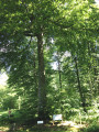
Beech is the most common tree species in the Eawy Forest, making it one of the finest beech forests in France. Wild cherry trees are also found there.

The Route des Limousins is the forest track that crosses the Eawy Forest from east to west. Anyone who hasn’t travelled along this track hasn’t ‘done Eawy’ (3).

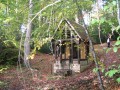
The Saint-Paër d’Orival Chapel is a typical chapel of the Pays de Bray. The road and the Châtelet crossroads are typical of the Eawy Forest. The Saint Paterne pond is a typical water feature of the Eawy Forest.

Picnic area. The Châtelet crossroads (4) is accessible by car via the road from the hamlet of Saint-Martin, Bellencombre, to Les Grandes-Ventes. Car park and picnic area.

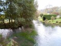
The Varenne is a small river a 5-minute walk from the chapel, at the foot of the other slope, accessible via Rue de la Filature, on the D154 road towards Saint-Hellier.

The Muchedent bison. Bison, teepees, kayaks, a restaurant. A rather unusual spot. See http://www.revedebisons.com/.

Bellencombre. The childhood village of French judoka David Douillet.

Saint-Hellier. Its village, its church, its river and its fishing ponds.

Hunting with hounds. The Châtelet crossroads is a starting point for hunts with hounds in the Eawy Forest.

Reviews and comments

4.8 / 5
Based on 4 reviews

Reliability of the description
5 / 5
Ease of following the route
5 / 5
Route interest
4.3 / 5
brunodufays
brunodufays

Thank you. Yes, that’s right; as the Route des Limousins is one of the few roads where you can park right in the middle of the forest, it’s used by cars. Yes, that’s right too; the Saint-Saens-Dieppe B-road is quite busy.

Machine-translated

papy diouf
papy diouf

Overall rating : 4.7 / 5

Date of your route : May 25, 2020
Reliability of the description : ★★★★★ Very good
Ease of following the route : ★★★★★ Very good
Route interest : ★★★★☆ Good
Very busy route : No

A lovely, easy walk in the Eawy Forest;
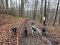
Done with a young puppy and a small adult dog, off the lead with good recall and no cars except on the Route des Limousins and at the finish

Machine-translated

AnGB
AnGB

Overall rating : 4.7 / 5

Date of your route : Feb 18, 2019
Reliability of the description : ★★★★★ Very good
Ease of following the route : ★★★★★ Very good
Route interest : ★★★★☆ Good

A pleasant little walk, though the car park by the roadside is a bit dangerous.
Clear paths and lanes at the end of winter; a walk enjoyed in the sunshine.

Machine-translated

MALET Catherine
MALET Catherine

Overall rating : 4.7 / 5

Date of your route : Oct 22, 2018
Reliability of the description : ★★★★★ Very good
Ease of following the route : ★★★★★ Very good
Route interest : ★★★★☆ Good

A lovely walk through this beautiful forest, especially with the autumn colours.

Machine-translated

elisa1967
elisa1967

Overall rating : 5 / 5

Date of your route : Jul 30, 2017
Reliability of the description : ★★★★★ Very good
Ease of following the route : ★★★★★ Very good
Route interest : ★★★★★ Very good

A very easy walk with excellent signposting.
Takes about 1½ hours, but can easily be extended as desired using the information sheet.

Machine-translated

Other walks in the area

For more walks, use our search engine .

The GPS track and description are the property of this route's author. Please do not copy them without permission.