Country:
 City:
City:


You must drive through Hauteville-lès-Dijon via the D107 to reach Fort d’Hauteville. It is easily recognisable thanks to the mast overlooking it. It is also possible to reach it from the D971. A car park to the south of the fort provides easy parking.
(S/E) From the car park, the path runs alongside the fort on the left, passing at the foot of the mast. Then turn right, following the fence until the path bends to the left, going round a large tree.
(1) Head towards the power lines until you cross a track, then continue straight on to join a small tarmac road coming from the village of Hauteville-les-Dijon. This leads to a place called Sur la Tête des Chevaux, where you’ll find a farm building on the left.
(2) Continue in the same direction (north-west) through very open countryside until you reach the edge of the Bois du Chêne on your left. The path, which is no longer tarmac, soon enters the woodland before following the valley floor to reach a crossroads of paths at the bottom of the valley, at elevation 383 at the foot of Les Minières.
(3) Turn left, then further on, turn right to climb up a pleasant wooded valley. The path leads out of the woods and offers a view of the village of Darois. On the right are the aerodrome buildings. Turn right to follow the edge of the woods up to elevation 451, just before La Roche Chaignot.
(4) Continue to the left to reach the first houses of Darois at elevation 495, on Rue du Grand Puits.
(5) Turn right, then cross a junction and take a path slightly to the left. Yellow signs indicate the routes. This is a good path that quickly takes you to the Orée du Bois campsite, where you can see the swimming pool renovation works.
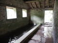
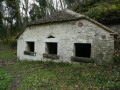
(6) Turn right onto the path leading down towards the valley and follow it to the wash house. This is a little off the path but is well worth a visit as it has been beautifully restored.
(7) Continue along the path at the bottom of the valley, which is also theGR®2andGR®7, until you reach the Combe de Chênaux and the Bois Brûlé.
(8) Turn left towards the Fontaine de la Trouvée, then right. Head up the valley; you’ll soon come across theGR® 2 markings and take a slightly steep path on the right which climbs towards the Fontaine de la Trouvée.
(9) Continue along the path, which is a little tricky but broadly follows a contour line before turning sharply to the right to follow a straight track. This leads to the 503-metre mark, where you’ll find a large field on the left and the Bois de la Vaseraie.
(10) Turn right onto the lovely, straight forest lane, which slopes gently downwards, and follow it for 1.5 km. The path then turns sharply to the right, leading back down a little further to the beautifully landscaped Source des Chênaux.
(11) After the spring, continue down to the left and then left again through the Combe de Chênaux until you reach a major crossroads at the bottom of the valley. Keep to the right and, at the second crossroads, take the path opposite signposted ‘les Minières’. This slightly steep path takes you through the Bois Monsieur and back onto the plateau.
(12) As you emerge from the woods, you’ll come across the Bassot de Ragot fields. Continue straight on towards a copse of trees, then follow the gently sloping path back to the beautiful Rogne spring on your left.
(13) The path is now tarmacked. It descends slightly before climbing again after a wide bend just before the wooded Combe de Talant. Once more, you’ll reach the fields and the view over the Dijon plain, then continue to the junction at Cote 406.
(14) Turn right onto a wide dirt track; you’ll soon pass under the power lines and emerge a little further on onto a small road. Turn left towards the first houses of Hauteville-lès-Dijon and Rue des Riottes, which is just past the first house.
(15) Follow it to the right, heading south. You’ll pass a very pretty square on your right; continue on to the first junction, then turn right onto Rue du Fort, which leads directly there. The road (D107) is used by cars. It is in poor condition, so please take care. In front of the fort, after a bend to the left, you’ll return to the starting point of the walk (S/E).


 A lovely walk, very well signposted, fairly easy
 Visorando Member

 Association / Club / Walk leader
 Easy
Easy 
 Difficult