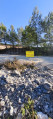
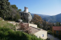
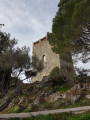
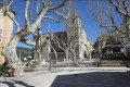
The Siou Blanc sheepfold at the start of the trail in Le Revest-les-Eaux

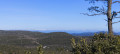
This hike takes you to the Siou Blanc plateau. After passing the quarry, a path through the heath will lead you to a beautiful sheepfold in our region, despite its graffiti.
You will enjoy a variety of landscapes and a multitude of scents that change with the seasons. Have a good walk.

Details

2686107
Creation:
Last update:
Last review:
  • Walking
    Activity: Walking
  • ↔
    Distance: 10.85 mi
  • ◔
    Average duration: 6h 35 
  • ▲
    Difficulty: Moderate

  • ⚐
    Back to start: Yes
  • ↗
    Ascent: + 1,867 ft
  • ↘
    Descent: - 1,844 ft

  • ▲
    Highest point: 2,559 ft
  • ▼
    Lowest point: 906 ft

Photos

Description of the walk

Departure from the stadium in Le Revest-les-Eaux. For parking, see § Practical information.

(S/E) At the stadium, near the changing rooms, take theGR® 99 (marked red and white) on the right, which is signposted towards Signes. You will reach a crossroads at a high-voltage pylon. Continue right on theGR®. You will reach the Col des Morts.

(1) Continue up theGR®, overlooking the Fiéraquet quarry. You will reach a large crossroads of paths.

(2) Turn left and walk back to see the impluvium. Return to the wide track and continue to the left. Keep the summit of Rouca Traouca on your left, staying on theGR® towards Signes. You will reach a trail junction at a fenced-off karstic cave with a sign for Signes and Le Revest.

(3) Continue on theGR®, cross the forest road from Signes to Sollies-Toucas, and reach the Siou Blanc sheepfold.

(4) Return via the same track to the previous crossroads.

(3) Take the path on the left, which runs parallel to theGR®. Walk to the Aven du Grilladier crossroads.

(5) Turn left onto the track and pass under the high-voltage power line. Walk along the karstic cave and cross another track to reach a cistern located in a recess on the right.

(6) Continue straight ahead. The track soon seems to end, narrowing at the high-voltage power line.

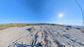
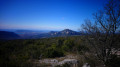
(7) Pass under it and join a wider track. Turn right and begin the climb that ends at the top of the Pyramide de Cassini. Enjoy the magnificent 360° view from here.

(8) Begin the descent via the blue-marked trail. Pass under the high-voltage power line further down to reach the quarry road.

(9) Take it to the right, pass in front of the entrance to the quarry and reach the end of the tarmac road.

(10) Turn left onto the yellow-marked trail. This discreet trail, eroded by runoff, leads to the stadium car park (S/E).

Waypoints

  1. S/E : mi 0 - alt. 906 ft - Car park at the Revest-les-Eaux stadium
  2. 1 : mi 0.93 - alt. 1,818 ft - Col des Morts
  3. 2 : mi 1.75 - alt. 2,192 ft - Carrefour impluvium
  4. 3 : mi 3.78 - alt. 2,070 ft - Crossroads of the circular
  5. 4 : mi 4.3 - alt. 2,034 ft - Siou Blanc sheepfold
  6. 5 : mi 6.26 - alt. 2,201 ft - Crossroads towards the karstic cave
  7. 6 : mi 6.77 - alt. 2,333 ft - Cistern
  8. 7 : mi 7.1 - alt. 2,379 ft - High-voltage power line
  9. 8 : mi 7.8 - alt. 2,559 ft - Au somet la pyramide de Cassini
  10. 9 : mi 9.73 - alt. 1,342 ft - Quarry road
  11. 10 : mi 10.13 - alt. 1,217 ft - Crossroads on the return trail
  12. S/E : mi 10.85 - alt. 906 ft - Car park at the Revest-les-Eaux stadium

Notes

Parking: there is a car park opposite the stadium gate, where I was told that vehicles had been broken into. So be careful, take as few vehicles as possible, there is a car park in the village. Carpool.
Do not do this hike in rainy weather, as the rocks are slippery and there is significant runoff in some of the ravines along the trail.
There are no drinking water sources. Wear good hiking boots.

Worth a visit

(Between 1 and 2) The Fiéraquet quarry has been expanding over the years at the expense of nature.
(2) The Orves catchment area.
(4) The Siou Blanc sheepfold is magnificent.
(8) Panorama at the Cassini pyramid, honourable founder of the topography of the area.
Numerous changes in scenery along the way, in terms of rocks and vegetation.
Caution. Numerous karstic caves, not always marked.

Always be cautious and plan ahead when you're outdoors. Visorando and the author of this route cannot be held responsible for any accidents occurring on this route.

The GR® and PR® markings are the intellectual property of the Fédération Française de Randonnée Pédestre.

Reviews and comments

4.8 / 5
Based on 8 reviews

Reliability of the description
4.9 / 5
Ease of following the route
5 / 5
Route interest
4.5 / 5
mrpalmier
mrpalmier

Overall rating : 4.7 / 5

Date of your route : Jan 11, 2026
Reliability of the description : ★★★★★ Very good
Ease of following the route : ★★★★★ Very good
Route interest : ★★★★☆ Good
Very busy route : Yes

A beautiful 19-kilometre circular route.

Passage 10 is a bit tricky, with lots of branches and no visible trails. But we're still alive.

Watch out for unprotected karstic caves along the route, some of them are very, very deep!

Machine-translated

Babu83
Babu83

Overall rating : 4.7 / 5

Date of your route : Apr 26, 2025
Reliability of the description : ★★★★★ Very good
Ease of following the route : ★★★★★ Very good
Route interest : ★★★★☆ Good
Very busy route : No

Hike completed on 24 April 2025 in fine weather with gusts of wind. Very pleasant, the start is a bit of a challenge with a steep climb, but the rest of the hike is very easy going and presents no particular difficulties.
Numerous wild boar digs along the way and fresh tracks around the ponds, which sometimes obstruct the path; I didn't encounter any.
Beautiful panoramic view at the Cassini pyramid. I took a small, well-cleared path on the left just before reaching point 10 to rejoin the trail.

Machine-translated

gegemft
gegemft

Overall rating : 5 / 5

Date of your route : Feb 06, 2022
Reliability of the description : ★★★★★ Very good
Ease of following the route : ★★★★★ Very good
Route interest : ★★★★★ Very good
Very busy route : No

You'll quickly warm up on the first slopes. Pace yourself so you can enjoy the scenery to the fullest. Once you reach the plateau, the GR 99 trail winds its way to the Bergerie de Siou Blanc sheepfold. This sheepfold is very busy on Sundays and the area is noisy. The rest of the route towards the Cassini pyramid is wilder and you need to pay attention to the many intersections. Be careful at point 7: do not hesitate to enter the forest on a path that is well marked but not colour-coded. The short steep climb before the Grand Cap is the last difficult part of the hike. Once at the top, the 360° view is remarkable. Blue lines guide walkers before and after point 8. Once the path joins the quarry track, the hike loses its appeal (about 3 km to go). The return to civilisation is jarring, with motorbikes, mopeds and cars speeding along the road towards the Cierge abyss. Be careful at point 10 not to miss the small yellow path that branches off to the left. This path is not very well used and therefore not well marked.
A superb hike in a wonderful setting.

Machine-translated

Tarte-Aux-Fraises
Tarte-Aux-Fraises

Overall rating : 4.7 / 5

Date of your route : Jun 10, 2021
Reliability of the description : ★★★★☆ Good
Ease of following the route : ★★★★★ Very good
Route interest : ★★★★★ Very good
Very busy route : No

Difficult for amateurs, it took us 9 hours and some of the route was hard to find... Thanks to those who left cairns, we took the opportunity to make some more...
Discovering the pluvium piqued our curiosity!
The 10 was impassable, but we threw ourselves into it like adventurers battling holly!
In any case, the highest point of the hike is breathtaking!!!! We encountered between 7 and 8 wild boars.

Machine-translated

Rainbow83
Rainbow83

Overall rating : 5 / 5

Date of your route : Apr 24, 2021
Reliability of the description : ★★★★★ Very good
Ease of following the route : ★★★★★ Very good
Route interest : ★★★★★ Very good
Very busy route : No

Beautiful route, very wild between 7 and 8, superb!
From 10 onwards, it was impossible to take the shortcut. We could see the yellow line, but the drovers' road was impassable, so we stayed on the path to rejoin the GR a little further on.
PS: near the entrance to the quarry, there are lots of noisy motocross bikes, which are very disruptive.

Machine-translated

giloee
giloee

Overall rating : 4.7 / 5

Date of your route : Feb 02, 2021
Reliability of the description : ★★★★★ Very good
Ease of following the route : ★★★★★ Very good
Route interest : ★★★★☆ Good
Very busy route : No

Lovely walk, no problem following the trail between 7 and 8. Not many people on the route this Tuesday.

Machine-translated

Martine 83
Martine 83

Overall rating : 4.7 / 5

Date of your route : Jan 31, 2021
Reliability of the description : ★★★★★ Very good
Ease of following the route : ★★★★★ Very good
Route interest : ★★★★☆ Good
Very busy route : No

A beautiful hike, fairly sheltered from the mistral wind and without any particular difficulties. Be careful between 1 and 2, as there are numerous motocross tracks, but they were careful with the hikers. We lost our way between 7 and 8 after passing the high-voltage wires because we followed the path that descends a little and ends up a little lower than on the map on a more marked path that climbs to the Cassini pyramid, but it's no big deal. The route has a lot of electric wires, though...

Machine-translated

Chalurando
Chalurando

Cblue, hello
There isn't really a trail once you pass under the high-voltage power line. You have to head southeast to reach the path that leads to Cassini's Pyramid a few hundred metres further on.
Next time I'm there, I'll try to place a few cairns.
Thank you
Chalurando

Machine-translated

cblue
cblue

Overall rating : 5 / 5

Date of your route : Jan 25, 2020
Reliability of the description : ★★★★★ Very good
Ease of following the route : ★★★★★ Very good
Route interest : ★★★★★ Very good

loses part of the trail between 7 and 8, on the narrowing path.

Machine-translated

Other walks in the area

For more walks, use our search engine .

The GPS track and description are the property of this route's author. Please do not copy them without permission.