Country:
 City:
City:


Start from the Jean Moulin car park in Revest-les-Eaux.
The walk is signposted in turquoise blue (one or two dots). In places, you’ll follow aGR® route signposted in red and white.
(S/E) From the car park, head north along Boulevard de l’Égalité, then turn left into Traverse de la Luzerne. Take the first right and enter the Le Clot housing estate. Join Boulevard d’Estienne d’Orves and follow it to the right.
(1) When the tarmac road takes a sharp left-hand bend, carry on straight ahead. When the path turns right, continue straight ahead along a track known as the Chemin des Baumettes (marked in red and white onthe GR®99). Walk northwards until you reach a tarmac road.
(2) Leave theGR® and follow the turquoise-blue markings. Cross the road and turn left to follow a path that runs diagonally to the right of the road. Keep parallel to the road and you’ll come to a junction.
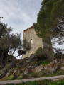
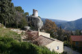
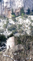
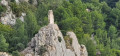
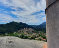
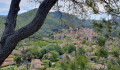
(3) Turn left to climb up to the Pigeonnier. Lovely view over the village and a place for meditation. Take great care, especially with children, as this is an unprotected site at the top of a cliff.
Return to the previous fork in the path.
(3) Continue along the path to the left (west-south-west). Ignore two turn-offs on the left. Join theGR®51and follow it south-west, ignoring all side paths. Ignore a path coming from the left and pass a house on your left.
(4) Turn slightly to the right. At the junction, directly beneath a high-voltage power line, turn left (south).
(5) At the Fork in the road, carry on straight ahead (south; let theGR® head off to the left). Look down below to see a wayside shrine and, in the distance, a wall on a promontory – this is a sundial.
(6) Join theGR®51and follow it to the right. You’ll soon reach a viewpoint slightly to the left.
(7) Continue westwards along theGR®51. You’ll reach a tarmac road (Chemin des Pommets au Revest) and follow it as it continues.
(8) At a sharp right-hand bend, leave theGR®51and turn left. At the Fork in the road that appears immediately (a false turn-off marked by two pillars), keep to the right onto a local track. Follow the path marked in blue as it winds its way along.
(9) You’ll come out onto Chemin de Fontanieu; follow it to the right. Wind your way down the hill, staying on the signposted path.
(10) Turn right onto the Chemin des Institutrices. At the end of the tarmac road, turn right, then take the path on the left. After a few hairpin bends, you’ll come out onto the Chemin du Fontainier; follow it downhill.
(11) At the bottom, at a junction, carry on straight ahead onto the Chemin du Collet de Saint-Pierre. You’ll reach the Route des Comoni; follow it to the right. Pass a junction, then turn left to cross at the traffic lights. Turn left again, then turn right onto the Route du Val Dardenne (D46). Cross this road at the pedestrian crossing and follow it to the right.
(12) Turn left onto Chemin du Banier. Continue along a footpath, then onto Chemin du Béal (old wash houses on the left).
(13) Turn left onto Chemin du Château, pass the beautiful Dardennes washhouse and continue to follow the signposts along the Rivière Neuve. Turn left and you’ll come out onto a road called Chemin du Val Dardennes.
(14) Follow this road to the left. At the fork in the road, take the middle path.
(15) Join theGR®99and follow it to the right. Stay on theGR® and on the Chemin de la Gardanne.
(16) At the T-junction, follow a tarmac road to the left (GR®99). Ignore all turn-offs to the left. You’ll come out onto the Route du Colombier; follow it as it continues. Walk past a wash house, then turn right to return to the car park (S/E).

 Visorando Member
 Difficult