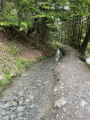
La Croisette

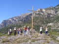
La Croisette du Lauzet.
This is part of the glacial barrier against which the village of Le Lauzet has nestled.

Details

n°117963
Creation:
Last update:
Last review:
  • Walking
    Activity: Walking
  • ↔
    Distance: 0.57 mi
  • ◔
    Average duration: 0h 20 
  • ▲
    Difficulty: Easy

  • ⚐
    Back to start: Yes
  • ↗
    Ascent: + 105 ft
  • ↘
    Descent: - 82 ft

  • ▲
    Highest point: 3,048 ft
  • ▼
    Lowest point: 2,933 ft

Photos

Description of the walk

The walk starts at the Place de l’Église in the heart of the old village.

(S/E) Walk behind the church and, once you’ve spotted the town hall, follow its wall to the right along a narrow passageway that quickly turns into a path. Simply follow it to reach the summit of La Croisette in no time.

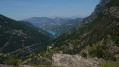
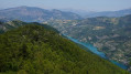
(1) From the summit, you look out over the valley and the village nestled between the two rocks, remnants of the glacial barrier.
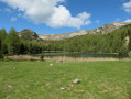
Below, you can see the lake. Continue along this path until you reach the cemetery.

(2) From there, head back towards the village along the road on the right. You’ll reach the first houses in the village.

(3) Turn left onto Rue Haute, known as the ‘back street’, then turn right and left to return to the square, our starting point (S/E).

Waypoints

  1. S/E : mi 0 - alt. 2,992 ft - Place de l’Église
  2. 1 : mi 0.14 - alt. 3,041 ft - La Croisette
  3. 2 : mi 0.28 - alt. 2,933 ft - Lauzet Cemetery
  4. 3 : mi 0.45 - alt. 3,015 ft - The first houses in the village
  5. S/E : mi 0.57 - alt. 2,995 ft - Church Square

Notes

Alternative route: return to the village via the mill road to the left or the cemetery road to the right as you descend from La Croisette. A short walk – just take it easy… do not go near the edges of the rock, as the cliffs are sometimes steep.

Worth a visit

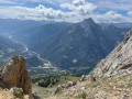
From the summit, you can look out over the whole valley from Pontis to Les Séolanes!
The old cross was replaced in August 2014 by volunteers from the Lauzet-Ubaye Heritage Conservation Association. This cross, made from larch wood from the valley, weighs 150kg and was carried on the backs of men.

Reviews and comments

4.2 / 5
Based on 2 reviews

Reliability of the description
5 / 5
Ease of following the route
3.5 / 5
Route interest
4 / 5
tomeyerfr
tomeyerfr

Overall rating : 3.3 / 5

Date of your route : Sep 08, 2022
Reliability of the description : ★★★★★ Very good
Ease of following the route : ★★☆☆☆ Disappointing
Route interest : ★★★☆☆ Average
Very busy route : No

There was no problem reaching the cemetery by road, but the path up the hill was clearly poorly signposted.

Machine-translated

pateisseire
pateisseire

Overall rating : 5 / 5

Date of your route : Apr 01, 2019
Reliability of the description : ★★★★★ Very good
Ease of following the route : ★★★★★ Very good
Route interest : ★★★★★ Very good

On Saturday we went on this short walk, which was perfectly suited to our fitness levels. Thank you very much – I’ve signed up to this very interesting website.

Machine-translated

Other walks in the area

For more walks, use our search engine .

The GPS track and description are the property of this route's author. Please do not copy them without permission.