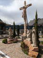
The ‘Horse Walk’ between Lachapelle-Sous-Rougemont and Petitefontaine
A very short walk, ideal for families, through the countryside and woodland. It is dotted with numerous information boards detailing the local heritage, wildlife, flora and landscapes.
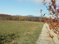
You’ll discover two welcoming villages: La Chapelle-Sous-Rougemont and Petitefontaine. Beautiful views of the Vosges peaks without having to climb them.
The route is signposted with a Yellow Ring.
The starting point is easily accessible from the D83 (formerly the N83), about fifteen kilometres north-east of Belfort. There is a car park behind the church and the town hall in Lachapelle-Sous-Rougemont.
The route is signposted with a Yellow Ring.
(S/E) Set off to the left towards the north-east on the D83, Rue du Général de Gaulle. Turn left 150 metres further on. 50 metres further on, turn left at the signpost describing the walks. Please note that there is a junction where two marked trails split: the Blue Ring to the right, the Yellow Ring to the left.
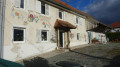
After a short climb, take in the view of the church, the town hall and the Vosges. Look out for the first information sign featuring the Ardennais and Comtois draught horses (there will be other signs). Ignore a path on the right.
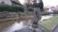
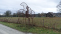
Reach the D11 road at the entrance to Petitefontaine. Admire the artwork depicting horses by Mala-Hela Gascard.
(1) Continue left along Rue du Lac to the centre of the village, at the next junction.
(2) Turn left and cross the River Saint-Nicolas. Pass the small street on your right and continue along Rue des Marronniers.
(3) About 200 m further on, turn left onto Rue du Bois Devant and follow it for 600 m.
(4) Turn left onto a farm track near a fire-fighting water reservoir. Keep a close eye on the signposts so as not to miss it. Cross a road and continue straight ahead. This is a nature trail with numerous information boards about the local flora and fauna. As you go, take a moment to admire the old windmill. You’ll reach the D83.
(5) Follow it to the left until you reach (S/E).
Waypoints
S/E : mi 0 - alt. 1,247 ft - Car park at the church in Lachapelle-Sous-Rougemont
1 : mi 1.08 - alt. 1,316 ft - D11 at the entrance to Petitefontaine
4 : mi 1.82 - alt. 1,293 ft - Near the fire reservoir
5 : mi 2.58 - alt. 1,273 ft - D83 at the entrance to Lachapelle-Sous-Rougemont
S/E : mi 2.95 - alt. 1,247 ft - Car park at the church in Lachapelle-Sous-Rougemont
Notes
Start at the car park behind the church and the town hall. Address: 29, rue du Général-Charles-de-Gaulle, 90360 Lachapelle-sous-Rougemont.
It is possible to park at the exit from Petitefontaine heading towards Lauw. There are only one or two spaces at the side of the road. In this case, start the walk at point (1).
Visorando was provided with this information by Mr Chevalley, a volunteer member of Balisage90.
This walk was created by the South Vosges Community of Communes.
The route is signposted with a Yellow Ring.
Worth a visit
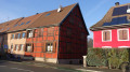
Lachapelle-sous-Rougemont
Place names: Capella (1214), Ecclesiam de villa que Capella nuncupatur (1234). À la Chapelle vers Roigemont (1295), Capel (1576), Capplen (1579). In German: Welschen Kappelen.
Its inhabitants are known as the Chapelons.
The village name Capella is first mentioned as early as the late 11th century. At that time, it formed part of the seigneury of Rougemont. Lachapelle served as a post station and a popular stopover lodge. During the Restoration, in 1818, a minor seminary was established, which operated until the war of 1870. It became an independent secondary school in 1873 and, by 1882, was attended by around 300 Alsatian pupils who came to study in French to escape the Germanisation of their province. It was no doubt the beer consumed by travellers in the town’s many inns that prompted the Grisez family to build a brewery in 1835 at the entrance to the village on the road from Belfort. From 1893 to 1961, a forging workshop, Établissements Woerlin, manufactured shuttle points for looms.
In 1914, Lachapelle was linked to Belfort by a branch line of the local metre-gauge railway passing through Les Errues. At the outbreak of the war, the line was extended by the military engineers as far as the Alsatian village of Sentheim. The trains were hauled by electric locomotives, which were less conspicuous than steam engines, which would have been immediately spotted by the enemy nearby.
Source: Wikipedia:
Petitefontaine
Place-name history: Brun (1576), Dz dorff Brun (1628), Petite Fontaine (1793), Petite-Fontaine (1801), Petitefontaine (1962). In German: Klein-Brunn
The village’s name was first recorded in 1388. At that time, it was probably already part of the parish of Angeot and belonged to the seigneury of Rougemont. Following the war of 1871 and the implementation of the Treaty of Frankfurt, Petitefontaine was separated from the canton of Masevaux along with the other municipalities: Rougemont, Leval and Romagny.
Source: Wikipedia:
Reviews and comments
4.7 / 5
Based on 1 review
Reliability of the description 5 / 5
Ease of following the route 5 / 5
Route interest 4 / 5
chamane7
Overall rating :
4.7 / 5
Date of your route : Oct 12, 2026 Reliability of the description : ★★★★★ Very good Ease of following the route : ★★★★★ Very good Route interest : ★★★★☆ Good Very busy route : No
To open this route on your smartphone, you must have the Visorando app installed. If not, got to the Apple Store (iPhone) or Google Play Store (Android) to download the app.



 Country:
 City:


 Visorando Member

 Local authority
 Moderate