La Ville-aux-Clercs walking trails: Yellow route

La Ville-aux-Clercs offers four walking routes that are also suitable for mountain biking. This is the longest one, passing by the Étangs du Milieu and the Étangs du Souci. (Geocaching on this route).

Details

161816
Creation:
Last update:
Last review:
  • Walking
    Activity: Walking
  • ↔
    Distance: 9.65 mi
  • ◔
    Average duration: 4h 35 
  • ▲
    Difficulty: Moderate

  • ⚐
    Back to start: Yes
  • ↗
    Ascent: + 135 ft
  • ↘
    Descent: - 151 ft

  • ▲
    Highest point: 522 ft
  • ▼
    Lowest point: 404 ft

Photos

Description of the walk

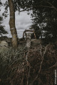
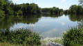
Start of the path leading to the lake.

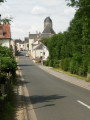
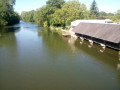
(S) Head down towards the village across the grass to cross the small wooden bridge over the Gratteloup stream. Pass to the left of the wash house and join Rue Françoise de Lorraine. Turn right onto this street, then left onto Rue du Vieux Moulin towards the church, passing the former gendarmerie on your left.

(1) Turn right onto the square and immediately turn left into Rue des Écoles. Pass the schools on your right and, at the three-way junction, go straight on into Rue des Métairies. Pass a path on your right.

(2) After the last houses and the copse, take the dirt track on the left.

(3) At the end of the track and before Le Petit Marchais, turn left and pass the Ferme de la Batterie on your right. Continue straight on, crossing the Route de Danzé (D24). Pass the hamlet of Le Marchais and continue straight on across the plain until you reach the D357 (Le Mans–Orléans).
Cross the D357 with care.

(4) Carry on straight ahead, following the Étang du Milieu on your right. At the tarmac road, turn left, pass the Étang du Souci on your right and continue to the junction with the Route de Vendôme (D141).

(5) Cross the D141 and, turning right then left, pass Le Plaisir farm until you reach the dirt track. Follow this track, continue straight on at the junction and walk alongside the woodland on your right. At the T-junction, turn left. Then turn left onto the Route de Lisle and follow it for about a hundred metres.

(6) Take the first track on the right and continue north-east through the fields.

(7) At the junction with the Route de Pezou, turn left, go downhill to cross a stream and then head back uphill. Cross the D357 road (take care) then walk straight through the hamlet of l’Essert, keeping the inn on your right. Take the first right (Rue du Colombier) and follow it to the grassy track. Continue along the track towards “Petit Grand Champ”, passing the first junction on your left. At the second fork, turn left towards the hamlet of Beaulieu, which you cross to rejoin the D12.

(8) Turn right and follow the D12 for a few dozen metres, then turn right again at a place called Nid de Pie, onto a small road that quickly gives way to a track. Walk alongside the Bois du Nid de Pie and head down to the Bois de Fort Girard.

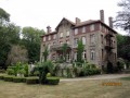
(9) At the edge of the woodland, turn sharply left. Follow the track alongside the woodland on your right. At the corner of the woodland, turn right to reach the entrance to the Manoir de la Forêt.

(10) Continue in the same direction and follow the tarmac road, the ‘Françoise de Lorraine’, which soon bends to the left.

(11) At the corner of the lake, turn right and cross the footbridges. Turn left into the woods onto the path running parallel to the lake. At the end of this path, veer right and head back up to the starting point (S/E).

Waypoints

  1. S/E : mi 0 - alt. 453 ft - Path leading to the lake
  2. 1 : mi 0.26 - alt. 469 ft - Église Saint-Barthelemy (La Ville-aux-Clercs)
  3. 2 : mi 0.7 - alt. 476 ft - Fork in the road after the last houses
  4. 3 : mi 1.5 - alt. 515 ft - Le Petit Marchais
  5. 4 : mi 3.27 - alt. 492 ft - Crossing the D357 road
  6. 5 : mi 4.4 - alt. 469 ft - Crossing the D141 road
  7. 6 : mi 5.55 - alt. 486 ft - The path starts on the Route de Lisle
  8. 7 : mi 6.25 - alt. 449 ft - Route de Pezou
  9. 8 : mi 7.83 - alt. 495 ft - Le Nid de Pie
  10. 9 : mi 8.37 - alt. 446 ft - Fort-Girard Wood
  11. 10 : mi 9 - alt. 446 ft - Entrance to the manor house
  12. 11 : mi 9.35 - alt. 430 ft - Lake
  13. S/E : mi 9.65 - alt. 453 ft - Path leading to the lake

Notes

- No particular difficulty. Make sure you wear good walking shoes and bring a small snack for a 15.52 km walk.
- Parking available at the starting point.
- Public toilets and an electric vehicle charging point in the village near the church.

(Geocaching on this route).
(9) Geocaching: La Porte du Fort Girard (GC6NHZT).

Worth a visit

- Wash house, village centre and church.
- Various ponds.
- At L’Essert, you can enjoy a meal at the inn.
- Picnic tables around the lake (village pond).

Reviews and comments

4.2 / 5
Based on 3 reviews

Reliability of the description
4.3 / 5
Ease of following the route
5 / 5
Route interest
3.3 / 5
denouvel
denouvel

Overall rating : 4 / 5

Date of your route : Jun 13, 2020
Reliability of the description : ★★★★☆ Good
Ease of following the route : ★★★★★ Very good
Route interest : ★★★☆☆ Average
Very busy route : No

It took less time than expected: 3 hours 20 minutes for me, and I managed to take quite a few photos. The route is very well signposted, with signposts dotted along the way.

Machine-translated

gabrirelle
gabrirelle

Overall rating : 4 / 5

Date of your route : Mar 16, 2020
Reliability of the description : ★★★★☆ Good
Ease of following the route : ★★★★★ Very good
Route interest : ★★★☆☆ Average

Lots of open countryside, few wooded paths and not much to discover

Machine-translated

jacky reveillere
jacky reveillere

Overall rating : 4.7 / 5

Date of your route : Nov 19, 2017
Reliability of the description : ★★★★★ Very good
Ease of following the route : ★★★★★ Very good
Route interest : ★★★★☆ Good

A pleasant walk alternating between open plains and wooded countryside along well-maintained, relatively dry paths, best enjoyed in calm weather (plenty of open spaces). Best avoided in hot weather for those who prefer cooler conditions.

Machine-translated

Other walks in the area

For more walks, use our search engine .

The GPS track and description are the property of this route's author. Please do not copy them without permission.