Walking trails in La Ville-aux-Clercs: Blue route

Of the four walking routes on offer around La Ville-aux-Clercs, here is the Blue route.

Details

161676
Creation:
Last update:
Last review:
  • Walking
    Activity: Walking
  • ↔
    Distance: 6.00 mi
  • ◔
    Average duration: 2h 50 
  • ▲
    Difficulty: Easy

  • ⚐
    Back to start: Yes
  • ↗
    Ascent: + 69 ft
  • ↘
    Descent: - 69 ft

  • ▲
    Highest point: 522 ft
  • ▼
    Lowest point: 427 ft

Photos

Description of the walk

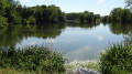
Start of the path leading to the lake.

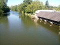
(S/E) Walk along the lake on the left-hand side, then cross the footbridge over the spillway. Cross the small car park beside the lake and turn right onto the tarmac road (Rue Françoise de Lorraine); walk for 60 metres, then turn left into the woods, after the road leading up to the sewage treatment plant, at a small car park under the trees, heading up the path. Continue to the right along the path through the woods.

(1) At the end of the woods, turn left onto the uphill path that runs alongside the housing estate, bringing you back to Rue Pineau. Continue along this street until you reach the junction with the Route de Vendôme.

(2) At the corner by the cemetery, turn right for 30 metres, then immediately left into Rue de la Tutinière.

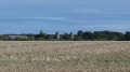
(3) At the bend by the sports hall, turn left onto Chemin du Bois de Gournay and walk past the stadium on your right. Continue along this path, walking alongside the Bois de Gournay on your left and crossing the plain heading south-west.
At the end of the path, where it turns at a 90° angle, turn right towards the hamlet of Le Marchais.

(4) Cross straight ahead over the D24, Route de Danzé, heading towards the Ferme de la Batterie. Leave the farm on your left and turn into the first track on the right just before the Ferme du Petit Marchais. Follow this track alongside the woodland and continue across the plain.

(5) When you reach the tarmac road, turn left immediately, towards the Métairies dairy farm. Follow this road until you reach the first junction with a dirt track.

(6) Turn right onto this track until you reach the junction with the D12, Route de Romilly.

(7) Turn right onto the D12 and head down towards the hamlet of La Fleuriette. At the bottom of the descent, take the first track on the left.

(8) Follow this path until you reach the junction with the D141, Route de Chauvigny. Cross the D141, then walk a few dozen metres straight ahead towards the ford.

(9) Just before you reach it, turn right onto Chemin Vert. At the end of Chemin Vert, carry on straight ahead along Rue du Chemin Vert until you reach the junction with Route de Cloyes (Rue du Vieux Moulin). Turn left and cross the Ruisseau Gratte-Loup to return to your starting point (S/E).

Waypoints

  1. S/E : mi 0 - alt. 453 ft - Start of the path leading to the lake
  2. 1 : mi 0.46 - alt. 443 ft - Path running alongside the housing estate
  3. 2 : mi 0.78 - alt. 476 ft - Corner of the cemetery
  4. 3 : mi 0.98 - alt. 482 ft - Turn at the sports hall
  5. 4 : mi 2.41 - alt. 518 ft - D24, continue straight ahead
  6. 5 : mi 3.66 - alt. 476 ft - Where the tarmac begins, turn left
  7. 6 : mi 4.23 - alt. 512 ft - At the junction with the dirt track, turn right
  8. 7 : mi 4.64 - alt. 495 ft - Junction with the D12, turn right
  9. 8 : mi 5.15 - alt. 456 ft - Path on the left
  10. 9 : mi 5.45 - alt. 436 ft - Take the Chemin Vert on the right before the ford
  11. S/E : mi 6 - alt. 453 ft - Start of the path leading to the lake

Notes

- No particular difficulty; please wear good walking shoes and bring some refreshments (water).
- Parking available at the starting point.
- Public toilets and an electric vehicle charging point in the village near the church.

Worth a visit

Must-sees:
- the lake.
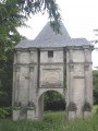
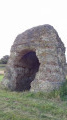
- the restored gate of Fort Girard (a 500-metre detour, on the left after the lake).
- the flora and fauna of the Centre region.

Reviews and comments

4.4 / 5
Based on 3 reviews

Reliability of the description
4.7 / 5
Ease of following the route
4.7 / 5
Route interest
4 / 5
User 26411498

Overall rating : 5 / 5

Date of your route : Aug 04, 2025
Reliability of the description : ★★★★★ Very good
Ease of following the route : ★★★★★ Very good
Route interest : ★★★★★ Very good
Very busy route : No

A very pleasant route with lots of country lanes running alongside forests and quite a few false flats, so although it's not a difficult walk, it's good exercise for the legs. And then there's the village of Ville aux Clercs with its beautiful church and magnificent zinc (or slate?) bell tower, which is full of charm... With Visorando, hiking is a piece of cake!

Machine-translated

Cavilla
Cavilla

Overall rating : 4.7 / 5

Date of your route : Aug 02, 2017
Reliability of the description : ★★★★★ Very good
Ease of following the route : ★★★★★ Very good
Route interest : ★★★★☆ Good

A pleasant walk offering sweeping views over vast fields of cereals and rapeseed (all harvested by this time), forming a huge patchwork of subtly varying colours. It ends on a lovely tree-lined path, where the canopy forms a shady archway alongside a stream with the picturesque name of ‘Gratte-Loup’.
NB: The weather was lovely.

Machine-translated

gbrillard
gbrillard

Overall rating : 3.7 / 5

Date of your route : Sep 26, 2016
Reliability of the description : ★★★★☆ Good
Ease of following the route : ★★★★☆ Good
Route interest : ★★★☆☆ Average

A bit too much bare plain.

Machine-translated

Other walks in the area

For more walks, use our search engine .

The GPS track and description are the property of this route's author. Please do not copy them without permission.