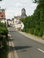
Circular walk starting from Rahart

A lovely walk with plenty of sections through the woods.
Hiking is all about having ‘fun’, and even if it’s ‘customary’ to pass through the ‘desert’, don’t worry – you’ll always make it to the church.

Details

3548890
Creation:
Last update:
Last review:
  • Walking
    Activity: Walking
  • ↔
    Distance: 6.94 mi
  • ◔
    Average duration: 3h 15 
  • ▲
    Difficulty: Moderate

  • ⚐
    Back to start: Yes
  • ↗
    Ascent: + 108 ft
  • ↘
    Descent: - 128 ft

  • ▲
    Highest point: 492 ft
  • ▼
    Lowest point: 381 ft
  • ⚐ Country: France
  • ⚐ City: Rahart (41160)
  • ⚑
    Start/End: N 47.870616° / E 1.066391°
  • ❏
    IGN map(s): Ref. 1919SB, 1920SB, 2019SB, 2020SB
  • Hour-by-hour weather

Photos

Description of the walk

Park on Rue des Châtaigniers in the village of Rahart.

(S/E) Head west along Rue de la Poterie. Pass Rue des Noyers on your left and carry straight on along the path. You’ll reach a right-angled junction at the edge of a woodland.

(1) Turn right, walk alongside the Bois du Bouillon, then leave it behind to reach a four-way junction, where you’ll join theGRP® Perche-Vendomois.

(2) Ignore theGRP® and turn right onto the road. Leave this road and turn left onto the road leading to the hamlet of Les Grimaudières; you’ll see a sign for Le Rouillis here.
After this hamlet, take the path on the right alongside the woodland, then ignore the paths on the left and right and carry on straight ahead. You’ll arrive at a place called Les Étangs.

(3) Pass the private track on your right and reach the Route du Haut Souci. Follow it to the right and continue on to reach the junction with the D141 at the hamlet of Haut Souci.

(4) Cross the road and take the path opposite leading to the hamlet of Le Plaisir. Walk through the hamlet, enter the woods and turn immediately right onto the yellow-marked path. At the next junction, turn left at a 90° angle towards Les Masures. Ignore the path on the left and turn right at the next junction to reach Bois Brûlé.

(5) Turn left towards Le Désert and, at the next junction, keep left again to reach the lake and the Le Désert estate. Carry on straight ahead until you reach the road at the entrance to the hamlet of L’Usage.

(6) Turn right onto this road, then turn right again at thefirst junction; follow the edge of the woodland and enter the woods, where you’ll soon come to a junction with five paths.

(7) Take the path to the right, then to the left; look out for the purple and white markings further on, on a tree to your left, as this section is quite tricky. Continue straight ahead. Cross the D 141 and head along the path opposite into the woods. You’ll reach the edge of the woods.

(8) Turn slightly to the right, then immediately to the left. Pass a path heading off to the left, then turn right. Reach thefirst houses in Rahart and carry on until you reach the car park on Rue des Châtaigniers (S/E).

Waypoints

  1. S/E : mi 0 - alt. 463 ft - Car park on Rue des Châtaigniers
  2. 1 : mi 0.38 - alt. 469 ft - Crossroads at the edge of the woods
  3. 2 : mi 1.16 - alt. 486 ft - GRP junction
  4. 3 : mi 2.24 - alt. 456 ft - After the ponds
  5. 4 : mi 2.87 - alt. 469 ft - D141 Le Haut Souci
  6. 5 : mi 4.12 - alt. 430 ft - Le Bois Brûlé
  7. 6 : mi 4.68 - alt. 449 ft - L’Usage
  8. 7 : mi 5.43 - alt. 407 ft - Five-way junction
  9. 8 : mi 6.18 - alt. 387 ft - Crossroads at the edge of the woods
  10. S/E : mi 6.94 - alt. 463 ft - Car park on Rue des Châtaigniers

Reviews and comments

4.4 / 5
Based on 3 reviews

Reliability of the description
4.5 / 5
Ease of following the route
4.7 / 5
Route interest
4 / 5
denouvel
denouvel

Overall rating : 4.7 / 5

Date of your route : Apr 01, 2021
Reliability of the description : ★★★★★ Very good
Ease of following the route : ★★★★★ Very good
Route interest : ★★★★☆ Good
Very busy route : No

A short, easy and pleasant walk.

Machine-translated

Nicholas
Nicholas

Overall rating : 4.5 / 5

Date of your route : Feb 14, 2021
Reliability of the description : Not used / Not applicable
Ease of following the route : ★★★★★ Very good
Route interest : ★★★★☆ Good
Very busy route : No

A really lovely walk – a mix of hedgerows and woodland

Machine-translated

tango 1
tango 1

Overall rating : 4 / 5

Date of your route : Dec 21, 2020
Reliability of the description : ★★★★☆ Good
Ease of following the route : ★★★★☆ Good
Route interest : ★★★★☆ Good
Very busy route : No

A pleasant and easy walk as there is very little elevation gain. The route description is accurate, which is just as well as there are no signposts.

Machine-translated

Other walks in the area

For more walks, use our search engine .

The GPS track and description are the property of this route's author. Please do not copy them without permission.