The Patte d’Oie Pond, starting from Rhodes

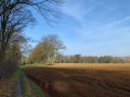
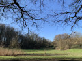
A lovely little walk where you can enjoy the coolness of the Sonian Forest on hot days or the magnificent autumn colours. In spring, carpets of hyacinths and anemones add touches of blue and pinkish-white to certain parts of the forest.

Details

28026633
Creation:
Last update:
Last review:
  • Walking
    Activity: Walking
  • ↔
    Distance: 4.79 mi
  • ◔
    Average duration: 2h 20 
  • ▲
    Difficulty: Easy

  • ⚐
    Back to start: Yes
  • ↗
    Ascent: + 171 ft
  • ↘
    Descent: - 138 ft

  • ▲
    Highest point: 495 ft
  • ▼
    Lowest point: 341 ft

Photos

Description of the walk

Park at the start of Rue Brassine, in Rhodes-Saint-Genèse, which is easily accessible from one of the traffic lights on the Chaussée de Waterloo.

(S/E) Take the forest path running parallel to Avenue Brassine towards Brussels. After about 100 metres, at the junction, turn right onto the path called ‘Hazedelle’.

(1) Leave this path and turn onto the first path on the left. Follow it in the same direction through the forest and continue in the same direction after Drève Francus (Francusdreef). Please note that after this lane, the path is less clearly marked; a barrier of branches hides the start of it, but it continues in the same direction as far as Drève Fromont.

(2) Take the Drève Fromont (Fromontdreef) to the right. Continue in the same direction, downhill for 2 km, ignoring any other paths you come across, in particular the Drève de Lorraine. The Drève Fromont then changes its name to Drève des Puits (Puttendreef).

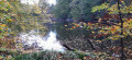
(3) At the junction at the end of Drève des Puits, take Drève des Framboises (Frambozendreef) on the right to reach the Patte d’Oie pond. Continue along this path, skirting the pond, until you reach thesecond point (on a map, this corresponds to thesecond ‘finger’ of the three-way junction formed by the pond), then take the Preumont path (Preumontpad), which leaves the pond to the right.

(4) At the Y-junction after crossing the stream, take the first path on the left (Sentier des Palissades or Palissadepad). Follow it alongside a small stream. At thesecond Y-junction, turn right, continuing to follow the main stream along the Sentier des Palissades, and join the ‘Verdunningsdreef’.

(5) Cross this lane, continue straight on for 20 metres, then take the Chemin du Beau Chêne (Shone Eykenweg), which runs alongside the stream to the left. Continue along this path, which climbs steadily, then take thethird path on the right – that is, the first one after the Drève de Lorraine – when the ground levels out, and this will take you to the path running alongside Avenue Brassine.
Carry on straight ahead until you reach the starting point.

Waypoints

  1. S/E : mi 0 - alt. 417 ft - Parking at the start of Rue Brassine
  2. 1 : mi 0.32 - alt. 430 ft - Fork in the path
  3. 2 : mi 0.72 - alt. 413 ft - Fromont Forest Track
  4. 3 : mi 1.97 - alt. 354 ft - Patte d’Oie Pond
  5. 4 : mi 2.55 - alt. 387 ft - Three-Way Junction
  6. 5 : mi 3.16 - alt. 420 ft - Verdunningsdreef
  7. 6 : mi 4.28 - alt. 456 ft - Path running parallel to Avenue Brassine
  8. S/E : mi 4.79 - alt. 423 ft - Parking at the start of Rue Brassine

Notes

A lovely walk, entirely through the forest. Best avoided at weekends and on public holidays, as it can get quite busy due to its proximity to Brussels and its suburbs.

Some path names are given in Dutch in the forest, which is why they are shown in brackets in the description above.

Worth a visit

The Sonian Forest covers 4,383 hectares. The beech trees were planted from the 18th century onwards, largely to provide high-quality timber. It would later become the largest cathedral beech forest in Europe. Many of the beech trees are over 200 years old.
Later, the forest’s purpose changed; commercial logging was scaled back in favour of management focused in particular on recreation, landscape conservation and biodiversity. In 1959, this landscape was included on the official list of Monuments and Sites. The Forest of Soignes’ current ‘Natura 2000’ status ensures the preservation of the ecosystem and the species characteristic of this environment. This explains the many fallen trees that have been left where they are. It is therefore a highly protected area, where visitors should follow the signs found in many places, such as staying on the paths. Dogs must therefore be kept on a lead.
The forest is criss-crossed by numerous forest lanes and paths. Most of them have a name, making it easy to follow the route of this walk.

Reviews and comments

4.2 / 5
Based on 3 reviews

Reliability of the description
4.3 / 5
Ease of following the route
4 / 5
Route interest
4.3 / 5
nicorandos
nicorandos

Overall rating : 4.3 / 5

Date of your route : Sep 30, 2024
Reliability of the description : ★★★★☆ Good
Ease of following the route : ★★★★☆ Good
Route interest : ★★★★★ Very good
Very busy route : Yes

I really enjoyed the route, apart from the start, which wasn’t very clear given the many small paths right from the outset. Then we had to take a path that was ‘normally reserved for horses’?? Otherwise, there were no problems. Thank you

Machine-translated

Luc1
Luc1

Overall rating : 4.3 / 5

Date of your route : Jan 29, 2024
Reliability of the description : ★★★★★ Very good
Ease of following the route : ★★★★☆ Good
Route interest : ★★★★☆ Good
Very busy route : No

There’s a section of the route reserved for horses… but thanks to the GPS route, we manage to avoid it

Machine-translated

Martine (Bruxelles)
Martine (Bruxelles)

Overall rating : 4 / 5

Date of your route : Jul 12, 2023
Reliability of the description : ★★★★☆ Good
Ease of following the route : ★★★★☆ Good
Route interest : ★★★★☆ Good
Very busy route : No

A lovely little walk in the Forest of Soignes.
At the start of the walk (point 1), the path is actually quite hard to find... a GPS is essential!

Machine-translated

Other walks in the area

For more walks, use our search engine .

The GPS track and description are the property of this route's author. Please do not copy them without permission.