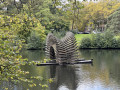
Soignes Forest, passing alongside three streams

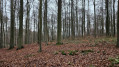
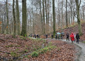
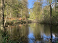
The route follows three streams in the forest: the Bocq, the Vuylbeek and the Source Laineuse. It is a circular route best tackled in dry weather.
Normally, the route follows footpaths. Please make sure you do not take any paths reserved for horse riders: if you encounter this issue, take a detour and (please) mention it in the comments.

Details

n°67118999
Creation:
Last update:
Last review:
  • Walking
    Activity: Walking
  • ↔
    Distance: 5.23 mi
  • ◔
    Average duration: 2h 45 
  • ▲
    Difficulty: Easy

  • ⚐
    Back to start: Yes
  • ↗
    Ascent: + 387 ft
  • ↘
    Descent: - 361 ft

  • ▲
    Highest point: 492 ft
  • ▼
    Lowest point: 289 ft

Photos

Description of the walk

The starting point is along Avenue Van Bever in Uccle.
It is accessible by public transport (the ‘Van Bever’ stop) and by car (park at the end of the avenue, near the woods, and bear in mind that this is a blue zone).

(S/E) Follow Avenue Van Bever.

(1) At the end of the avenue, cross the Drève de Lorraine with care, go through the gate into the woods and you’ll come to a Y-junction. Turn left onto the Chemin du Réservoir (a cobbled path) for 450 m.

(2) Take the Sentier du Bocq, well to the right, and follow the winding path to the Drève des Enfants Noyés for about 800 m. Take the Drève on the left for about 300 m to reach a four-way crossroads. Turn right onto the Drève du Comte.

(3) You’ll emerge, near a pond, onto the Chemin des Tumulis; follow this for 50 m before continuing along the Drève du Comte by turning right. Cross the Drève des Deux Montagnes – without taking it – and, a little further on, the Chemin des Tumulis to reach the stream, the Vuylbeek.

(4) Walk round the pond, keeping it on your right, and follow the Sentier du Vuylbeek (do not take the path leading uphill to the left!). Here too, follow the stream as it winds its way for approximately 2 km.

(5) At the junction of the Sentier du Vuylbeek and the Chemin du Hangar, leave the stream bed, keeping well to the right to take the Sentier des Sables, cross the Chemin des Deux Montagnes and continue along the Sentier de la Duchesse to reach the stream, the Wolleborre: known as the Source Laineuse in French.

(6) Follow this stream by taking the path on the right. Wind your way along this small watercourse for about 1 km. This will take you to the Drève de l’Infante.

(7) Take this lane on the left for about 50 metres. At the top of the hill, take the sharp left turn onto the Chemin du Fer à Cheval. 1.1 km further on, you’ll reach the Drève de Lorraine again

(8) Cross it carefully to reach the Petite Drève de Groenendael, which you should follow until you reach the Chaussée de Waterloo. Follow the road to the right to return to the car park (S/E).

Waypoints

  1. S/E : mi 0 - alt. 351 ft - Avenue Van Bever
  2. 1 : mi 0.36 - alt. 394 ft - Y-junction: Chemin du Réservoir, Drève des De
  3. 2 : mi 0.64 - alt. 430 ft - The Bocq Trail
  4. 3 : mi 1.36 - alt. 295 ft - Chemin des Tumulis
  5. 4 : mi 2.12 - alt. 325 ft - The Vuylbeek Trail
  6. 5 : mi 3.05 - alt. 453 ft - Vuylbeek Trail junction, Chemin du Hangar
  7. 6 : mi 3.43 - alt. 449 ft - The Wolleborre
  8. 7 : mi 4.01 - alt. 351 ft - Chemin du Fer à Cheval
  9. 8 : mi 4.71 - alt. 459 ft - Drève de Lorraine
  10. S/E : mi 5.23 - alt. 351 ft - Avenue Van Bever

Notes

Best tackled in dry weather (on the day and the day before)

Worth a visit

Shortly afterwards (7) Memorial 22/03 is a monument erected in tribute to the victims of the events of 22 March 2016 in Brussels2. The memorial was designed by the Belgian landscape architect Bas Smets3.

Shortly afterwards (5) Hangar: Wikipedia: https://fr.wikipedia.org/wiki/Chemin_de_...
The Soignes Forest Railway was a Belgian Decauville-type railway, which ceased operations in 1918.
Opened in 1902, this railway linked Petite Espinette, a hamlet in the municipality of Uccle (on the border with Rhode-Saint-Genèse), which was then served by the former SNCV line to Waterloo, with Boitsfort station on the Brussels–Namur–Luxembourg railway line. Running through the Sonian Forest, the line was 2.5 km long.
After the First World War, it was abandoned for financial reasons. This railway line was used to transport ballast for forest tracks and was also used to transport timber.

Reviews and comments

5 / 5
Based on 1 review

Reliability of the description
5 / 5
Ease of following the route
5 / 5
Route interest
5 / 5
Seblaumaud
Seblaumaud

Overall rating : 5 / 5

Date of your route : Jan 12, 2025
Reliability of the description : ★★★★★ Very good
Ease of following the route : ★★★★★ Very good
Route interest : ★★★★★ Very good
Very busy route : Yes

A lovely walk, especially in the snow. An easy, pleasant walk.

Machine-translated

Other walks in the area

For more walks, use our search engine .

The GPS track and description are the property of this route's author. Please do not copy them without permission.