L’Épaule de Gallardon

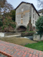
Step back in time… Discover the Gallardon of the Middle Ages, when the Épaule was still the central keep of a major fortress. As you wander through the medieval streets, do pause for a moment in front of the half-timbered houses, reminders of the 16th century.

Details

n°24404538
Creation:
Last update:
Last review:
  • Walking
    Activity: Walking
  • ↔
    Distance: 3.74 mi
  • ◔
    Average duration: 1h 55 
  • ▲
    Difficulty: Easy

  • ⚐
    Back to start: Yes
  • ↗
    Ascent: + 187 ft
  • ↘
    Descent: - 171 ft

  • ▲
    Highest point: 489 ft
  • ▼
    Lowest point: 367 ft
  • ⚐ Country: France
  • ⚐ City: Gallardon (28320)
  • ⚑
    Start/End: N 48.524471° / E 1.685398°
  • ❏
    IGN map(s): Ref. 2116E
  • Hour-by-hour weather

Description of the walk

You can use the car park at the Collège du Val de Voise.

(S/E) The Collège de la Voise car park along the River Voise. Take Rue du Marly on the left, turn right into Rue de la Porte Mouton, then turn left immediately onto Rue de l’Arsenal. Walk as far as the ruins of the tower known as l’Épaule de Gallardon. Turn back and head towards the church.

(1) Turn left, then right into Rue de l’Hostel-Dieu.

(2) Turn left, then immediately right to go down Place du Jeu de Paume, and continue straight on along Rue de la Fontaine.

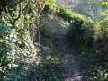
(3) Carry on until you reach the bend to the right and take the path on the left which climbs up and overlooks the Voise Valley. Follow it to the first hedge, ignore the path leading down to the right and follow the one that winds behind the houses along the edge of the fields. Head back up to join the D331 just before a cemetery.

(4) Turn sharply right and head down the road towards Montlouet. You’ll come across the war memorial, thePR® trail through the Voise Valley and the megaliths. Cross the square and follow Rue du Château towards the Pont de la Poivrette. Turn left to cross the bridge.

(5) Turn right onto the path at the right-hand corner which runs alongside the woods.

(6) At the crossroads, turn right. When you reach the road, turn right and follow the D331 for 400 m.

(7) : In Saint-Léonard, at the junction of the two roads, take the path on the left between the gardens and the woods, which continues along the Ruelle de la Source and leads to the Voise and the ruins of the Notre-Dame Chapel.

(3) Turn left to reach the Place du Jeu de Paume and the town hall. Turn left.

(2) Continue along Rue Pierre Martin, then turn right onto Rue de la Porte Mouton (half-timbered houses). Head down Rue Saint-Honoré on the left, then turn right onto Rue des Templiers. Turn left onto Rue du Marly to return to the secondary school car park (S/E).


Waypoints

  1. S/E : mi 0 - alt. 377 ft - Val de Voise Secondary School - Voise (rivière) - Affluent de l'Eure
  2. 1 : mi 0.24 - alt. 436 ft - Église Saint-Pierre et Saint-Paul (Gallardon)
  3. 2 : mi 0.37 - alt. 404 ft - Town Hall
  4. 3 : mi 0.57 - alt. 377 ft - Junction of the second circular loop
  5. 4 : mi 1.62 - alt. 469 ft - Towards Montlouet
  6. 5 : mi 1.95 - alt. 377 ft - Path through the woodland
  7. 6 : mi 2.45 - alt. 407 ft - T-junction
  8. 7 : mi 2.76 - alt. 381 ft - Saint-Léonard
  9. S/E : mi 3.73 - alt. 377 ft - Val de Voise Secondary School - Voise (rivière) - Affluent de l'Eure

Notes

PR® certified by FFRandonnée in collaboration with the Eure-et-Loir Departmental Hiking Committee. Follow the yellow markings.

Worth a visit

- Vélorails Du Pays Chartrain
- Pioneers’ Workshop and Museum
- The goats of Bailleau

Always be cautious and plan ahead when you're outdoors. Visorando and the author of this route cannot be held responsible for any accidents occurring on this route.

The GR® and PR® markings are the intellectual property of the Fédération Française de Randonnée Pédestre.

Reviews and comments

4.2 / 5
Based on 2 reviews

Reliability of the description
4 / 5
Ease of following the route
4.5 / 5
Route interest
4 / 5
Zedve
Zedve

Overall rating : 4 / 5

Date of your route : Mar 07, 2026
Reliability of the description : ★★★★☆ Good
Ease of following the route : ★★★★★ Very good
Route interest : ★★★☆☆ Average
Very busy route : No

A pleasant little hike to explore this village in Eure-et-Loir. A long trek across Beauce, but spring was in full swing.

Machine-translated

dominique violette
dominique violette

Overall rating : 4.3 / 5

Date of your route : Jun 22, 2023
Reliability of the description : ★★★★☆ Good
Ease of following the route : ★★★★☆ Good
Route interest : ★★★★★ Very good
Very busy route : No

A pleasant walk. On weekdays, it’s best to park at the multi-purpose hall car park on Rue Guy Pouiller. Place St Luc is usually full.

Machine-translated

Other walks in the area

For more walks, use our search engine .

The GPS track and description are the property of this route's author. Please do not copy them without permission.