The Alpine Pasture and Lake Djouan

A walk through the hunting grounds of King Victor Emmanuel, who owned a very large building in Orvieille that is currently being refurbished. Passing through the mountain pastures that follow, the very pretty Lac de Djouan then comes into view.

Details

2517962
Creation:
Last update:
Last review:
  • Walking
    Activity: Walking
  • ↔
    Distance: 8.30 mi
  • ◔
    Average duration: 6h 15 
  • ▲
    Difficulty: Difficult

  • ⚐
    Back to start: Yes
  • ↗
    Ascent: + 2,808 ft
  • ↘
    Descent: - 2,808 ft

  • ▲
    Highest point: 8,248 ft
  • ▼
    Lowest point: 5,440 ft

Description of the walk

Follow the SS23 to the hamlet of Eaux-Rousses. Park in the car park at the junction by the Hostellerie du Paradis (signposted).

(S/E) Turn right onto the tarmac road leading to the hostel. Just before reaching it, turn right onto the path marked with a Yellow Triangle bearing the number 2. This is the Alta Via No. 2, which crosses the valleys running perpendicular to the Aosta Valley (see ‘Practical Information’ section).
Continue along this path through the woods until you reach an open area.

(1) Take a hairpin bend to re-enter the forest and reach the Roundzegou mountain pasture.

(2) Head back into the forest, then alternate between mountain pastures and woodland until you reach the wide, flat area of Orvieille. On the right, you’ll find the wide track leading up from the hamlet of Vers les Bois and the path leading to Punta di Bioula.

(3) Stay on the Via Alta No. 2 to the left, going round the Orvieille building. Follow a wide track to reach the large farm at Alpe Djouan.

(4) Here, begin a long traverse with a gentle, gradual climb. Head towards the green rocks at a place called Tramauil.

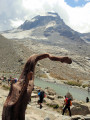
(5) Continue along this well-marked path to discover the very pretty Lac de Djouan behind a small hill.

(6) Retrace your steps along the route you took on the way out to return to the car park at Eaux-Rousses (S/E).

Waypoints

  1. S/E : mi 0 - alt. 5,440 ft - Eaux-Rousses car park
  2. 1 : mi 0.59 - alt. 5,932 ft - Area of interest
  3. 2 : mi 1.4 - alt. 6,588 ft - Roundzegou mountain pasture
  4. 3 : mi 2.15 - alt. 7,113 ft - Orvieille
  5. 4 : mi 2.56 - alt. 7,300 ft - Alpe Djouan building
  6. 5 : mi 3.35 - alt. 7,733 ft - Tramauil
  7. 6 : mi 4.15 - alt. 8,248 ft - Lake Djouan
  8. S/E : mi 8.3 - alt. 5,440 ft - Eaux-Rousses car park

Notes

Total duration of the hike, including breaks: 8 hours
To extend this hike to 7 days, see here
Alternative route: Going round Lake Djouan, leave the Via Alta No. 2 on your right and take the path through the scree on your left, climbing up to reach the Col du Marteau. Begin the descent towards the Meyes chalets, then continue either:
- to the right to reach the hamlet of Pont,
- to the left to reach the SS23, then follow the road to Eaux-Rousses.

Worth a visit

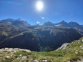
(Between 4 and 6) The crossing offers remarkable views of the remaining glaciers opposite and the summit of Gran Paradiso.

Reviews and comments

4.9 / 5
Based on 3 reviews

Reliability of the description
5 / 5
Ease of following the route
5 / 5
Route interest
4.7 / 5
Fernand1254
Fernand1254

Overall rating : 4.7 / 5

Date of your route : Aug 03, 2026
Reliability of the description : ★★★★★ Very good
Ease of following the route : ★★★★★ Very good
Route interest : ★★★★☆ Good
Very busy route : Yes

A lovely walk, with no major difficulties. It’s easy to follow.
A lovely picnic by the lake.
For the more adventurous, it’s possible to continue the walk towards the pass; the route passes by two other lakes.

Machine-translated

Xtophe&Val
Xtophe&Val

Overall rating : 5 / 5

Date of your route : Jul 30, 2025
Reliability of the description : ★★★★★ Very good
Ease of following the route : ★★★★★ Very good
Route interest : ★★★★★ Very good
Very busy route : Yes

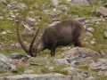
A magnificent walk. Bring binoculars or a telescope to see the ibex and chamois. The last stretch to Lake Djouan is very long but well worth the effort.

Machine-translated

bernardino
bernardino ★

Hello, and I’m really glad you enjoyed this route report on Lake Djouan.
As for the elevation gain, your GPS shows 1,117 metres, and sometimes these devices provide information that may later turn out to be slightly inaccurate.
And that’s certainly the case for this outing, as there’s actually only one climb on this route; given that the lowest point is at 1,661 metres and the finish at 2,514 metres, the elevation gain is therefore 853 metres. The automatic calculation provided by the app is therefore correct.
Have a good day

Machine-translated

franzcabas
franzcabas

Overall rating : 5 / 5

Date of your route : Jun 13, 2022
Reliability of the description : ★★★★★ Very good
Ease of following the route : ★★★★★ Very good
Route interest : ★★★★★ Very good
Very busy route : No

I did this route on a weekday in June, so there weren’t many people about; however, the condition of the path suggests it’s quite popular.
As for the elevation gain, my GPS recorded 1,117 metres of elevation gain at the end, which is a significant difference from the advertised figure. The route is classified as difficult due to the cumulative elevation gain, but there are no technical difficulties and no tricky sections.

Machine-translated

Other walks in the area

For more walks, use our search engine .

The GPS track and description are the property of this route's author. Please do not copy them without permission.