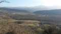
L’Aiguillon – La Bastide-sur-l’Hers and back

An easy, shaded walk along the banks of the Hers on a section ofthe GR® 7B. The route follows the right bank of the Hers between L’Aiguillon to the south and La Bastide-sur-l’Hers to the north. There are no difficulties; the route is practically flat, with just one short climb.

Details

n°24940326
Creation:
Last update:
Last review:
  • Walking
    Activity: Walking
  • ↔
    Distance: 7.10 mi
  • ◔
    Average duration: 3h 35 
  • ▲
    Difficulty: Easy

  • ⚐
    Back to start: Yes
  • ↗
    Ascent: + 354 ft
  • ↘
    Descent: - 338 ft

  • ▲
    Highest point: 1,594 ft
  • ▼
    Lowest point: 1,404 ft

Photos

Description of the walk

Access by car: at L’Aiguillon, at the traffic lights, head towards La Bastide-sur-l’Hers; about a hundred metres further on, take the road on the right. Park your car in the well-equipped car park.

(S/E) Take Rue du Moulin – this is also part of theGR® route – and cross the bridge over the Hers. Turn left and follow the white and red markings ofthe GR® 7B. Follow the path along the Hers, veering northwards. You’ll reach a multi-way junction at the entrance to Lesparrou.

(1) Carry on to the right and you’ll very soon come to another junction.

(2) Turn left at a right angle onto Rue Rives de l’Hers, which soon reaches the River Hers. Carry on until you reach the treatment works’ ponds.

(3) Walk alongside them, following the left bank of a small stream that flows into the Hers. You’ll reach Camp Redon.

(4) Turn right and stay on this road until you reach the last houses.

(5) Turn left onto the path – this is still theGR® – and begin a gentle descent to reach a Y-junction where theGR® and theGRP® d’Olmes meet.

(6) Carry on to the left along theGR®, following the River Hers, then take the Route de Foncirgue. Atthe first houses in La Bastide-sur-l’Hers, you’ll reach the junction with Rue Victor Hugo.

(7) Turn left onto this street and follow it to the bridge over the Hers in the centre of the village.

(8) Follow this route back in the opposite direction to return to the Aiguillon car park (S/E).

Waypoints

  1. S/E : mi 0 - alt. 1,522 ft - Car park - Hers (rivière) à finaliser
  2. 1 : mi 0.84 - alt. 1,493 ft - Lesparrou. Road
  3. 2 : mi 1.06 - alt. 1,496 ft - Turn left at Lesparrou
  4. 3 : mi 1.34 - alt. 1,480 ft - Wastewater treatment plant
  5. 4 : mi 2 - alt. 1,467 ft - Camp Redon. Head up to the right (road)
  6. 5 : mi 2.29 - alt. 1,578 ft - Junction. GR to the left
  7. 6 : mi 2.57 - alt. 1,496 ft - Junction with the GR Pays d’Olmes
  8. 7 : mi 3.36 - alt. 1,421 ft - Crossroads. Rue Victor Hugo
  9. 8 : mi 3.55 - alt. 1,404 ft - La Bastide-sur-l’Hers
  10. S/E : mi 7.1 - alt. 1,522 ft - Car park

Notes

The estimated time obviously does not take into account any stops.
As the route presents no difficulties, light kit (low-cut shoes) is sufficient in dry weather. However, if there has been heavy rain, you’ll need to wear sturdy footwear as the mud is frequent and deep in places, particularly on the climb between (5) and (6).

Always be cautious and plan ahead when you're outdoors. Visorando and the author of this route cannot be held responsible for any accidents occurring on this route.

The GR® and PR® markings are the intellectual property of the Fédération Française de Randonnée Pédestre.

Reviews and comments

5 / 5
Based on 1 review

Reliability of the description
5 / 5
Ease of following the route
5 / 5
Route interest
5 / 5
User 3147545

Overall rating : 5 / 5

Date of your route : Feb 23, 2026
Reliability of the description : ★★★★★ Very good
Ease of following the route : ★★★★★ Very good
Route interest : ★★★★★ Very good
Very busy route : No


A very pleasant walk to do again this summer and no doubt this autumn for the colours.

Machine-translated

Other walks in the area

For more walks, use our search engine .

The GPS track and description are the property of this route's author. Please do not copy them without permission.