


Toukamalou

 Visorando Member
 Premium user
Sign up:
Published route(s)
 Pic de Saint-Barthélemy via Moulzoune
 8.37 mi
 +3,432 ft
 -3,432 ft
 6h 50
6h 50
 Difficult
 Departure from Montferrier (Ariège)
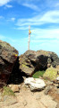
Superb viewpoint over the entire eastern part of the Pyrenees. The Pic de Saint-Barthélemy also offers an exceptional view of the plain to the north. It is easily identifiable on a clear day from the motorway...
The route combines beech forest, where the small Lac de Moulzoune nestles, two old quarries, grassy hilltops overlooking two high-altitude lakes, a small forest of mountain pines and ends with a stony ridge covered with rhododendrons.
Bassiès Lakes
 7.45 mi
+2,940 ft
-2,943 ft
6h 00
Difficult
Departure from Auzat (Ariège)
7.45 mi
+2,940 ft
-2,943 ft
6h 00
Difficult
Departure from Auzat (Ariège)
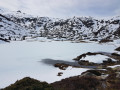
The granite cirque of Bassiès, near the Montcalm massif, is impressive for its size and its lakes. It is accessed from the right bank of the steeply-sided Bassiès stream via a comfortable but steep path that passes through a beautiful forest before coming out onto a rocky outcrop that marks the first lake. The descent is on the other bank, which is just as steep, following a well-maintained stony mule track.
Lac d'Aygue Longue and Pic de l'Homme
 5.83 mi
+3,409 ft
-3,409 ft
5h 40
5.83 mi
+3,409 ft
-3,409 ft
5h 40
 Average
Departure from Orgeix (Ariège)
Average
Departure from Orgeix (Ariège)
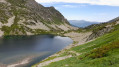
In the Orgeix Valley, this very varied hike on a well-marked trail to a beautiful glacial lake can be divided into three parts: a beech forest where you walk not far from the stream and its small waterfalls, meadows at the edge of the forest, and finally a series of small glacial locks leading to the lake's spillway.
You can then climb the Pic de l'Homme, which is easily accessible via the ridge from the Lac d'Aygue Longue, passing through the Col de la Parade.
The Dent d'Orlu
 2.84 mi
+2,257 ft
-2,257 ft
3h 15
Average
Departure from Ascou (Ariège)
2.84 mi
+2,257 ft
-2,257 ft
3h 15
Average
Departure from Ascou (Ariège)
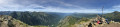
The Dent d'Orlu or Pic de Brasseil is known to climbers for its south-east and south faces, the latter offering a vertical wall of over 1,000 metres. However, its north face, although very steep, is accessible for hiking, as described here. It offers an interesting viewpoint over the Ariège mountains as a whole due to its central position.
La Pique d'Endron
 5.67 mi
+3,245 ft
-3,235 ft
5h 25
Difficult
Departure from Goulier (Ariège)
5.67 mi
+3,245 ft
-3,235 ft
5h 25
Difficult
Departure from Goulier (Ariège)
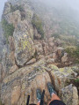
The Pique d’Endron is a central vantage point in the Haute-Ariège. From here, you can see the Montcalm massif and the Bassiès massif with its terraced lakes up close, and look out over two large lakes: Gnioure, with its small island, and Izourt. The view to the north stretches for miles. The hike is relatively short but quite challenging, with a 1,000-metre elevation gain, dizzying views and a short section where you’ll need to ‘get your hands dirty’.
The Red Pond of Riou Blanc
 6.38 mi
+2,680 ft
-2,680 ft
5h 15
Average
Departure from Auzat (Ariège)
6.38 mi
+2,680 ft
-2,680 ft
5h 15
Average
Departure from Auzat (Ariège)
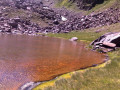
Accessible via a route that takes climbers to the Pointe de Roumazet, this little-known pond is well worth a visit due to the uniqueness of its setting. Overhung by two sloping peaks shaped like gigantic horns, it is surrounded by scree slopes laden with iron ore, which explains the red colour of its waters. The aquatic plants lining its banks are a vivid fluorescent green, and the white deposit left on the stones by the stream flowing out of it (thus justifying its name, Riou Blanc) completes the palette of bright colours in this landscape that is both wild and intimate.
The route, starting from Soulcem, first takes you to the Étang de Roumazet. Just before reaching it, turn right onto the path leading to the Port de Roumazet; you must then leave this path to follow the Riou Blanc upstream to the pass that overlooks the small plateau where the Étang Rouge de Riou Blanc is nestled.
The Château and the Grotte de Coulzonne on a short route from Roquefixade
2.76 mi
+791 ft
-778 ft
1h 55
 Easy
Departure from Roquefixade (Ariège)
Easy
Departure from Roquefixade (Ariège)
This route (actually walked, not copied) follows the one published by Grenouille09, but shortens the return leg. A route of around 2 hours.
The route along the ridge is slightly different from that of the hike mentioned above, but this doesn’t make much difference; it’s impossible to get lost. We’ve simply added a few extra details below.
Mont Fourcat via Croquié
 5.88 mi
+2,598 ft
-2,618 ft
5h 00
Average
Departure from Mercus-Garrabet (Ariège)
5.88 mi
+2,598 ft
-2,618 ft
5h 00
Average
Departure from Mercus-Garrabet (Ariège)
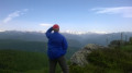
At an altitude of 2,000 metres, Mont Fourcat is the northernmost peak of the Cirque des Monts d'Olmes. It offers a vast view of the plain to the north and a view of the entire Ariège mountain range to the south and west. Beyond that, on a clear day, you can even see the Maladetta glacier in the distance. To the east, the view plunges into the Cirque des Monts d'Olmes, dominated by the imposing Saint-Barthélemy.
You first climb through a beautiful forest and as soon as you reach the open space among the ferns and heather, which then give way to rhododendrons, broom and gispet, you can enjoy a beautiful view as you walk along a ridge formed by continuous grassy hillocks leading to the summit.
This outing is quite challenging (800 m elevation gain), but the route is entirely on very comfortable trails and tracks, hence its "medium" rating.