Greenway, Locjean Chapel, countryside and ponds around Rosporden

This route starts on the greenway, a former railway line between Carhaix and Rosporden, before reaching the Locjean Chapel. It continues along sunken lanes, farm tracks and quiet country lanes, taking in picturesque villages in the Rosporden countryside, before returning to the starting point alongside ponds frequented by numerous resident and migratory birds.

Details

32562728
Creation:
Last update:
Last review:
  • Walking
    Activity: Walking
  • ↔
    Distance: 9.90 mi
  • ◔
    Average duration: 4h 50 
  • ▲
    Difficulty: Moderate

  • ⚐
    Back to start: Yes
  • ↗
    Ascent: + 348 ft
  • ↘
    Descent: - 358 ft

  • ▲
    Highest point: 515 ft
  • ▼
    Lowest point: 299 ft
  • ⚐ Country: France
  • ⚐ City: Rosporden (29140)
  • ⚑
    Start/End: N 47.96186° / W 3.828477°
  • ❏
    IGN map(s): Ref. 0620ET
  • Hour-by-hour weather

Photos

Description of the walk

Start point: Second Étang car park.

GRP® signposting (yellow and red)

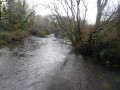
(S/E) Facing the second pond, leave the car park on the left to join the greenway, which forms part ofthe GRP® Tour des Portes de Cornouaille route at this point. Follow it to the right, cross a bridge over the Aven, ignore the first path on the right and reach the start of a second path on the left.

Unmarked

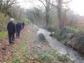
(1) Follow this path, turning left then right before a footbridge over the Aven. Walk along the left bank of the Aven on a path that veers to the right, then turn left onto an uphill path opposite a ‘no hunting’ sign. Follow this path until you reach a small road; follow it to the right to cross the greenway again.

GRP® signposting (Yellow and Red)

(2) Continue left along the greenway and, after five hundred metres, let theGRP® route branch off to the right.

Mountain bike markings (yellow)

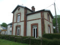
Continue along the greenway, pass under two high-voltage power lines and cross the D782. Cross it carefully, continue straight ahead and reach the former Rubian-Locjeanrailway halt (informative panels on the history of the Carhaix–Rosporden railway line opposite the halt).

No signposting

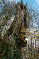
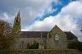
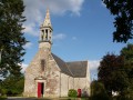
(3) Leave the greenway by going round the station on the right. Carry on to the left at the next junction, then turn left to reach the Locjean Chapel (note the tree trunk carved with a Korrigan and a magnificent oak tree).

(4) Go round the chapel on the right, continue right onto a small road and follow it to the end. Take a small road on the left and follow it for a few dozen metres until you reach the start of a path on the right.

(5) Follow the path, turning left then right to reach a small road (along the way, there are lovely views of the bocage and the Coatloc’h and Cascadec forests). Follow the road to the left, go straight ahead at the next junction and you’ll arrive at the village of Quistinit.

Mountain bike signposting (yellow)

(6) Turn right just after the Quistinit signpost, then turn left and then right to reach a downhill track after an old house with a pink façade and blue shutters. Follow this track as it veers to the left, ignoring the paths branching off to the left and right, until you reach a junction at the bottom of the descent.

(7) Turn right onto a path which joins a small road. Follow it to the right, passing Stang Rozoz farm, ignore a road on the right and continue uphill until you reach the start of a path on the right, level with Kerlouan farm.

(8) Follow this path downhill, then turn left onto a sunken track that climbs steadily before veering left and crossing a small road. Continue to the right until you reach a junction at the foot of the Kerstéphan water tower.

(9) Turn left, pass under the first high-voltage power line and turn right onto a path. Pass under a second high-voltage power line and cross a road. Continue straight ahead to reach the village of La Grande Boissière.

(10) Walk through the village, ignore a road on the left and join theGRP® Tour des Portes de Cornouaille at the next junction.

GRP® signposting (yellow and red)

Carry on to the right at an acute angle, then turn left onto a small road which continues as a stony track before reaching another road. Follow this to the right until you reach the village of Bourdel.

(11) Take the road on the left after the village, turn right to go round the Trémel farm, then take the path on the left after the farm buildings. Continue along this path, which leads onto a small road, and reach the start of a new road on the left, just before the D782.

Mountain bike signposting (yellow)

(12) Leave theGRP® and follow this road. Ride alongside a property, then continue along a path. Pass a makeshift pétanque court and reach the village of Kerantou. Turn right, then left, and turn right onto a path that joins the D782.

(13) Follow it to the left via a designated path on the left-hand side, then onto a pavement, and cross the road carefully just before a roundabout. Continue alongside the D782 and look out for a path on the right after the Rosporden Technical Services premises.

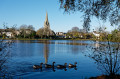
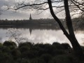
(14) Follow this path between the Paris–Quimper railway line on the left and a wetland area on the right to reach the Second Étang. Carry on and turn left onto a footbridge through a tunnel under the railway line to reach the Premier Étang and the Church of Notre-Dame de Rosporden.

(15) Walk round the church and return across the footbridge in the opposite direction. Then turn left and walk along the Second Étang to reach the car park (S/E).

Waypoints

  1. S/E : mi 0 - alt. 374 ft - Second Étang car park - Gare de Rosporden
  2. 1 : mi 0.28 - alt. 377 ft - Start of a footpath on the left - Aven (fleuve)
  3. 2 : mi 0.94 - alt. 420 ft - Greenway
  4. 3 : mi 2.22 - alt. 423 ft - Former Rubian-Locjean railway station
  5. 4 : mi 2.5 - alt. 476 ft - Locjean Chapel
  6. 5 : mi 2.87 - alt. 502 ft - Start of a footpath on the right
  7. 6 : mi 3.9 - alt. 479 ft - Quistinit
  8. 7 : mi 4.77 - alt. 344 ft - Junction of footpaths. Near the - Ster Goz (rivière) - Affluent de l'Aven
  9. 8 : mi 5.56 - alt. 410 ft - Path on the right, level with Kerlouan Farm
  10. 9 : mi 6.13 - alt. 453 ft - Junction near a water tower
  11. 10 : mi 6.57 - alt. 423 ft - La Grande Boissière
  12. 11 : mi 7.4 - alt. 469 ft - Bourdel
  13. 12 : mi 8.08 - alt. 456 ft - Road on the left
  14. 13 : mi 8.69 - alt. 407 ft - D782
  15. 14 : mi 9 - alt. 387 ft - Start of a footpath on the right
  16. 15 : mi 9.6 - alt. 377 ft - Église Notre-Dame (Rosporden)
  17. S/E : mi 9.9 - alt. 371 ft - Second Etang car park

Notes

Between (1) and (2), you can, of course, continue in a straight line along the greenway. As well as exploring the wetland area around the third pond, the aim of this detour is to break up the monotony of the first section of the route.

Between (5) and (6), the paths can be very muddy in winter or after heavy rain. Waterproof, high-top walking boots are strongly recommended where necessary.

There are a few patches of tarmac here and there, but very few people use them.

It is possible, and indeed advisable, to extend this route by walking around the ponds, which adds only 1 to 2 km depending on the route taken. Binoculars may be useful for spotting the many birds that inhabit the ponds.

The areas around the ponds can be busy at weekends or during the summer months. It’s completely deserted as soon as you head out into the countryside.

Market every Thursday morning in Rosporden.

Alternative car park near Notre-Dame Church.

Picnic tables, benches and information boards are located all around the ponds and along the greenway.

Toilets to the left of the church car park.

Worth a visit

Rosporden Ponds and the Aven Valley.

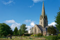
Notre-Dame Church (14th century, remodelled in the 16th and 19th centuries).
In the fenced area of land, the grave of Pierre Le Cor, whom Pierre Loti named Yves Kermadec in his novel *Mon Frère Yves*, based on true events. The house where the writer stayed is on Place de Verdun, a stone’s throw from the church.

Saint John the Baptist Chapel in Locjean (16th century) and the trunk of a centuries-old yew tree adorned with a sculpture of a Korrigan created by Patrig Ar Goarnig in 2007. This sculpture was damaged by arson.
A remarkable oak tree nearby.

Rubian-Locjean rest stop.

Greenway: the former railway line from Carhaix to Rosporden.

Beautiful old houses in the hamlets along the route and lovely views over the bocage and the forests of Coatloc’h and Cascadec.

Reviews and comments

4.8 / 5
Based on 2 reviews

Reliability of the description
5 / 5
Ease of following the route
5 / 5
Route interest
4.5 / 5
Arthur 29
Arthur 29

Overall rating : 5 / 5

Date of your route : Jul 15, 2024
Reliability of the description : ★★★★★ Very good
Ease of following the route : ★★★★★ Very good
Route interest : ★★★★★ Very good
Very busy route : No

This is the third time I’ve done this walk. It’s lovely and easy, even in rubbish weather. I do it when I want to get back into the swing of things after a break. The signposting is spot on – though in the hamlet of Quistinit, you need to turn just before the farm (the sign must have been moved). Thanks!

Machine-translated

RIBIN
RIBIN

Overall rating : 4.7 / 5

Date of your route : Oct 12, 2023
Reliability of the description : ★★★★★ Very good
Ease of following the route : ★★★★★ Very good
Route interest : ★★★★☆ Good
Very busy route : Yes

A very pleasant route, but take care on sections of road that can be dangerous.
If you’re doing this in autumn, some sections are likely to be quite muddy in wet weather.
Don’t hesitate to take a detour to visit the chapel at LOCJEAN.

Machine-translated

Other walks in the area

For more walks, use our search engine .

The GPS track and description are the property of this route's author. Please do not copy them without permission.