Jesselsberg, Scharrarbergheim from Wolxheim

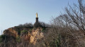
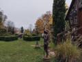
A walk that allows you to explore the dry hills of Jesselsberg and Scharrach, protected and managed by the Conservatoire des Sites Alsaciens. You can take a short detour via Kaltenbrunnen and reach Soultz via the Chemin des Casemates. The return route takes you past the Horn, an imposing statue of the Sacred Heart erected in 1912, which offers a beautiful view of the vineyards.

Details

29602488
Creation:
Last update:
Last review:
  • Walking
    Activity: Walking
  • ↔
    Distance: 8.24 mi
  • ◔
    Average duration: 4h 40 
  • ▲
    Difficulty: Moderate

  • ⚐
    Back to start: Yes
  • ↗
    Ascent: + 988 ft
  • ↘
    Descent: - 974 ft

  • ▲
    Highest point: 1,148 ft
  • ▼
    Lowest point: 551 ft
  • ⚐ Country: France
  • ⚐ City: Wolxheim (67120)
  • ⚑
    Start/End: N 48.570912° / E 7.506202°
  • ❏
    IGN map(s): Ref. 3716ET, 3716ETR
  • Hour-by-hour weather

Photos

Description of the walk

Park near the Saint-Denis Chapel, situated on the outskirts of Wolxheim heading towards the Soultz Canal.

(S/E) Head south and, at the bend, turn right to join the D45. Follow it to the right towards “le Canal” as far as the Saint-Léon Retirement Home.

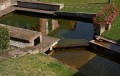
(1) Leave the road to the left, cross the canal’s feeder channel and turn right to rejoin the greenway. Follow it until it intersects with the greenway towards Molsheim, just past a picnic area. Continue until you reach the D422.

(2) Cross it – watch out for heavy traffic. Carry on straight ahead and take Rue Saint-Amand. Continue along the path which turns right then left, until you reach a crossroads of paths.

(3) Keep left to join the signposted ‘Green Ring’ path at a place called Oberberg. See ‘During the walk’ or ‘Nearby’.

(4) Turn right onto the ‘Green Ring’ path (caution: slippery in wet weather), pass the Holtzbrunnen (two pools) and continue to Soultz-les-Bains. Cross the D4 again with care and join the greenway after crossing the Mossig.

(5) Turn left onto the greenway and follow it to Scharrachberheim-Irmsett. Continue along Rue des Jardins; at the end of the street, past the school, you’ll reach the junction with the D225.

(6) Turn right onto Rue Principale and follow it to Rue de la Montagne.

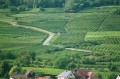
(7) Turn right onto this street (marked with a Red Ring) and continue along the path through the vineyards until you reach the junction with the Sentier de Découverte.

(8) Turn left and follow the ‘Sentier de Découverte’ to the main road in Dahlenheim (D118).

(9) Cross the road and, opposite, head towards La Horn (Red Ring). This will take you to theGR®534(Red Diamond) and then on to La Horn and its Sacré-Cœur monument.

(10) There’s a lovely view from the monument; look out for the Saint-Denis Chapel. Carry on for 500 metres downhill to reach the Saint-Denis Chapel (S/E).

Waypoints

  1. S/E : mi 0 - alt. 591 ft - Chapelle Saint-Denis (Wolxheim)
  2. 1 : mi 0.56 - alt. 558 ft - Junction. Cross the - Canal de la Bruche
  3. 2 : mi 1.12 - alt. 571 ft - Cross the D422. After the - Mossig (rivière)
  4. 3 : mi 1.63 - alt. 840 ft - Junction with the Jesselesberg path
  5. 4 : mi 2.43 - alt. 1,145 ft - Oberberg
  6. 5 : mi 4 - alt. 564 ft - Junction with the greenway
  7. 6 : mi 5.39 - alt. 581 ft - Exit via Rue Principale
  8. 7 : mi 5.72 - alt. 659 ft - Exit via Rue de la Montagne
  9. 8 : mi 6.82 - alt. 830 ft - Junction with the Sentier de la Découverte
  10. 9 : mi 7.15 - alt. 830 ft - Cross the D118 at the Dahlenheim exit
  11. 10 : mi 7.81 - alt. 781 ft - Horn - Sacré Cœur (Horn)
  12. S/E : mi 8.24 - alt. 591 ft - Saint-Denis Chapel

Notes

At Holtzbrunnen there are two pools, a refreshing spot in summer.

Worth a visit

At point (4), if you carry on straight ahead, you can take a short detour to Kaltenbrunnen, where there are two fountains, and return via the Chemin des Casemates (Red Disc).

Always be cautious and plan ahead when you're outdoors. Visorando and the author of this route cannot be held responsible for any accidents occurring on this route.

The GR® and PR® markings are the intellectual property of the Fédération Française de Randonnée Pédestre.

Reviews and comments

4.3 / 5
Based on 2 reviews

Reliability of the description
4 / 5
Ease of following the route
4 / 5
Route interest
5 / 5
goettle
goettle

Overall rating : 3.7 / 5

Date of your route : Apr 27, 2026
Reliability of the description : ★★★☆☆ Average
Ease of following the route : ★★★☆☆ Average
Route interest : ★★★★★ Very good
Very busy route : No

The written directions are a bit too brief, but the GPX file is spot on
The variety of landscapes along the route makes this route truly appealing

Machine-translated

isasup
isasup

Overall rating : 5 / 5

Date of your route : Oct 16, 2023
Reliability of the description : ★★★★★ Very good
Ease of following the route : ★★★★★ Very good
Route interest : ★★★★★ Very good
Very busy route : No

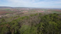
A truly beautiful route through the vineyards. Stunning views of the Black Forest and the villages in the wine-growing region.
I did the route in the opposite direction, starting from Scharrachbergheim. I also avoided the cycle path by walking along the parallel tracks.

Machine-translated

Other walks in the area

For more walks, use our search engine .

The GPS track and description are the property of this route's author. Please do not copy them without permission.