Ihisu

A short circular loop to climb above Bidarray.

Details

3145690
Creation:
Last update:
Last review:
  • Walking
    Activity: Walking
  • ↔
    Distance: 4.16 mi
  • ◔
    Average duration: 3h 05 
  • ▲
    Difficulty: Moderate

  • ⚐
    Back to start: Yes
  • ↗
    Ascent: + 1,325 ft
  • ↘
    Descent: - 1,316 ft

  • ▲
    Highest point: 1,516 ft
  • ▼
    Lowest point: 269 ft

Photos

Description of the walk

To get to the start, head to Bidarray via the D918 and park at the entrance to the Latsaga district; there are spaces near the bins and just before the shelter along the D918. Please note that the car park between the restaurant and the Ur Bizi rafting centre is reserved for customers of these establishments.

(S) Head back west along the D918; there is a footpath on the verge.
Turn north onto the small road that runs alongside the bar and continue to the second left-hand bend.

(1) Turn onto the path leading off to the right towards the north as you come out of the bend. The path climbs gently up to a T-junction near the Xaraboilenea farm.

(2) Take the path on the left, heading west, which goes through a gate (close it behind you), winds through woodland and leads to a meadow.

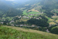
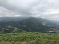
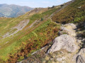
(3) Turn left towards the south-west at the bottom of the meadow, step over the fence onto a small platform and climb to the summit of Ihisu following the ridge line (path not shown on the map but clearly visible amongst the ferns).

(4) Continue down the opposite slope, still following the ridge line until you reach a gently sloping path (path not shown on the map). Please note, the path leads to Lardapidea farm but you cannot cross through.

(5) Turn slightly to the right to go round the small copse on the right, then turn left after it to reach the road. (path not shown on the map).

(6) Take the road on the right.

(1) Continue along the road to return to the start (S/E).

Waypoints

  1. S/E : mi 0 - alt. 279 ft - Ur Bizia car park
  2. 1 : mi 0.57 - alt. 571 ft - Common junction. Return route to the right
  3. 2 : mi 1.65 - alt. 807 ft - Xaraboilenea
  4. 3 : mi 2.01 - alt. 1,125 ft - Clearing
  5. 4 : mi 2.54 - alt. 1,516 ft - Summit - Ihisu
  6. 5 : mi 2.94 - alt. 968 ft - Small fork before the woods
  7. 6 : mi 3.11 - alt. 735 ft - Lardapidea
  8. S/E : mi 4.16 - alt. 279 ft - Return to the car park

Notes

No water sources along the route.

Reviews and comments

3.7 / 5
Based on 7 reviews

Reliability of the description
3.4 / 5
Ease of following the route
3.3 / 5
Route interest
4.3 / 5
Damien_Itxassou
Damien_Itxassou

Overall rating : 3.7 / 5

Date of your route : Oct 05, 2023
Reliability of the description : ★★★★☆ Good
Ease of following the route : ★★★★☆ Good
Route interest : ★★★☆☆ Average
Very busy route : No

Thanks for this rather pleasant walk; the directions are clear. You do indeed need to go round the woods at point 5, as is clearly indicated. I had to climb over a barbed wire fence after the woods, but I may have missed a way to go round it on the right. At point 3, there was no ‘stepladder’ to get over the fence (or perhaps I missed it), so I had to climb over it.

Late summer/early autumn, I was a bit surprised by this hike, which is rated ‘moderate’ but could perhaps be classified as ‘difficult’ at this time of year. Apart from the fact that it climbs quite steeply in the first half, the last kilometre before the summit of Ihisu proved very tedious due to dense vegetation and a path that wasn’t always easy to find. Some sections are right in the middle of the ferns, up to face height in places. You have to follow the GPS track somewhat blindly, which is essential for the hike, as is clothing resistant to brambles and thorns.

The 2 kilometres of descent after the summit are also tricky, with a path that isn’t always easy to find and quite a few sections over slippery rocks – watch out for falls. Bringing walking poles seems like a good idea.

Views: very beautiful
Shade: very little
Mud: a little
Suitable for children: no
Duration: 2 hours

Machine-translated

ANNE40
ANNE40

Overall rating : 4 / 5

Date of your route : Mar 27, 2022
Reliability of the description : ★★★★☆ Good
Ease of following the route : ★★★☆☆ Average
Route interest : ★★★★★ Very good
Very busy route : Yes

Hello, please do not head towards the farm at point 5 – they no longer want people walking through their fields, though the gate has been left open. From point 5, do not head towards the farm, but turn right, leaving the woods below on your left
to join the path clearly marked on the IGN map. Otherwise, it’s a lovely walk.

Machine-translated

Jijidé
Jijidé

Overall rating : 5 / 5

Date of your route : Jan 12, 2022
Reliability of the description : ★★★★★ Very good
Ease of following the route : ★★★★★ Very good
Route interest : ★★★★★ Very good
Very busy route : No

A very pleasant walk. The description is spot on right up to the end, but there’s a slight variation around point 5: we walked down almost as far as the farm, then turned right (following the contour line) into the small wooded area, which is fenced off, and walked along the fence (an easy-to-follow path). This makes it easy to find the way back via a wide path on the left at the end of the fence.
Thanks to the Visorando team for this walk off the beaten track.

Machine-translated

catsail 40
catsail 40

Overall rating : 4.3 / 5

Date of your route : Mar 28, 2021
Reliability of the description : ★★★★☆ Good
Ease of following the route : ★★★★☆ Good
Route interest : ★★★★★ Very good
Very busy route : No

Hello, it’s a lovely walk, but at the end, to get around the woods, you have to climb over a fence and cross a meadow to reach the road; it’s quite a steep climb towards the middle.

Machine-translated

Martine et Patrick
Martine et Patrick

Overall rating : 3.3 / 5

Date of your route : Feb 14, 2021
Reliability of the description : ★★★☆☆ Average
Ease of following the route : ★★★☆☆ Average
Route interest : ★★★★☆ Good
Very busy route : No

We turned off just before the farm onto a track blocked by a metal gate; further up, we walked along a meadow, passed through a gate and followed a poorly marked path towards a hilltop, but the path soon came to an end just before the summit, amidst brambles and rocks, so we turned back.
We returned to the road below and tried to pick up the path again from point 6 in the opposite direction, but after Mokorrea Farm the path is blocked by impassable barbed wire.
Nevertheless, we managed our 20,000 steps and didn’t come across a single soul.

Machine-translated

Cécile A2.
Cécile A2.

Overall rating : 2.3 / 5

Date of your route : Oct 24, 2020
Reliability of the description : ★★☆☆☆ Disappointing
Ease of following the route : ★☆☆☆☆ Very disappointing
Route interest : ★★★★☆ Good
Very busy route : No

Hello,
I did this hike today and wanted to point out two errors: the first is at point 3: when you follow the route and the instructions after the meadow, you end up at a dead end with ferns. You need to head up to the left first to reach the ridge and the summit. The views are lovely, especially with the autumn colours. I had a bit of trouble getting back down – there were lots of brambles and ferns (so be careful not to wear shorts) – and then further down towards point 6, it gets a bit tricky: you come across some barbed wire. If you follow the route, you’ll need to go round it to get back onto the path and then the road.

Machine-translated

Hervé Bignon
Hervé Bignon
• Edited:

Hello Tchav, I noticed your issue when I was having another look. My route didn’t go all the way to the farm, but that’s where the path branches off to the left – so it’s further up than the point where you were looking

It’s been corrected

Machine-translated

Tchav
Tchav
• Edited:

Overall rating : 3 / 5

Date of your route : Jun 09, 2020
Reliability of the description : ★★☆☆☆ Disappointing
Ease of following the route : ★★★☆☆ Average
Route interest : ★★★★☆ Good
Very busy route : No

There is no path on the left at point number 2, just thick undergrowth and fences; otherwise, it’s a lovely viewpoint. Instead, take the fork just before it to reach the road – it’s a much shorter route.

Machine-translated

Other walks in the area

For more walks, use our search engine .

The GPS track and description are the property of this route's author. Please do not copy them without permission.