Country:
 City:
City:


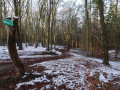
Starting point of the walk: car park at the Kärntner Hütte, where there is also an information board showing the walking routes and mountain bike trails
(S/E) We set off from the car park heading south along a wide forest track (Stadtscheide).
(1) At the junction with the picnic bench, we join the W1 circular route through the Harburg Hills and simply need to follow the signs. We continue to the left along a wide path through the woods, heading south.
(2) At the fork in the path, we keep to the right and follow the Sennhüttenweg as it winds up and down.
(3) We pass a restaurant, cross the main road and turn left, then take the 3rd right onto Wulmsberggrund. The path takes us past a few houses: 2nd right, next left, 2nd left, next right, back onto Wulmsberggrund. We leave the houses behind us, walk through a beautiful wooded area again and take the 6th left.
(4) We continue along a narrow footpath through the woods. At the fork in the path, we keep to the right, take the third right, and at the junction, the second from the right.
(5) We have reached the Bredenberg; we turn round and, at the crossroads, take the second path on the right.
(6) We walk along a stretch of heathland, take the second right and make a detour to a hill with a lovely view of the heathland. We then return to the circular route (two right turns). We take the second right onto a wide path, then immediately left, second right (here we briefly leave the circular route), and left at the fork.
(7) We have reached the Scheideberg. At the end of the path, we turn right and are back on the circular route. At the end, turn right and then immediately left, then left, right, right; at the fork, turn left; at the next fork, turn left again and then turn left.
(8) We reach a residential area and turn left onto the Talweg, which we follow as far as a woodland; there, we turn right, then take the next right and another right. At the end, turn left onto Bredenbergsweg, cross the Ehestorfer-Heuweg and, just beyond it, take the second left; then turn right near the car park, then right onto the Wiedenthaler Trift and then right again onto the Schäferstieg.
(1) We reach the junction with the picnic bench again, turn left and walk back along the familiar path to the car park (S/E).
 Visorando Member

 Easy
Easy