The Grenairon mountain refuge

A return walk to the Chalet du Buet, finishing with a circular route to see the Sabaudy and Déchargeux waterfalls.

Details

n°5065
Creation:
Last update:
Last review:
  • Walking
    Activity: Walking
  • ↔
    Distance: 12.13 mi
  • ◔
    Duration according to the author: 10 hrs 
  • ▲
    Difficulty: Very difficult

  • ⚐
    Back to start: Yes
  • ↗
    Ascent: + 4,623 ft
  • ↘
    Descent: - 4,629 ft

  • ▲
    Highest point: 6,457 ft
  • ▼
    Lowest point: 2,510 ft

Photos

Description of the walk

Park at the Auberge de Salvagny (a stopover lodge located at the entrance to Salvagny).
(S/E) Take the road towards Passy for about 700 metres. When the road bends left towards Passy, turn right after the last houses, crossing the meadow beneath the ski lifts. Head for the resort’s large car park.

(1) Take the path on the left and follow the track, which runs alongside the D29 road, as far as the Croix des Sprits.

(2) Leave the road and turn left onto the path which winds its way uphill through the woods. You’ll reach the hairpin bends opposite the Crépines chalets.

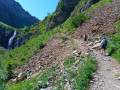
(3) Carry on until you reach the foot of the cliff.

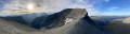
(4) Begin the final ascent via a series of tight hairpin bends to reach the Grenairon, also known as the Chalet-Hôtel du Buet.

(5) Retrace your steps, this time downhill, to reach the resort’s crossroads.

(1) Head straight on towards Salvagny until you reach the wayside shrine.
Turn left onto the road; at the next junction, turn right towards the Rouget waterfall, heading for the junction of theGR®5and GR®96.

(6) Turn right and follow theGR®5to a wooden bridge.

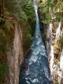
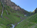
(7) Cross the Giffre via this bridge and follow the path straight ahead which climbs up to the waterfalls: first the Déchargeux waterfall, then the Saubaudy waterfall.

(8) Head back down to the wooden bridge.

(7) Turn left onto theGR®, and further on, near a chapel, you’ll reach a crossroads. Turn right onto the Route de la Cote du Fay to return to the car park where you started (S/E).

Waypoints

  1. S/E : mi 0 - alt. 2,707 ft - Salvagny Inn
  2. 1 : mi 0.68 - alt. 2,927 ft - Car park
  3. 2 : mi 1.44 - alt. 3,524 ft - Croix des Sprits
  4. 3 : mi 2.89 - alt. 4,577 ft - Les Crépines
  5. 4 : mi 3.93 - alt. 5,568 ft - Cliff
  6. 5 : mi 4.76 - alt. 6,457 ft - Grenairon mountain hut
  7. 6 : mi 9.5 - alt. 2,684 ft - Junction of the GR5 and 96
  8. 7 : mi 10.07 - alt. 2,566 ft - Bridge
  9. 8 : mi 10.71 - alt. 3,153 ft - Waterfalls
  10. S/E : mi 12.13 - alt. 2,707 ft - Salvagny Inn

Notes

Worth a visit

Always be cautious and plan ahead when you're outdoors. Visorando and the author of this route cannot be held responsible for any accidents occurring on this route.

The GR® and PR® markings are the intellectual property of the Fédération Française de Randonnée Pédestre.

Reviews and comments

5 / 5
Based on 1 review

Reliability of the description
5 / 5
Ease of following the route
5 / 5
Route interest
5 / 5
pierrethales
pierrethales

Overall rating : 5 / 5

Date of your route : Nov 05, 2018
Reliability of the description : ★★★★★ Very good
Ease of following the route : ★★★★★ Very good
Route interest : ★★★★★ Very good

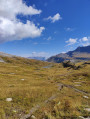
one of the finest views in the area.
Not very difficult, despite a significant elevation gain.

Machine-translated

Other walks in the area

For more walks, use our search engine .

The GPS track and description are the property of this route's author. Please do not copy them without permission.