Grande Tête Rouge, Pounche des Escaouprés and Vallon de l’Amandier

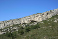
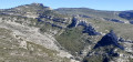
A hike that avoids the wide DFCI tracks as much as possible to reach the summits of the Grande Tête Rouge and the Pounche des Escaouprés, before descending into the bottom of the Vallon de l’Amandier, giving this route a challenging and wild character. Stunning views over Marseille and its harbour, the Étoile range to the north and the Garlaban massif to the south.

Details

11309350
Creation:
Last update:
Last review:
  • Walking
    Activity: Walking
  • ↔
    Distance: 6.91 mi
  • ◔
    Average duration: 5h 00 
  • ▲
    Difficulty: Difficult

  • ⚐
    Back to start: Yes
  • ↗
    Ascent: + 2,067 ft
  • ↘
    Descent: - 2,051 ft

  • ▲
    Highest point: 1,864 ft
  • ▼
    Lowest point: 794 ft
  • ⚐ Country: France
  • ⚐ City: Allauch (13190)
  • ⚑
    Start/End: N 43.337808° / E 5.485141°
  • ❏
    IGN map(s): Ref. 3145ET
  • Hour-by-hour weather

Photos

Description of the walk

At the main entrance to the village of Allauch, take the road on the left which winds uphill towards the cemetery. Pass the cemetery and then park on the left in the designated angled parking spaces.

(S/E) Head towards the Chemin du Garlaban. Walk for about a hundred metres and look out for the start of a path on the right. Follow this rocky path as it climbs and winds its way beneath the tall pine trees. You’ll reach a crossroads.

(1) Turn left and look out for a yellow marker. Climb steadily through the trees until you reach the ruins of the Sainte-Croix Chapel, of which only a few stones remain.
Take in the view of Allauch, Marseille and the start of the Côte Bleue. The path levels out and then descends slightly.

(2) Turn right, following the yellow markings. Take care, as the descent is steep and stony. Wind your way down through numerous hairpin bends, then turn left onto a flat, pleasant path.
You’ll pass several houses. Head uphill, still through the woodland, to reach the Col du Puits Rouge, signposted and situated next to a small hut.
The path then turns into a lovely track. Turn left onto the wide track towards Grande Tête Rouge, signposted on a rock.

(3) Walk about forty metres along the track, then turn left onto the very steep path leading to the summit of the Grande Tête Rouge. Descend northwards, following the yellow markings. Reach a junction of tracks and head towards the signpost. Turn right to reach the Pounche des Escaouprés via a steep but steady climb.

(4) Turn right for a return trip to the summit. Then continue to the right (yellow markings) to descend into the valley towards a wide DFCI track. You’ll come to a signpost.

(5) Look out for a path on the other side of the track heading north, with the Pilon du Roi in sight.
Reach this path by following a small blue-marked trail that starts at the signpost and passes a cairn. Pass several fire lookouts, begin descending a stony section, then reach a junction with a DFCI track.

(6) Cross the track and take the path running alongside it to the left, marked with old red markings. Join the track further up, then, about a hundred metres further on, take another path on the left which is circular, passing above the cliffs of the Vallon de Font Rouge.
Reach the track, cross it to arrive at the Pas du Figuier. At the top, turn left, heading north-east, to reach the Col de l’Amandier. The markings are yellow.

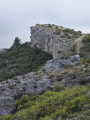
(7) Take the path which descends steeply to the left through fairly dense vegetation. This path runs along the right-hand side of the Vallon de l’Amandier. Walk for about 100 m and you will see, on the left, the start of a very overgrown path (marked by a cairn) leading towards the bottom of the valley; look out for a large, isolated rock on the right, amidst the vegetation, which you will need to reach and pass by (see photo).

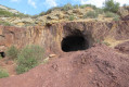
(8) Turn left onto this path, which becomes pleasant and clear after the boulder. Pass by a ruin and descend into the clearly visible valley floor. Cross a few rocky sections and potholes without difficulty (see the ‘Nearby’ section).

(9) Keep to the left at the Y-junction. Head towards the large rocky outcrops to rejoin, further down, the path that branches off to the right into a valley, heading west-north-west.

(10) You’ll come to a track; turn left here. (On the right is the end of the path with a rusty gate)
Turn left, past a gas pipeline and yellow posts, then join a dirt track. Carry on straight ahead. Pass by private properties, go through a large green gate, then follow a wire fence until you come within sight of a closed gate.

(11) A few metres before this gate, turn right onto the small path that runs alongside the wire fence and climbs towards an electricity pylon. You’ll reach the Chante Colline facilities. Turn right and follow the red route, a former bauxite mining site. Pass through the Chante Colline barrier and join a tarmac road. At the bottom, turn right onto the Chemin du Garlaban.

(12) Turn left onto a path marked in yellow which runs alongside the road and leads back to the starting point and the car park (S/E).


Waypoints

  1. S/E : mi 0 - alt. 807 ft - Garlaban Trail
  2. 1 : mi 0.16 - alt. 945 ft - Turn left at the junction - Chapelle Notre-Dame du Château (Allauch)
  3. 2 : mi 0.53 - alt. 1,224 ft - Steep descent to the right
  4. 3 : mi 1.35 - alt. 1,214 ft - Turn left towards Grande Tête Rouge
  5. 4 : mi 2.36 - alt. 1,804 ft - Crossroads: valley – summit - Pounche des Escaouprés
  6. 5 : mi 2.71 - alt. 1,644 ft - Cross the DFCI track and the path to the north
  7. 6 : mi 3.27 - alt. 1,289 ft - Cross the track and the path running alongside it
  8. 7 : mi 4.19 - alt. 1,437 ft - Steep descent to the left - Col de l'Amandier
  9. 8 : mi 4.24 - alt. 1,368 ft - Turn left towards the bottom of the valley
  10. 9 : mi 4.94 - alt. 856 ft - Turn left at the Y-junction
  11. 10 : mi 5.3 - alt. 794 ft - Turn left onto the path
  12. 11 : mi 5.75 - alt. 915 ft - Turn right at the end of the fence
  13. 12 : mi 6.53 - alt. 869 ft - Path running alongside the road
  14. S/E : mi 6.91 - alt. 807 ft - Garlaban Trail

Notes

Caution: The climb up to the Grande Tête Rouge is very steep.
Avoid venturing to the bottom of the valley after a thunderstorm: risk of water running off, slippery slabs.

For reference: the author’s time for this route was 4 hours 10 minutes

Worth a visit

The section leading to the bottom of the valley can be avoided by continuing along the track after point (8). You will then pass a well restored by a hunters’ association, then turn left onto the track which winds downwards in a circular manner towards point (10) to arrive at a rusty gate.

Reviews and comments

4.5 / 5
Based on 2 reviews

Reliability of the description
4.5 / 5
Ease of following the route
4 / 5
Route interest
5 / 5
Vusky
Vusky
• Edited:

Hello,
Thank you very much for your comment. Yes, indeed, I look for walks that take you off the beaten track and often involve creating routes not marked on IGN maps (though sometimes visible on satellite imagery). This allows you to discover stunning landscapes you’d never imagine finding in such places, as well as points of interest such as karstic caves, sinkholes, springs, waterfalls, wells, ruins, valley bottoms with their potholes, and so on…
Please do feel free to send me any further comments.
Vusky

Machine-translated

visorando2017
visorando2017

Overall rating : 5 / 5

Date of your route : Apr 11, 2022
Reliability of the description : ★★★★★ Very good
Ease of following the route : ★★★★★ Very good
Route interest : ★★★★★ Very good
Very busy route : No

We love the walks organised by Vusky.
They’re reliable and often off the beaten track. That was certainly the case with this walk too. Thank you… some lovely moments out walking

Machine-translated

phildaix
phildaix

Overall rating : 4 / 5

Date of your route : Sep 29, 2021
Reliability of the description : ★★★★☆ Good
Ease of following the route : ★★★☆☆ Average
Route interest : ★★★★★ Very good
Very busy route : No

It’s absolutely stunning! We’re hiking above Marseille and the surrounding villages, through wild valleys; it’s magnificent!
The walk is challenging and rugged, but not really difficult (you might need to use your hands once or twice, but there’s no risk of vertigo).
According to the route description and the IGN map provided: everything’s fine up to point 8 (note, however, that at point 3, you mustn’t take the small gully 3 metres after the rock, but 40 metres further on). We got lost from point 8 onwards: neither on the ground nor on Google Earth can you see a path leading down to this point, nor following the bottom of the valley; in theory, you could turn further on than point 8 and rejoin the route; but without a precise map (the IGN map is definitely out of date in several places, particularly in this section of the walk), we found it more difficult and ended up finishing via the road; a shame.
Finally, the estimated duration seems very optimistic to me: we usually take much less time than expected, but this time it took much longer (even disregarding the mistake at the end of the route).
But all in all, one of the best walks of the year: thank you!

Machine-translated

Other walks in the area

For more walks, use our search engine .

The GPS track and description are the property of this route's author. Please do not copy them without permission.