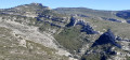
Grande Tête Rouge and the Escaouprés valley

A lovely circular walk along the paths of Marcel Pagnol, with panoramic views of the sea and mountains. To finish, a more touristy spot: Allauch and its little Notre-Dame du Château Chapel.

Details

5100701
Creation:
Last update:
Last review:
  • Walking
    Activity: Walking
  • ↔
    Distance: 5.65 mi
  • ◔
    Average duration: 4h 10 
  • ▲
    Difficulty: Moderate

  • ⚐
    Back to start: Yes
  • ↗
    Ascent: + 1,772 ft
  • ↘
    Descent: - 1,772 ft

  • ▲
    Highest point: 1,850 ft
  • ▼
    Lowest point: 702 ft
  • ⚐ Country: France
  • ⚐ City: Allauch (13190)
  • ⚑
    Start/End: N 43.334182° / E 5.486947°
  • ❏
    IGN map(s): Ref. 3145ET
  • Hour-by-hour weather

Photos

Description of the walk

Park at the Théâtre de Nature car park on Avenue Marcel Pagnol.

(S/E) Walk slightly down Avenue Marcel Pagnol and take the path on the left.

(1) Turn left to go through a gate, then follow the yellow-marked path, taking care not to take any of the paths on the left, which would lead you directly to the Notre-Dame du Château Chapel.

(2) When you reach the houses, turn right onto the path, which will widen. Walk past a small shed, then some olive trees, and continue until you reach a three-way junction.

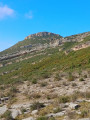
(3) Leave the track that heads downhill and turn left for about fifty metres. Then, keeping to the left, take the path that climbs very steeply to the summit of Grande Tête Rouge.

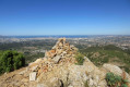
(4) At the summit (520 m), it’s worth stopping to take in the view. Then turn left to begin the descent down the opposite slope. Join a cross-country path and follow it to the right until you reach a junction with several tracks.

(5) Turn right; about fifty metres further on, let a wide path branch off to the right and continue to the next junction.

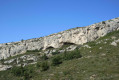
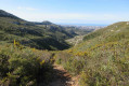
(6) Take the blue-marked path on the right to reach the Pas dei Menoun and descend to the source of the Chien. Cross this tiny stream and head up the Escaouprés valley on the left. At the 516-metre mark, take the path on the left which climbs as close as possible to the cliff.

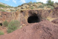
(7) Turn left and climb to quickly reach the Pounche des Escaouprés. Retrace your steps.

(7) Then continue south-west until you reach the junction you took on the way out.

(6) Carry on straight ahead (west-south-west) to reach the crossroads of tracks you took on the way there.

(6) Take the track on your right towards the Col de Cante-Perdrix.

(8) At the pass, head down to the left to join the small road leading to the village. Follow the southern flank of Petite Tête Rouge, then leave the road to follow the path running alongside it on the left.

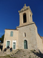
(9) Before reaching the cemetery, start the final climb on the left, which leads up to the Notre-Dame du Château Chapel.

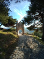
(10) All that remains is to walk down a lovely avenue, pass under the old castle gate, then turn left to reach Rue Notre-Dame. Follow it to the left, continue along Rue Trinière and return to the car park (S/E).


Waypoints

  1. S/E : mi 0 - alt. 705 ft - Théatre de Nature car park
  2. 1 : mi 0.13 - alt. 778 ft - Junction – Barrier
  3. 2 : mi 0.73 - alt. 978 ft - Path on the right
  4. 3 : mi 1.21 - alt. 1,178 ft - Three-way junction
  5. 4 : mi 1.48 - alt. 1,686 ft - Grande Tête Rouge
  6. 5 : mi 1.79 - alt. 1,490 ft - Junction on the circular Col de Cante-Perdrix loop
  7. 6 : mi 1.89 - alt. 1,526 ft - Junction of the Vallon des Escaouprés circular loop
  8. 7 : mi 2.97 - alt. 1,788 ft - Access to - Pounche des Escaouprés
  9. 8 : mi 4.02 - alt. 1,273 ft - Col de Cante Perdrix
  10. 9 : mi 5.03 - alt. 814 ft - Notre-Dame du Château Chapel Trail
  11. 10 : mi 5.26 - alt. 1,001 ft - Chapelle Notre-Dame du Château (Allauch)
  12. S/E : mi 5.65 - alt. 705 ft - Théâtre de Nature car park

Reviews and comments

4.6 / 5
Based on 3 reviews

Reliability of the description
4.3 / 5
Ease of following the route
4.3 / 5
Route interest
5 / 5
juliemolto
juliemolto

Overall rating : 5 / 5

Date of your route : May 29, 2025
Reliability of the description : ★★★★★ Very good
Ease of following the route : ★★★★★ Very good
Route interest : ★★★★★ Very good
Very busy route : No

Magnificent hike with breathtaking views! Get your cardio ready, as there are some challenging climbs, but they're well worth it! A 3h15 hike with a dog and a lot of heat!

Machine-translated

/adjedj
/adjedj

A lovely walk with magnificent views
A fairly challenging route, but completely safe

Machine-translated

Gerfaut13
Gerfaut13

Overall rating : 4.7 / 5

Date of your route : May 02, 2021
Reliability of the description : ★★★★☆ Good
Ease of following the route : ★★★★★ Very good
Route interest : ★★★★★ Very good
Very busy route : No

A lovely walk. At point 1, we couldn’t find the yellow markings, so we picked up the trail again on the small wooded hilltop above. From there, we followed it without any trouble along a very well-maintained path. The steep climb to the summit of Grande Tête Rouge is a bit of a challenge but manageable; once at the top: what a view! The 360° panorama is magnificent. We stopped for lunch at the summit. We descended on the other side. When we reached the bottom, near the crossroads, it was honestly very crowded (Sunday afternoon). On the rest of the route – the circular route – there were fewer people and we simply had to follow the trail. The return journey was trouble-free, but it was crowded again from the crossroads onwards. We visited Notre Dame du Château to round off the walk.
A lovely walk less than 10 km from home.

Machine-translated

njnrando
njnrando

See you soon, maybe on another hike, and always in great shape 👍

Machine-translated

User 3967368

Hello
If the comments are visible to users, I think that’s enough.
Thank you for the quality of the discussions, which are in everyone’s best interests

Machine-translated

njnrando
njnrando

Hello Jacques, and thank you for your feedback.
It’s true that it’s a tough climb to reach the summit of Tête Rouge, but this is mentioned in the description
As this is the only really steep section, do you think it’s worth me adjusting the difficulty rating?
Lots of walkers read the reviews, and now, thanks to you, they’ll be in the know.

Machine-translated

User 3967368

Overall rating : 4 / 5

Date of your route : Mar 03, 2021
Reliability of the description : ★★★★☆ Good
Ease of following the route : ★★★☆☆ Average
Route interest : ★★★★★ Very good
Very busy route : Yes

This route is classified as ‘moderate’ – we consider it to be rather ‘difficult’ – in fact, the climb to the summit of ‘Grande Tête Rouge’ borders on rock climbing – which is surprising, to say the least, for those unfamiliar with it –
that said, the route is magnificent and we have very fond memories of it.

Machine-translated

Other walks in the area

For more walks, use our search engine .

The GPS track and description are the property of this route's author. Please do not copy them without permission.