Around Cloué

This walk, starting from Sainte-Théodosie Church, will take you in the footsteps of Melusine along paths that are sometimes open and through woodland on the outskirts of Lusignan.

Details

18760054
Creation:
Last update:
Last review:
  • Walking
    Activity: Walking
  • ↔
    Distance: 7.13 mi
  • ◔
    Average duration: 3h 25 
  • ▲
    Difficulty: Moderate

  • ⚐
    Back to start: Yes
  • ↗
    Ascent: + 177 ft
  • ↘
    Descent: - 174 ft

  • ▲
    Highest point: 482 ft
  • ▼
    Lowest point: 322 ft
  • ⚐ Country: France
  • ⚐ City: Cloué (86600)
  • ⚑
    Start/End: N 46.441719° / E 0.163094°
  • ❏
    IGN map(s): Ref. 1727SB, 1728SB
  • Hour-by-hour weather

Photos

Description of the walk

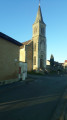
Park in front of the Church of Sainte-Théodosie.

(S/E) Set off to the left with your back to the cemetery and immediately turn right onto Chemin de La Fontaine, then, at the bottom, turn left.

(1) At the T-junction at the end of Rue Ferrée, turn right onto Rue Dauphine, then continue straight on along Rue des Martinières, and follow the path beyond the last houses.

(2) At the crossroads, on the corner of the last house, turn left, then take the first path on the right before reaching the main road and carry on towards Mons.

(3) Take a sharp right-hand bend in front of the sheds onto the small road that descends towards the Vonne. Before heading back up towards the village, take the path on the left, go past the sewage treatment plant and come out onto a road.

(4) Turn slightly left, head downhill and cross the Vonne via a bridge

(5) Turn right towards the Moulin de Leigne and its rest area, continue along the road and follow the path after the last house.

(6) Once at the top, at the T-junction, take the path on the left which follows the Lusignan bypass, then turn left, with your back to the underpass, and follow the path. Continue straight on after the right-hand bend and follow this path to the small D97b road.

(7) At the road, turn right, then, after the bend, turn right towards the houses. At the sign for Lusignan, take the dirt track on the left and, after about 200 m, you’ll come to a path branching off to the left.

(8) Turn 90° onto this track, follow the hedge and reach a cross-track; turn left to come out onto a small road.

(9) Take the path opposite, which leads down through the trees, and turn right onto the road below – but not the first one (10 m before it), which is a dead end leading to La Poupardière.
Pass through Les Hauts de Leigne and you’ll see the lay-by on the left and the River Vonne.

(5) Continue straight ahead on the road you have already taken.

(4) Leave the route you’ve already taken, carry on straight ahead along the road and head for the next junction.

(10) Leave the road and take the dirt track which climbs steeply. Carry on, ignoring the track on the right which heads towards Cloué. At the T-junction, turn right and, when you reach the road, turn right onto Rue du Treuil, and head for the car park in front of the cemetery (S/E).

Waypoints

  1. S/E : mi 0 - alt. 420 ft - Church of Sainte-Théodosie
  2. 1 : mi 0.13 - alt. 420 ft - Rue Dauphine
  3. 2 : mi 0.48 - alt. 446 ft - Junction
  4. 3 : mi 1.31 - alt. 367 ft - Mons
  5. 4 : mi 2.28 - alt. 328 ft - Road junction
  6. 5 : mi 2.45 - alt. 341 ft - Crossroads at the end of the circular loop
  7. 6 : mi 3.52 - alt. 430 ft - Junction opposite the D611
  8. 7 : mi 4.32 - alt. 456 ft - D97b road
  9. 8 : mi 4.81 - alt. 482 ft - 90° junction
  10. 9 : mi 5.55 - alt. 453 ft - Crossing the road
  11. 10 : mi 6.54 - alt. 354 ft - Cross
  12. S/E : mi 7.13 - alt. 420 ft - Church of Sainte-Théodosie

Reviews and comments

4.1 / 5
Based on 4 reviews

Reliability of the description
4.8 / 5
Ease of following the route
4.5 / 5
Route interest
3 / 5
Chamdom
Chamdom

Thank you for your comment.

Machine-translated

AYRAULT DANIELLE
AYRAULT DANIELLE

Overall rating : 4.7 / 5

Date of your route : Sep 02, 2024
Reliability of the description : ★★★★★ Very good
Ease of following the route : ★★★★★ Very good
Route interest : ★★★★☆ Good
Very busy route : No

Between points 3 and 4, there were four magnificent llamas in an enclosure, which is a rare sight in our region. At number 8, the path was poorly maintained; luckily, we’d had a good look at the walls, which kept us company all the way along the hedge. This is the second time I’ve done this route, and the great thing is we always spot something new; I love VISORANDO… See you next time

Machine-translated

philouis
philouis

Overall rating : 4.3 / 5

Date of your route : Oct 08, 2023
Reliability of the description : ★★★★★ Very good
Ease of following the route : ★★★★★ Very good
Route interest : ★★★☆☆ Average
Very busy route : No

A lovely walk, though best avoided in the heat as there’s very little shade. There’s not much in the way of historical sites apart from the village of Cloué.

Machine-translated

Chamdom
Chamdom
• Edited:

Well, where am I supposed to get the photo from if I didn’t go on the hike? And on top of that, I’m supposed to give you the soil composition as well!
During my recce, I walked over 15 km because I ended up on private land, where I went to check out a cave marked on the map that turned out to be completely uninteresting. Posting a walk already takes a fair bit of effort; I’m not a tour guide – it’s up to you to keep your eyes open. And whilst this walk might not be of any interest to you, it might be of interest to someone else.
Discovering a wash house and walking in the countryside is good enough in itself.
But between the supervisors’ daft corrections and the (fortunately rare) overly cautious comments, I’m no longer publishing any walks; I’m keeping them for myself and my friends, and I’ll leave it to you to publish your own.

Machine-translated

danmic
danmic

That means that not only did you not go on the walk – it’s just based on a map! – but you don’t know the area either, and so you don’t know what would be worth showing visitors… There might be some remarkable trees, ruins, old houses, wells… since the ‘Pas de Mélusine’ have long since been covered in tarmac. So I’d like to point out the renovated wash house right at the start of the walk along this ‘Chemin de la Fontaine’, which isn’t signposted on the ground but is no doubt marked on the map.
That said, it’s no problem as far as I’m concerned – we just went for a walk, that’s all – so don’t worry about it.
Kind regards

Machine-translated

Chamdom
Chamdom
• Edited:

And I would add that there’s nothing stopping you from taking the initiative to visit Cloué or Lusignan – take matters into your own hands; don’t expect others to do everything for you...

Machine-translated

Chamdom
Chamdom

Well, there’ll always be someone to criticise it anyway – ‘too short for a cycle route…’ – but you can’t tell what the paths are like just by looking at a map.
The best thing is to plan your own rides.

Machine-translated

danmic
danmic

Of course, but in that case, include it on the cycle route! Sometimes we go on very pleasant rides in areas where there’s nothing to see, but we’re on paths – not in the dust kicked up by every passing vehicle – through woods, pastures and villages. There’s nothing to discover there, neither in Cloué nor in Lusignan...
Otherwise, the route is very well described.

Machine-translated

Chamdom
Chamdom

Thank you for your comment. Hiking routes are planned based on what the terrain has to offer; it’s not always easy to organise good hikes.

Machine-translated

danmic
danmic

Overall rating : 3.3 / 5

Date of your route : Jul 23, 2023
Reliability of the description : ★★★★★ Very good
Ease of following the route : ★★★★☆ Good
Route interest : ★☆☆☆☆ Very disappointing
Very busy route : No

There’s nothing of interest apart from a restored wash house at the start, but the worst thing is that practically the whole route is on tarmac or gravel farm tracks – which, fortunately, aren’t very busy on Sundays!
Not recommended for a walk.

Machine-translated

Chamdom
Chamdom

Thank you for your feedback; I’m delighted to be able to share my walks with you.

Machine-translated

AYRAULT DANIELLE
AYRAULT DANIELLE

Overall rating : 4 / 5

Date of your route : Feb 25, 2022
Reliability of the description : ★★★★☆ Good
Ease of following the route : ★★★★☆ Good
Route interest : ★★★★☆ Good
Very busy route : No

A well-designed route

Machine-translated

Other walks in the area

For more walks, use our search engine .

The GPS track and description are the property of this route's author. Please do not copy them without permission.