


There are only a few benches along the route.
The only picnic tables are at the Passerelle Maria rest area.
The Lesse, the forest and the old country lane


Centred around the River Lesse and the old local road that linked Wellin to Graide, this entirely woodland walk spans the municipalities of Wellin, Daverdisse and Libin.
The route alternates between sections of signposted local walks, Grande Randonnée trails, the Entre-Lesse-et-Lomme circular route and other unmarked paths, which are consequently very little used. It is likely to be on one of these latter paths that you’ll have the chance to spot the odd wild animal, such as wild boars fleeing from one of their favourite haunts.
The route mainly follows footpaths and tracks, with only two sections on tarmac: one around the magnificent Daverdisse Mill, and the other on the small road linking Daverdisse to Redu.
Details
Creation:
Last update:
Last review:
–
–
-
 Activity: Walking
 -
 Distance: 10.72 mi
 -
 Average duration: 6h 05
 -
 Difficulty: Moderate
 -
-
 Back to start: Yes
 -
 Ascent: + 1,348 ft
 -
 Descent: - 1,345 ft
 -
-
 Highest point: 1,332 ft
 -
 Lowest point: 696 ft
-
 Country:
Belgium
Country:
Belgium
-
 Area: Massif des Ardennes
 -
 City:
Wellin
City:
Wellin -
 Start/End: N 50.045286° / E 5.137048°
 -


 Hour-by-hour weather
Photos
Waypoints
- S/E : mi 0 - alt. 709 ft - Ry des Glands – Former Redu railway station - lesse (rivière) - Belgique
- 1 : mi 0.11 - alt. 702 ft - Maria Footbridge
- 2 : mi 0.3 - alt. 748 ft - RAVeL junction – gravel path
- 3 : mi 0.48 - alt. 843 ft - GR 17, 129 & SAT
- 4 : mi 0.66 - alt. 892 ft - Trail
- 5 : mi 2.08 - alt. 1,293 ft - Junction between the GR, a stony path and a grassy track
- 6 : mi 2.41 - alt. 1,273 ft - Route
- 7 : mi 2.95 - alt. 1,047 ft - Stream
- 8 : mi 3.55 - alt. 823 ft - Former Fays railway station
- 9 : mi 4.48 - alt. 758 ft - Daverdisse Mill
- 10 : mi 4.74 - alt. 873 ft - Crossroads
- 11 : mi 6.58 - alt. 814 ft - Barbouillons Bridge - lesse (rivière) - Belgique
- 12 : mi 7.27 - alt. 961 ft - Gravel path
- 13 : mi 8.32 - alt. 1,257 ft - La Buche Haie
- S/E : mi 10.72 - alt. 709 ft - Ry des Glands – Former Redu railway station - lesse (rivière) - Belgique
Notes
Worth a visit
On the route: the Daverdisse Mill
Off the route: Redu’s ‘Village du Livre’
Other walks in the area
Between Wellin and Daverdisse
 Visorando Member
 7.18 mi
+1,414 ft
-1,430 ft
4h 30
Moderate
7.18 mi
+1,414 ft
-1,430 ft
4h 30
Moderate
 Departure from Wellin (Province de Luxembourg)
In the north of the province of Luxembourg, on the border between the Ardennes and the Famenne, a hike in the Great Forest of Saint-Hubert to discover the serenity of the forest, a few historic buildings and beautiful views.
In the Great Forest of Saint-Hubert, immerse yourself among streams and woods.
 6.43 mi
+732 ft
-702 ft
3h 35
Moderate
Departure from Wellin (Province de Luxembourg)
6.43 mi
+732 ft
-702 ft
3h 35
Moderate
Departure from Wellin (Province de Luxembourg)
Starting from the old Redu railway station, now converted into a lodge, take a walk through the Grande Forêt de Saint-Hubert, along the Ry des Glands, then the Ry de Houssi and finally along the Lesse. Immerse yourself in the forest, among conifers and deciduous trees.
L'Almache and the Belvédère
 11.81 mi
+1,795 ft
-1,788 ft
7h 00
11.81 mi
+1,795 ft
-1,788 ft
7h 00
 Difficult
Departure from Wellin (Province de Luxembourg)
Difficult
Departure from Wellin (Province de Luxembourg)
A circular forest between Daverdisse and Fays-Famenne with a magnificent diversity of trees and streams near the Lesse valley. Although entirely forested, the route offers panoramic and rural landscapes for a good kilometre near Fays-Famenne.
The Rogifosse stream
 7.59 mi
+1,368 ft
-1,368 ft
4h 40
Moderate
Departure from Wellin (Province de Luxembourg)
7.59 mi
+1,368 ft
-1,368 ft
4h 40
Moderate
Departure from Wellin (Province de Luxembourg)
Starting from the Daverdisse mill, this route is exclusively through the forest, returning along the Rogifosse stream, a tributary of La Mache, which you will find in the last kilometre.
Circular forest from Chanly
 11.91 mi
+1,631 ft
-1,608 ft
6h 55
Moderate
Departure from Wellin (Province de Luxembourg)
11.91 mi
+1,631 ft
-1,608 ft
6h 55
Moderate
Departure from Wellin (Province de Luxembourg)
Based on sections of Grande Randonnée trails and marked walks, in particular the new 'Par Monts et par Vaulx' circulars inaugurated in 2025 by the Wellin Tourist Office, the walk takes place mainly in magnificent deciduous forests where beech and oak trees reign supreme.
Circular starting from the old communal mill in Lomprez.
 12.06 mi
+1,362 ft
-1,352 ft
6h 45
Difficult
Departure from Wellin (Province de Luxembourg)
12.06 mi
+1,362 ft
-1,352 ft
6h 45
Difficult
Departure from Wellin (Province de Luxembourg)
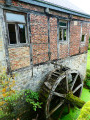
This long walk, which is mostly through forest for just over half of the route, starts behind the imposing church of Lomprez with its turrets. The old village mill is nearby. While the street-facing building and its dormer window (whose pulley has disappeared) are in good condition, the rear and the old wheel are in need of restoration. There are a few difficulties on this route: see the "description" box.
Through mountains and valleys from Lomprez
 14.41 mi
+1,378 ft
-1,388 ft
7h 50
Difficult
Departure from Wellin (Province de Luxembourg)
14.41 mi
+1,378 ft
-1,388 ft
7h 50
Difficult
Departure from Wellin (Province de Luxembourg)
With sections in the countryside offering magnificent panoramic views of the Famenne and Calestienne regions and beautiful forest sections alternating between deciduous and coniferous trees, this long circular walk is one of the 2025 proposals from the Wellin Tourist Office. It is part of a series comprising a large circular 50 km and four other smaller circular ones, including this one.It is worth noting that the circular route passes through Sohier, one of the most beautiful villages in Wallonia, with its pretty stone houses: don't miss the old village hall/school, the church and the castle.
To the Pont du Sanglier from Redu
6.89 mi
+860 ft
-856 ft
3h 55
 Easy
Departure from Libin (Province de Luxembourg)
Easy
Departure from Libin (Province de Luxembourg)
A lovely walk of nearly 11 km, mostly along the banks of the Lesse and through the woods.
Start from the centre of Redu near the tavern.
There you’ll find a small beach (1) where you can have a picnic or dip your toes in the water.
The route is fairly easy, although there are a few short climbs, but nothing too difficult.
I simply crossed the Lesse at (5) about 750 m from the Pont du Sanglier (4) – the water was 30 cm deep – to follow the riverbank in the opposite direction; otherwise, you can turn around and retrace your steps to rejoin the route at the Pont du Sanglier.
And to finish off, enjoy a drink on the terrace at the tavern at the starting point.
For more walks, use our search engine .
The GPS track and description are the property of this route's author. Please do not copy them without permission.

