Route of the Five Villages starting from Tonnoy

A walk to explore the little-known villages of Velle-sur-Moselle, Haussonville, Saffais, Ferrières and Tonnoy.

Details

n°3271423
Creation:
Last update:
Last review:
  • Walking
    Activity: Walking
  • ↔
    Distance: 11.48 mi
  • ◔
    Average duration: 5h 50 
  • ▲
    Difficulty: Difficult

  • ⚐
    Back to start: Yes
  • ↗
    Ascent: + 630 ft
  • ↘
    Descent: - 600 ft

  • ▲
    Highest point: 1,161 ft
  • ▼
    Lowest point: 764 ft
  • ⚐ Country: France
  • ⚐ City: Tonnoy (54210)
  • ⚑
    Start/End: N 48.549301° / E 6.243447°
  • ❏
    IGN map(s): Ref. 3416E, 3416O
  • Hour-by-hour weather

Photos

Description of the walk

The walk starts at a small car park opposite the entrance to the Grand Vanné campsite on the D74 in Tonnoy.

(S/E) Pass through the barrier to keep cars out and take the field path, following the ‘Blue Circle’ or ‘Nancy/Épinal’ signposts, and continue along the Moselle. At the next four junctions, turn left between the ponds and the Moselle.

(1) You’ll come out onto a pebble beach; turn right immediately, follow the track and turn left to reach the Canal des Voges.

(2) At the canal, turn left. Continue along the canal until you reach Lock No. 41 at Crévéchamps.

(3) At the road, turn left onto Rue de Velle (D 116), leave the ‘Blue Circle’ signposting and follow the ‘Red Ring’ signposting. Leave the signposting and cross over the Moselle on the metal bridge to enter the village.

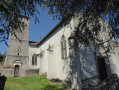
(5) At the first junction, turn right onto Rue du Bac. At the end of the street, turn right onto Grande Rue. Turn left onto Rue de l’Église. Walk past the church and rejoin Grande Rue.

(6) Follow this road, turn left, then take the first right into Rue du Calvaire.

(7) At the calvary, take the path on the left; towards the end it’s a bit hard to see, but you need to reach a track at the top of the embankment.

(8) At the track, first turn left then right and carry on straight ahead along the hedge. At the end of the field, carry on straight ahead into the woodland.

(9) At the end of the small path, turn left then right onto the field track running alongside the woodland and join the D 116A. At the road, turn right. At the junction with the D 112, cross the road and carry on straight ahead towards Haussonville along the D 116A, entering the village.

(10) At the first junction, turn right towards Blainville. Walk past the back of the church. In the bend, turn left, walk past the entrance to the castle and join the Grande Rue. Turn left and continue along this street to leave the village.

(11) Take the first road on the left, after the bridge, towards Saffais. Continue along the small road and enter the village of Saffais.

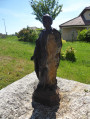
(12) At the end of the small road, first turn right then left into Rue de Ferrière, passing the church and the statue of Saint-Quentin. Continue straight on along the small road to reach the village of Ferrière.

(13) At the entrance to Ferrière, at the junction with the D112, first turn right then left onto Rue du Chemin Creux. At the end of the street, turn left and pass the church.

(14) At the next junction, by the town hall, turn right onto Rue de la Mairie and carry on straight ahead. At the end of the street, veer to the right.

(15) At the end of the short street, turn left, then take the first field track on the right. At the end of the field, turn left along the hedge and carry on straight ahead to join a small road.

(16) Follow it to the right, carry on straight ahead and enter the village of Tonnoy.

(17) At the junction with a wayside cross, turn right onto Rue du Moulin and carry on straight ahead along Rue de l’Église.

(18) At the end of the street, turn left onto Grande Rue and carry on straight ahead to leave the village, cross the bridge over the Moselle and reach the car park (S/E).

Waypoints

  1. S/E : mi 0 - alt. 768 ft - Small car park near the Grand Vanne campsite - Moselle (la)
  2. 1 : mi 1.23 - alt. 774 ft - Pebble beach
  3. 2 : mi 1.32 - alt. 784 ft - Vosges Canal
  4. 3 : mi 2.33 - alt. 794 ft - Lock No. 41 - Canal de l'Est
  5. 4 : mi 2.53 - alt. 784 ft
  6. 5 : mi 2.87 - alt. 787 ft - Rue du Bac
  7. 6 : mi 3.09 - alt. 781 ft - Grande Rue
  8. 7 : mi 3.22 - alt. 807 ft - Calvary
  9. 8 : mi 3.25 - alt. 833 ft - Trail
  10. 9 : mi 3.72 - alt. 935 ft - In the woods
  11. 10 : mi 5.43 - alt. 951 ft - Entrance to Haussonville
  12. 11 : mi 5.76 - alt. 919 ft - The road to Saffais
  13. 12 : mi 7.73 - alt. 1,145 ft - Saffais
  14. 13 : mi 8.46 - alt. 1,086 ft - Junction with the D112
  15. 14 : mi 8.69 - alt. 991 ft - Rue de la Mairie
  16. 15 : mi 9.4 - alt. 1,033 ft - Junction of two country lanes (elevation 315)
  17. 16 : mi 10.06 - alt. 961 ft - Junction on a country road
  18. 17 : mi 10.64 - alt. 791 ft - To the Calvary on Rue du Moulin
  19. 18 : mi 10.94 - alt. 794 ft - Grande Rue
  20. S/E : mi 11.48 - alt. 768 ft - Small car park near the Grand Vanne campsite

Worth a visit

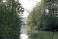
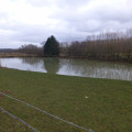
Set off between the ponds and the Moselle, then along the Canal des Vosges
A visit to the village of Velle-sur-Moselle, its church and the wayside cross
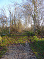
A bit of countryside and woodland
A visit to the village of Haussonville, its castle and its church
A stretch of country road with high vantage points over the Meurthe valley: Varangéville, Le Léomont and Lunéville
A visit to the village of Saffais with its statue of Saint Quentin
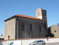
A visit to the village of Ferrières and its church
A visit to the village of Tonnoy, with the option of a detour to the church and the war memorial

Reviews and comments

4.2 / 5
Based on 2 reviews

Reliability of the description
5 / 5
Ease of following the route
3.5 / 5
Route interest
4 / 5
Gdupo54
Gdupo54

Overall rating : 4.3 / 5

Date of your route : Jan 01, 2022
Reliability of the description : ★★★★★ Very good
Ease of following the route : ★★★★☆ Good
Route interest : ★★★★☆ Good
Very busy route : No

Lots of sections on small (quiet) roads. Ideal for muddy terrain

Machine-translated

Brunodid
Brunodid

Overall rating : 4 / 5

Date of your route : Jul 08, 2021
Reliability of the description : ★★★★★ Very good
Ease of following the route : ★★★☆☆ Average
Route interest : ★★★★☆ Good
Very busy route : No

A lovely walk with varied scenery, but not very busy. As a result, some sections off the main marked routes were not maintained and were therefore overgrown with tall grass and, in places, brambles. Best avoided when the vegetation is growing.

Machine-translated

Other walks in the area

For more walks, use our search engine .

The GPS track and description are the property of this route's author. Please do not copy them without permission.