Country:
 City:


(S) Set off from the car park at the Haut-Asco ski resort. The path starts next to the rubbish bins to the north-east of the car park. As this section is an alternative route, it is marked with a double yellow line.
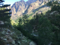
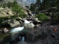
Follow the path through the forest, heading south-east at first, then south-west afterwards. The route runs along the mountainside amongst Laricio pines. A few metres after crossing a stream, the trees begin to thin out and the path gives way to a route amongst boulders on the left bank of a stream, the Tighiettu.
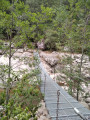
(1) After about an hour’s walk, you reach a footbridge over the Tighiettu. The scenery is already magnificent, with Punta Minuta and the few patches of snow that may still remain in the Cirque de Trimbolacciu to the south.
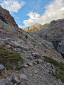
The real challenge begins after this footbridge. The ascent starts on wide slabs, which are slippery in wet weather, now fitted with handrails for the most dangerous sections.
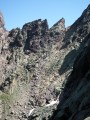
After a few sections of ‘scrambling’, you come to a more or less normal path which heads eastwards into a steep-sided valley. To the right, you can see the Tour Penchée, which may look menacing, and at the top of this couloir, the north face of Monte Cinto, covered in yellow lichen.
The path is sometimes difficult due to slippery and unstable rocks. Allow at least an hour and a half to reach a flat area in the middle of a scree slope, just below the Bocca Borba.
(2) A path branches off to the left. Take the path on the right, continuing to follow the double yellow markings heading south.
(3) After a few fairly steep hairpin bends on slippery ground, a cairn on your left and red markings will show you the way to Lac d’Argentu.
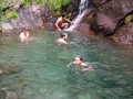
This pretty little lake at the foot of Monte-Cinto may surprise you with the clarity of its water… but also with the rubbish lying at the bottom.
Return to the main path, then continue left, heading south and then south-west towards the Point des Éboulis, which you can see to the south-west. There are still a few almost vertical sections equipped with handrails. This may be dizzying for those prone to vertigo.
(4) You’ll reach the small pass next to the Point des Éboulis in about an hour from the lake.
To reach the summit, follow the narrow path eastwards, marked by sparse red dots. The path descends down the southern slope of the mountain, then climbs back up onto the ridge, before descending again and climbing once more… all over enormous boulders with sporadic markings. It’s not really hiking… and it’s very gruelling!
You’ll find a semblance of a path just below the summit, which you reach from the east.
(5) At Monte Cinto, your efforts are rewarded with a superb 360° panorama.
Retrace your steps… without losing sight of your goal: the red markers!
Back at the pass (4), put your rucksacks back on! Begin the descent south-west towards Bocca Crucetta. You’ll follow the southern ridge above Lake Cinto, passing a few vantage points to the north overlooking a pretty, unnamed lake…
At Lake Cinto, a short, steep climb where you’ll need to use your hands takes you over the Bocca Crucetta.
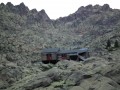
(6) From this pass, a long descent awaits you, starting on slippery stones and then continuing through fairly steep and crumbly rocky sections. The Tighiettu refuge can be reached in 1½ to 2 hours: here you’ll find the red and white markings ofthe GR®20. You can spend the night at the refuge, or take a short break and carry on to the charming Ballone sheepfold.
(7) To do this, follow theGR®20due south. Cross the Crucetta stream and walk down the left bank for a few minutes, then cross it again to reach the sheepfold via the right bank.
(E) The Bergerie de Ballone is a lovely spot by the river for camping.

 Visorando Member
 Association / Club / Walk leader
 Extremely difficult
 Difficult
 Moderate