


Refine your search for walks in Goumois
Goumois walks
 Circular route via “Chez le Bolé” to Goumois
 Visorando Member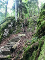
 7.51 mi
 +2,369 ft
 -2,343 ft
 5h 30
5h 30
 Difficult
 Departure from Goumois (Canton du Jura) (Canton of Jura)
Circular hike starting from Goumois for a short but intense hike, mainly through woodland.
As you cross the bridge, look out for the Rocher du Singe on your left – it’s incredible.
The climb up to “Chez le Bolé” follows a challenging (but not dangerous) path – expect chains and ladders along the way!
Return via Muriaux, along lovely paths and some lovely, steep descents!
Vautenaivre millstream leat
 6.89 mi
+951 ft
-945 ft
4h 00
6.89 mi
+951 ft
-945 ft
4h 00
 Moderate
Departure from Goumois (Canton du Jura) (Canton of Jura)
Moderate
Departure from Goumois (Canton du Jura) (Canton of Jura)
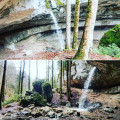
Coming from Goumois (Switzerland), park at the end of the Vautenaivre leat, next to a small rest area (with barbecue).
Les Sommêtres via La Goule
 9.04 mi
+2,254 ft
-2,267 ft
6h 05
Moderate
Departure from Le Noirmont (Canton of Jura)
9.04 mi
+2,254 ft
-2,267 ft
6h 05
Moderate
Departure from Le Noirmont (Canton of Jura)
This is a challenging walk, best done in dry weather, with a steady climb followed by a fairly technical descent through undergrowth with roots and stones.
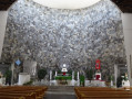
Nature lovers will be delighted by the Doubs valley and its banks, the views from the Roches des Sommêtres and the architecture of the churches and houses in the village of Le Noirmont.
The banks of the Doubs, Les Chapelles and the Corniche de Goumois viewpoint
 13.42 mi
+2,320 ft
-2,320 ft
8h 10
Difficult
Departure from Damprichard (Doubs)
13.42 mi
+2,320 ft
-2,320 ft
8h 10
Difficult
Departure from Damprichard (Doubs)
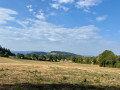
Set off to explore these magnificent trails, which are very pleasant along the River Doubs. The Leat d’Étoz and its Notre-Dame-des-Ermites Chapel, steeped in history and legend. Magnificent wooden sculptures in Urtière and its Saint-Roch Chapel. A walk through woodland, forest and meadows.
Damprichard on the banks of the Doubs
 8.85 mi
+1,949 ft
-1,952 ft
5h 45
Moderate
Departure from Damprichard (Doubs)
8.85 mi
+1,949 ft
-1,952 ft
5h 45
Moderate
Departure from Damprichard (Doubs)
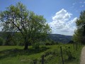
Views of the Chassera and the wind turbines in Switzerland, with the landscapes of the Haut Doubs.
Walk around the Étang de la Gruère
2.01 mi
+56 ft
-56 ft
1h 00
 Easy
Departure from Saignelégier (Canton of Jura)
Easy
Departure from Saignelégier (Canton of Jura)
Situated at an altitude of 1,000 metres, the Étang de la Gruère was created as a result of peat extraction. Restored by the Jura government, this exceptional environment has become a nature reserve. Set amongst the magnificent pastoral landscapes of the Franches-Montagnes, the site offers a chance to escape into the very Scandinavian atmosphere of the pond and its surroundings. The route around the lake is extremely easy, and consists largely of a wooden boardwalk where you needn’t worry about mud.
The Crampoulotte, the Old Females and the Ladders of Death
 5.91 mi
+1,683 ft
-1,683 ft
4h 10
Moderate
Departure from Charquemont (Doubs)
5.91 mi
+1,683 ft
-1,683 ft
4h 10
Moderate
Departure from Charquemont (Doubs)
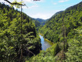
The ladders will probably be closed until autumn. Along picturesque, steep paths, winding through a jumble of mossy rocks, La Crampoulotte and its old ladies offer wild views of the Doubs valley. After a stop at the old charcoal kiln, you will walk along the peaceful banks of the river, a haven for ducks and fishermen. Then, facing the Échelles de la Mort (Ladders of Death), which turn out to be comfortable family stairs, you will make a sporty return via the evocative Couleuse aux Loups.
Short circular walk to the Grotte du Château de la Roche from Soulce-Cernay
 3.40 mi
+860 ft
-873 ft
2h 20
Moderate
Departure from Soulce-Cernay (Doubs)
3.40 mi
+860 ft
-873 ft
2h 20
Moderate
Departure from Soulce-Cernay (Doubs)
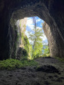
Discover a cave that was once temporarily transformed into a castle and has since become a paradise for cavers. A hike best enjoyed on fine summer days, making the most of the cool air of the Doubs Valley.
The Vieilles Femelles viewpoint
 5.11 mi
+1,243 ft
-1,230 ft
3h 25
Moderate
Departure from Charquemont (Doubs)
5.11 mi
+1,243 ft
-1,230 ft
3h 25
Moderate
Departure from Charquemont (Doubs)
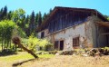
The ladders are likely to remain closed until autumn. From the ‘Ladders of Death’ to the ‘Old Ladies’, here are two places that evoke many poetic images. The ladders will prove to be comfortable, family-friendly staircases. As for these old ladies, they’ll offer you a wild view over the Franco-Swiss Doubs valley. Return via the peaceful riverbanks, a haven for ducks and anglers.
Circular Loop of the Échelles de la Mort via Le Refrain and the three belvédères.
 8.67 mi
+1,857 ft
-1,857 ft
5h 35
Moderate
Departure from Charquemont (Doubs)
8.67 mi
+1,857 ft
-1,857 ft
5h 35
Moderate
Departure from Charquemont (Doubs)
Superb hike in the Doubs Gorges offering magnificent panoramic views of the gorges and the surrounding Swiss Jura peaks. To get there, you will need to pass through the famous Échelles de la Mort, which are impressive but relatively easy to climb. Once you reach the ridge, you will go from the Cendrée viewpoint to the Vieilles Femelles viewpoint via the Crampoulotte viewpoint, before descending to the banks of the river via the magnificent Charbonnière du Haut site. The return journey is along a bucolic path with a pretty waterfall at the Ulysse bridge.
Banks of the Doubs, two magnificent viewpoints and the Grotte des Moines
 10.88 mi
+2,697 ft
-2,697 ft
7h 20
Difficult
Departure from Charquemont (Doubs)
10.88 mi
+2,697 ft
-2,697 ft
7h 20
Difficult
Departure from Charquemont (Doubs)
Set off to explore the banks of the Doubs, an old mill, the ruins of the Chapelle des Essarts Cuenot and two superb viewpoints: the Vieilles Femelles and the Échelles de la Mort. To finish, a lovely climb up to the Bois de la Biche to discover the Grotte des Moines and its ‘hidden’ box where you can leave a little note to say you’ve been there! Return via a magnificent path running alongside the banks of the Doubs.
The Réclère Caves
 8.60 mi
+1,772 ft
-1,781 ft
5h 30
Moderate
Departure from Montjoie-le-Château (Doubs)
8.60 mi
+1,772 ft
-1,781 ft
5h 30
Moderate
Departure from Montjoie-le-Château (Doubs)
From the castle ruins, you will climb up to the ledges where, like tightrope walkers from one border marker to the next, you will walk along the ridge line, neither in France nor in Switzerland. You will reach the Réclère Caves, considered the most beautiful in the world by the first explorers in 1886. From Journey to the Centre of the Earth by Jules Verne to Conan Doyle's The Lost World, you will squeeze between dinosaur feet. The return journey, via the old farmhouse at Montavon, will be less adventurous.
The Death Ladders
 7.11 mi
+1,739 ft
-1,739 ft
4h 45
Moderate
Departure from Charquemont (Doubs)
7.11 mi
+1,739 ft
-1,739 ft
4h 45
Moderate
Departure from Charquemont (Doubs)
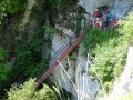
There are no danger points on these ladders. This site, steeped in history, bears witness to the fear once inspired by these legendary places, the scene of many fatal accidents during the "bricotte" (smuggling) era, when the ladders were nothing more than tree trunks crossed by pieces of wood. Today, these comfortable family staircases, which you can climb safely, will allow you to discover the Doubs Gorges from a variety of viewpoints.
The Death Ladders from La Cendrée
 Association / Club / Walk leader
 5.20 mi
+1,772 ft
-1,795 ft
3h 55
Moderate
Departure from Charquemont (Doubs)
5.20 mi
+1,772 ft
-1,795 ft
3h 55
Moderate
Departure from Charquemont (Doubs)
Beautiful views, a lovely setting and an unusual part of the hike, crossing the death ladders.
The wild Biaufond valley with ladders, steps and footbridges
 11.21 mi
+3,261 ft
-3,248 ft
8h 00
Difficult
Departure from Fournet-Blancheroche (Doubs)
11.21 mi
+3,261 ft
-3,248 ft
8h 00
Difficult
Departure from Fournet-Blancheroche (Doubs)
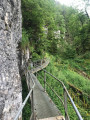
Set off to explore the Combe de Biaufond (in Switzerland) with its series of metal ladders, wooden staircases, fixed footbridges and bridges. Magical! Not recommended for those prone to vertigo. A mountain trail, therefore, difficult in places.
Then the Cerneux-Godat viewpoint and the Moulin de la Mort on the banks of the Doubs.
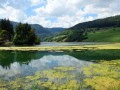
From a natural perspective, Biaufond’s main feature is its lake, which makes it a key wintering spot for the region’s waterbirds. But for everyone else, it is above all a magnificent destination for a walk and a meal by the water’s edge, at the crossroads of borders steeped in history.
The Combe de Biaufond
 6.45 mi
+1,719 ft
-1,706 ft
4h 30
Moderate
Departure from Fournet-Blancheroche (Doubs)
6.45 mi
+1,719 ft
-1,706 ft
4h 30
Moderate
Departure from Fournet-Blancheroche (Doubs)
Are you only going to do one of these hikes? Then choose to explore this valley, a pure marvel! To start with, the Gorges du Doubs, which are full of sunny green beauty here. Then there are the light-filled forests towards Roche Guillaume and the mountain pastures, which overlook the valley. And the highlight: the Gorges de la Ronde, wild, lush and tropical in appearance, framed by high rocks, a world of stones, moss and ferns.