


Refine your search for walks in Ghisonaccia
Ghisonaccia walks


 From Ghisonaccia to Serra-di-Fiumorbu
 Local authority
 4.78 mi
 +1,483 ft
 -7 ft
-7 ft
 3h 30
3h 30
 Moderate
 Departure from Serra-di-Fiumorbo (Haute-Corse)
This hike forms an integral part of the Mare a Mare Centre route.
From flat terrain to mountainous areas, the route takes you past various bodies of water: rivers, natural springs of sparkling water (drinkable!), streams… You’ll enjoy a wealth of refreshing scenery.
Étang de Palo : à la rencontre de deux univers
3.05 mi
+3 ft
-3 ft
1h 25
 Easy
Departure from Serra-di-Fiumorbo (Haute-Corse)
Easy
Departure from Serra-di-Fiumorbo (Haute-Corse)
Au Sud d’un chapelet de zones humides qui s’étend du Fiumorbu au Travu, l’Étang de Palo est une vaste lagune sédimentaire de 110 ha. Quatrième de l’île par sa taille, il a gardé depuis ses origines un caractère naturel. Palo accueille l’un des plus grands ensembles de sansouires de Corse (milieu limoneux stérile couvert d'efflorescence saline) avec une surface de plus de quarante hectares.
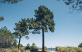
Pinia Forest: between forest, sea and lagoon
 2.66 mi
+30 ft
-30 ft
1h 15
Easy
Departure from Ghisonaccia (Haute-Corse)
2.66 mi
+30 ft
-30 ft
1h 15
Easy
Departure from Ghisonaccia (Haute-Corse)
Forest, lake and marine habitats provide valuable refuges for many birds, which find in Pinia a place to nest, overwinter or simply stop over.
From Serra-di-Fiumorbu to Catastaghju
 7.29 mi
+1,893 ft
-1,686 ft
5h 00
Moderate
Departure from Serra-di-Fiumorbo (Haute-Corse)
7.29 mi
+1,893 ft
-1,686 ft
5h 00
Moderate
Departure from Serra-di-Fiumorbo (Haute-Corse)
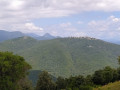
This walk forms part of the Mare a Mare Centre route. The Mare a Mare Centre route links the east coast at Ghisonaccia with the west coast at Porticcio in the southern Gulf of Ajaccio.
On the ridge between the sea and the Abatescu valley, you’ll discover varied landscapes as well as hilltop villages overlooking the sea.
A walk along the shores of the Urbinu peninsula
 1.02 mi
+20 ft
-20 ft
0h 30
Easy
Departure from Ghisonaccia (Haute-Corse)
1.02 mi
+20 ft
-20 ft
0h 30
Easy
Departure from Ghisonaccia (Haute-Corse)
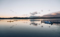
Life is good in Urbinu: Corsica’s second-largest lagoon with a 200 m² floating raft. The Urbinu lagoon will surprise you with its peaceful and rejuvenating atmosphere. Discover its natural beauty and history through the outdoor educational displays created by the Conservatoire du littoral.
Saltaruccio footbridge at the start of the route from Nazza
 Visorando Member
 1.44 mi
+761 ft
-751 ft
1h 20
Moderate
Departure from Lugo-di-Nazza (Haute-Corse)
1.44 mi
+761 ft
-751 ft
1h 20
Moderate
Departure from Lugo-di-Nazza (Haute-Corse)
At the bottom of a remote valley between Nazza and Poggio-di-Nazza, you will find a footbridge spanning the Saltaruccio stream.
Children will find a lovely playground there amongst the pools.
This walk is of moderate difficulty due to the sometimes steep gradient, but it is relatively easy as it is a short distance.
So, you can easily do it as a family and plan a picnic.
U Castellu, Circinellu cave and Bocca di Ghjuva from Ania
 6.38 mi
+1,709 ft
-1,683 ft
4h 25
Moderate
Departure from Serra-di-Fiumorbo (Haute-Corse)
6.38 mi
+1,709 ft
-1,683 ft
4h 25
Moderate
Departure from Serra-di-Fiumorbo (Haute-Corse)
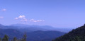
Set off to explore U Castellu and the Circinellu Cave, a prehistoric site steeped in revolutionary history from the time of Paoli. Then climb up to Bocca di Ghjuva via the Mare a Mare Centre and, after passing Bocca di Minagoli, descend through a chestnut forest towards Ania.
The Bughja Waterfall
 2.67 mi
+784 ft
-797 ft
1h 55
Easy
Departure from San-Gavino-di-Fiumorbo (Haute-Corse)
2.67 mi
+784 ft
-797 ft
1h 55
Easy
Departure from San-Gavino-di-Fiumorbo (Haute-Corse)
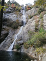
At a height of 100 metres, the Buja waterfall (Piscia di a Bughja) is one of the highest in Corsica. At its base is a pool where you can enjoy a refreshing dip, and you can relax on the rocks. If you look carefully, this waterfall is visible from a distance, particularly from the road leading to the village. The long white trail it leaves on the mountainside is particularly impressive in winter, when the water flows in abundance.Bughja (from the word ‘Bughju’: darkness).
The Undella Waterfall at San Gavinu di Fium'Orbu
 4.33 mi
+1,765 ft
-1,739 ft
3h 30
Moderate
Departure from San-Gavino-di-Fiumorbo (Haute-Corse)
4.33 mi
+1,765 ft
-1,739 ft
3h 30
Moderate
Departure from San-Gavino-di-Fiumorbo (Haute-Corse)
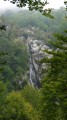
You will be delighted to discover the surrounding high peaks; this path will lead you through a beautiful beech forest and to the foot of the Undella waterfall (Ondella waterfall).
Da U Pinu a U piralzu (From Bread to Alder) starting from Solaro
 2.46 mi
+492 ft
-492 ft
1h 35
Easy
Departure from Haute-Corse
2.46 mi
+492 ft
-492 ft
1h 35
Easy
Departure from Haute-Corse
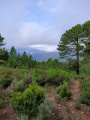
Starting from Solaro, walk through the forest. Focus mainly on discovering the flora.
The route is suitable for different audiences, fun and family-friendly, punctuated by several workshops, and focuses on discovering the riches of the heritage and preserving biodiversity.
From Sulaghju to the Rùvoli stream
 5.15 mi
+1,017 ft
-1,014 ft
3h 15
Moderate
Departure from Haute-Corse
5.15 mi
+1,017 ft
-1,014 ft
3h 15
Moderate
Departure from Haute-Corse
This path takes you through the pine woods to traditional sheepfolds on the banks of a beautiful mountain stream, less than a 2-hour walk from the village of u Sulaghju.
The Casevecchie Trail
 7.76 mi
+2,326 ft
-2,313 ft
5h 35
Moderate
Departure from Casevecchie (Haute-Corse)
7.76 mi
+2,326 ft
-2,313 ft
5h 35
Moderate
Departure from Casevecchie (Haute-Corse)
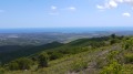
Casevecchie is a French commune situated in the departmental district of Haute-Corse and within the territory of the Corsican regional authority. Formerly part of the villages of Noceta and Rospigliani, it belongs to the Piève de Rogna. This walk will quickly take you up to a ridge line, leading to the highest point, Punta Capizzali (728m), where the boundaries of three communes meet: Antisanti, Casevecchie and Vezzani (360° view, sea and mountains).
U Saparghionu Cave via the heights of Chisa
 4.94 mi
+1,732 ft
-1,752 ft
3h 45
Moderate
Departure from Chisa (Haute-Corse)
4.94 mi
+1,732 ft
-1,752 ft
3h 45
Moderate
Departure from Chisa (Haute-Corse)
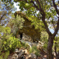
The walk to the heights of Chisa and the U Saparghionu cave is a short hike. Before setting off, we met Antonin, a village elder who speaks highly of it – a close-knit village that has lost its soul over the years. We also met two Brittany Spaniels who accompanied us throughout the walk. You’ll no doubt spot them in the village: true guides....
The old Petra Rossa lead mine.
 2.11 mi
+604 ft
-630 ft
1h 30
Easy
Departure from Ghisoni (Haute-Corse)
2.11 mi
+604 ft
-630 ft
1h 30
Easy
Departure from Ghisoni (Haute-Corse)
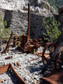
The old Petra Rossa mine, known as the Finosa mine, opened in 1912 to extract lead, silver, manganese and iron ores, and was closed after the Second World War. Source: WikipediaThe Finosa mines extracted silver-bearing lead (galena, cerussite), zinc (blende) and copper (bornite).Most of the mining at La Finosa was carried out in open pits.Prospecting on the site began in the 1910s. Source: Ghisoni Civil Heritage.
Mare è Stagnu trail
 4.65 mi
+148 ft
-121 ft
2h 15
Easy
Departure from Aléria (Haute-Corse)
4.65 mi
+148 ft
-121 ft
2h 15
Easy
Departure from Aléria (Haute-Corse)
Located north of Aléria, the Etang de Diane is renowned for its oyster and mussel production. It is surrounded by wetlands and marshes that constitute protected areas, thus hosting large populations of sedentary or migratory birds and sometimes endemic species.