From Serra-di-Fiumorbu to Catastaghju

This walk forms part of the Mare a Mare Centre route. The Mare a Mare Centre route links the east coast at Ghisonaccia with the west coast at Porticcio in the southern Gulf of Ajaccio.
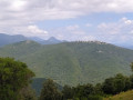
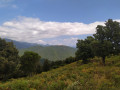
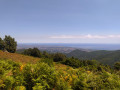
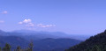
On the ridge between the sea and the Abatescu valley, you’ll discover varied landscapes as well as hilltop villages overlooking the sea.

Details

26851188
Creation:
Last update:
Last review:
  • Walking
    Activity: Walking
  • ↔
    Distance: 7.29 mi
  • ◔
    Average duration: 5h 00 
  • ▲
    Difficulty: Moderate

  • ⚐
    Back to start: No
  • ↗
    Ascent: + 1,893 ft
  • ↘
    Descent: - 1,686 ft

  • ▲
    Highest point: 3,130 ft
  • ▼
    Lowest point: 1,506 ft
  • ⚐ Country: France
  • ⚐ City: Serra-di-Fiumorbo (20243)
  • ⚑
    Start: N 41.98521° / E 9.3356°
  • ⚑
    End: N 41.96289° / E 9.25949°
  • ❏
    IGN map(s): Ref. 4253ET, 4253ETR, 4352OT
  • Hour-by-hour weather

Photos

Description of the walk

(S) From the Serra di Fium’Orbu stopover lodge, follow the D45 for 500 m southwards, passing thefirst track branching off to the right.

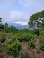
(1) Turn onto the path which curves slightly to the right shortly afterwards and climbs up onto the ridge, heading south-west. You will soon be walking through a vast, open landscape. You may stray briefly from the path at times, but a trail will guide you along the local track.

(2) Once past Punta di Giglio (666 metres), continue along the ridge, which now faces south.

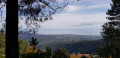
(3) At an altitude of 770 m, you turn south-west. Still on the ridge, the path descends a few metres, then climbs slightly. Punta di Quarcio Grosso, 1,045 m, rises up ahead, but the path ends at an altitude of 957 m, as the Mare à Mare Centre route does not climb to the summit: it skirts around Punta di Quarcio Grosso to the south, heading towards Bocca di Minagoli, 893 m, which lies behind it. It is here that you’ll meet hikers on the Mare Monti Solenzara–Ghisoni route coming from the opposite direction, before heading down towards Ania.

(4) After the Bocca di Minagoli, you do not descend northwards, but continue at the same altitude, heading west to the Bocca di Ghjuva, at an elevation of 866 m, passing in front of the Corbaja, 1,012 m. The Mare e Monti Solenzara – Ghisoni route climbs from the south up to the Bocca di Ghjuva.

(5) It veers northwards at the Bocca di Ghjuva before descending through the pine forest towards the depths of the Corsican valleys. You soon reach a forest track at 785 m and continue towards a stream.

(6) Just after the stream, turn left (do not follow the path towards Ania) and continue a little further north at the same altitude.

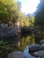
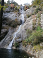
(7) Carry on, turning left and leaving the path to Ania on your right. Head west to descend into the Abatesco valley. You’ll start by walking along a slightly wider path, then leave it on the right to follow the clearly marked signpost (620 m) and head down to the river, which flows here at an altitude of 523 m and offers magnificent swimming spots right next to the lodge.
You then cross the Abatesco via a sturdy bridge to reach the Catastaghju stopover lodge, which is situated alongside the road leading up from San Gavino di Fium’Orbu (E).

Source: Corsica, Willi and Kristin Hausmann, ROTHER – Hiking Guide

Waypoints

  1. S : mi 0 - alt. 1,506 ft - Serra-di-Fium’Orbu stopover lodge
  2. 1 : mi 0.29 - alt. 1,562 ft - Junction on the trail
  3. 2 : mi 1.67 - alt. 2,110 ft - Punta di Giglio
  4. 3 : mi 2.84 - alt. 2,592 ft - View facing the Punta di Quarcio Grosso
  5. 4 : mi 4.36 - alt. 2,904 ft - Bocca di Minagoli
  6. 5 : mi 5.07 - alt. 2,828 ft - Bocca di Ghjuva
  7. 6 : mi 5.82 - alt. 2,405 ft - Stream
  8. 7 : mi 6.39 - alt. 2,316 ft - Head west towards the Abatesco Valley
  9. E : mi 7.29 - alt. 1,742 ft - Catastaghju stopover lodge

Notes

At a minimum: bring suitable hiking gear, walking boots and a water bottle.
Water source and shelter at the Bergeries de Scanciatella.
In winter, ensure you have suitable equipment for snowy conditions.
The Catastaghju lodge is open only during the summer months. Accommodation and meals are available by booking with the town hall.

Reviews and comments

4.5 / 5
Based on 2 reviews

Reliability of the description
4 / 5
Ease of following the route
4.5 / 5
Route interest
5 / 5
Pascal 38
Pascal 38

Overall rating : 4.7 / 5

Date of your route : Aug 04, 2026
Reliability of the description : ★★★★☆ Good
Ease of following the route : ★★★★★ Very good
Route interest : ★★★★★ Very good
Very busy route : No

It’s not at all difficult to follow the orange signs to the Mare a MARE Centre

Machine-translated

hypnovel
hypnovel

Overall rating : 4.3 / 5

Date of your route : Sep 21, 2024
Reliability of the description : ★★★★☆ Good
Ease of following the route : ★★★★☆ Good
Route interest : ★★★★★ Very good
Very busy route : No

Hello everyone,
We have just completed the Mare à Mare Centre route, which is very well signposted in orange, in September 2024
It’s best to follow these orange markers as, in some places, they don’t match the IGN route.
For example, between the 953-metre mark and Bocca di Minagoli, the route on the IGN map is impassable (it’s best to follow the Mare à Mare route on OpenStreetMap Hiking (World) if you’re using a map).
Otherwise, it’s a very beautiful crossing that’s well worth the effort, particularly on the descents (ruts, gullies), and special mention must go to the warm welcome and kindness encountered along the way and in the lodges.

Machine-translated

Other walks in the area

For more walks, use our search engine .

The GPS track and description are the property of this route's author. Please do not copy them without permission.