From Ghisonaccia to Serra-di-Fiumorbu

This hike forms an integral part of the Mare a Mare Centre route.
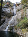
From flat terrain to mountainous areas, the route takes you past various bodies of water: rivers, natural springs of sparkling water (drinkable!), streams… You’ll enjoy a wealth of refreshing scenery.

Details

26850888
Creation:
Last update:
Last review:
  • Walking
    Activity: Walking
  • ↔
    Distance: 4.78 mi
  • ◔
    Average duration: 3h 30 
  • ▲
    Difficulty: Moderate

  • ⚐
    Back to start: No
  • ↗
    Ascent: + 1,483 ft
  • ↘
    Descent: - 7 ft

  • ▲
    Highest point: 1,506 ft
  • ▼
    Lowest point: 23 ft
  • ⚐ Country: France
  • ⚐ City: Serra-di-Fiumorbo (20243)
  • ⚑
    Start: N 41.97558° / E 9.39942°
  • ⚑
    End: N 41.98528° / E 9.33565°
  • ❏
    IGN map(s): Ref. 4253ET, 4253ETR, 4352OT
  • Hour-by-hour weather

Photos

Description of the walk

From Ghisonaccia, drive south on the T10; 1 km after the village of Casamozza, after crossing the bridge over the Abatesco, you’ll come to a wooden sign by the roadside indicating ‘Mare a Mare Centre’. From here, looking up, you can see the mountain ridges.

(S/E) Walk along a small road heading west, then north, passing a chapel and a few houses (Asprivu). Please note! The old route, which runs northwards, still appears on some maps.

(1) Continue along the small tarmac road, heading west again, until you reach a sharp bend to the left, where you take a footpath (still heading in the same direction) before crossing a stream (Ruisseau d’Aglia). A local track then takes us alongside the stream to a cluster of houses and, shortly afterwards, to a small road, the D545.

(2) Follow the county road for 1.2 km, heading north towards Acqua Acitosa, then turn left.

(3) After thefirst house on the right, slightly below the road, you’ll find Acqua Acitosa, a spring that once provided delicious iron-rich mineral water but has now almost dried up (partly due to the drought). We now head up the small road to the point where the signposted path branches off to the right 250 m further on.

(4) The climb through the forest is steep in places. Follow this path to the junction with the D45.

(5) Continue through the woods to cut across the road’s wide bend.

(6) Just before reaching the village of Serra di Fium’Orbu, you rejoin the D45. Here too, you can avoid the bends in the road by taking the small paths. The walk ends at the village of Ornasu, a vantage point overlooking the Mediterranean. The stopover lodge is located on the left as you leave the village. (E)

Source: Corsica, Willi and Kristin Hausmann, ROTHER – Hiking Guide

Waypoints

  1. S : mi 0 - alt. 30 ft - Abatesco Bridge
  2. 1 : mi 0.84 - alt. 56 ft - Asprivu
  3. 2 : mi 2.03 - alt. 164 ft - D545 road
  4. 3 : mi 2.77 - alt. 157 ft - Acqua Acitosa
  5. 4 : mi 2.83 - alt. 282 ft - Junction
  6. 5 : mi 3.71 - alt. 1,010 ft - Junction with the D45
  7. 6 : mi 4.23 - alt. 1,322 ft - Junction with the D45
  8. E : mi 4.78 - alt. 1,506 ft - Ornasu viewpoint

Notes

At the very least: bring suitable hiking gear, walking shoes and a water bottle

Worth a visit

You can eat or buy provisions at the stopover lodge in Ornasu.

Reviews and comments

4.5 / 5
Based on 2 reviews

Reliability of the description
4.5 / 5
Ease of following the route
4.5 / 5
Route interest
4.5 / 5
User 3467926

Overall rating : 4 / 5

Date of your route : May 26, 2025
Reliability of the description : ★★★★☆ Good
Ease of following the route : ★★★★☆ Good
Route interest : ★★★★☆ Good
Very busy route : No

The path wasn’t well-maintained at the start, which is a shame.
A stretch through thistles and a rutted path.
Signposting to Serra Di Fium Orbu is adequate.

Machine-translated

Master12
Master12

Overall rating : 5 / 5

Date of your route : Aug 24, 2023
Reliability of the description : ★★★★★ Very good
Ease of following the route : ★★★★★ Very good
Route interest : ★★★★★ Very good
Very busy route : No

Thank you for recommending this walk; it was very useful. I only did the final section, walking up from Acqu’Acitosa to the village of Serra-di-Fiurmobo, and back along the same route. It’s a 3km climb taking 45 minutes; the path is stony and very well signposted (orange), particularly in the final sections where you follow the road for a very short distance. I caught a glimpse of two wild boars (I think) chasing each other. There’s a lovely little viewing point (with chairs there that day) opposite the town hall, from where you can admire the plain and the sea. I carried on a little way beyond the village, as if to continue the Mare a Mare Sud route, just to get a view of the other side of the valley and the mountains. It makes you want to explore further. Apart from in the village, I didn’t come across anyone, but it was early in the morning because of the heat (in August). You can park your car near the start (by the spring). It was a lovely morning.

Machine-translated

Other walks in the area

For more walks, use our search engine .

The GPS track and description are the property of this route's author. Please do not copy them without permission.