Circular route via the Chapel of Saint Anthony

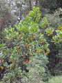
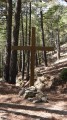
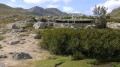
A lovely little walk, well signposted and easy going. The path is lined with arbutus and chestnut trees. It starts in a charming little village. Part of the route follows a quiet little road, whilst the other part follows a wide path.

Details

n°64253259
Creation:
Last update:
Last review:
  • Walking
    Activity: Walking
  • ↔
    Distance: 2.87 mi
  • ◔
    Average duration: 1h 45 
  • ▲
    Difficulty: Easy

  • ⚐
    Back to start: Yes
  • ↗
    Ascent: + 446 ft
  • ↘
    Descent: - 417 ft

  • ▲
    Highest point: 1,982 ft
  • ▼
    Lowest point: 1,585 ft

Photos

Description of the walk

Park in the car park next to the town hall and the church in Poggio.

Orange signposting.

(S/E) Set off westwards and head uphill; you’ll reach a fountain very quickly. Then turn left and you’ll immediately come to a Fork in the road.

(1) Take the left-hand road, which goes downhill. After a sharp left-hand bend, ignore a path coming from the right and continue along a path that runs alongside the road.

(2) At a junction, turn left to reach the Saint-Antoine Chapel (picnic table) straight away.

(3) Return to the junction.

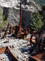
(2) Carry on straight ahead along the path opposite (west) and head uphill. Pass some ruins and continue along the path. Pass a sort of summit and descend gently. Join the D44 (viewpoint, benches).

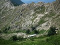
(4) Follow the road to the right. Note a lovely viewpoint, with the Italian islands visible in the distance. Continue straight on along the road and enter Poggio-di-Nazza.

(1) Go straight on, then turn right to quickly return to the car park (S/E).

Waypoints

  1. S/E : mi 0 - alt. 1,604 ft - Town hall car park
  2. 1 : mi 0.04 - alt. 1,617 ft - Junction of the circular loop
  3. 2 : mi 1.25 - alt. 1,686 ft - Junction
  4. 3 : mi 1.27 - alt. 1,683 ft
  5. 4 : mi 2.22 - alt. 1,900 ft - D44 Road – Viewpoint
  6. S/E : mi 2.87 - alt. 1,604 ft - Town hall car park

Notes

We parked in a three-space car park; there are other spaces in the village. There are public toilets next to the car park at the start of the walk.

Reviews and comments

3.8 / 5
Based on 2 reviews

Reliability of the description
4 / 5
Ease of following the route
5 / 5
Route interest
2.5 / 5
User 23438907

Overall rating : 3.7 / 5

Date of your route : Sep 29, 2025
Reliability of the description : ★★★★☆ Good
Ease of following the route : ★★★★★ Very good
Route interest : ★★☆☆☆ Disappointing
Very busy route : No

We were disappointed: we thought we would have a view of the valley or the mountains, but in fact everything is in the forest....
the only view we could get was of the power lines...
on the other hand, the village is pretty and has a beautiful viewpoint.

Machine-translated

Noce
Noce

Overall rating : 4 / 5

Date of your route : Nov 24, 2024
Reliability of the description : ★★★★☆ Good
Ease of following the route : ★★★★★ Very good
Route interest : ★★★☆☆ Average
Very busy route : Yes

Machine-translated

Other walks in the area

For more walks, use our search engine .

The GPS track and description are the property of this route's author. Please do not copy them without permission.