From Sulaghju to the Rùvoli stream

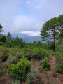
This path takes you through the pine woods to traditional sheepfolds on the banks of a beautiful mountain stream, less than a 2-hour walk from the village of u Sulaghju.

Details

26849355
Creation:
Last update:
Last review:
  • Walking
    Activity: Walking
  • ↔
    Distance: 5.15 mi
  • ◔
    Average duration: 3h 15 
  • ▲
    Difficulty: Moderate

  • ⚐
    Back to start: Yes
  • ↗
    Ascent: + 1,017 ft
  • ↘
    Descent: - 1,014 ft

  • ▲
    Highest point: 1,831 ft
  • ▼
    Lowest point: 1,010 ft
  • ⚐ Country: France
  • ⚐ City: Haute-Corse (2B)
  • ⚑
    Start/End: N 41.904692° / E 9.326799°
  • ❏
    IGN map(s): Ref. 4253ET, 4253ETR
  • Hour-by-hour weather

Photos

Description of the walk

Start from the town hall; parking available at the roadside.

Orange signposting (Mare e monti Livantinu)

(S/E) Head to the northern end of the village via the road (D845), which turns into a track, and continue along this track.

(1) At the first Fork in the road, keep to the right and, after about 1.5 km, once you have crossed the Castagnolu stream, look for a path on the right.

(2) Follow this path as it descends gently towards another stream, all the way to the Ruvoli sheepfolds.

(3) Turn round and head back along the same path to the village of u Sulaghju (S/E).

Waypoints

  1. S/E : mi 0 - alt. 1,732 ft - Town Hall
  2. 1 : mi 0.53 - alt. 1,821 ft - Road that turns into a track
  3. 2 : mi 1.13 - alt. 1,821 ft - Path leading off to the right
  4. 3 : mi 2.57 - alt. 1,063 ft - Ruvoli sheepfolds
  5. S/E : mi 5.15 - alt. 1,732 ft - Town Hall

Notes

At the very least: make sure you have suitable hiking kit, walking shoes and water.

Reviews and comments

4.7 / 5
Based on 2 reviews

Reliability of the description
5 / 5
Ease of following the route
5 / 5
Route interest
4 / 5
User 22708565

This route is currently closed by order of the prefect.

Machine-translated

Huerga
Huerga

Overall rating : 4.3 / 5

Date of your route : Jul 24, 2026
Reliability of the description : ★★★★★ Very good
Ease of following the route : ★★★★★ Very good
Route interest : ★★★☆☆ Average
Very busy route : No

The descent is gentle, mostly under the trees, so it’s easy despite the large number of stones on the path. The main points of interest, however, are concentrated around the woodland hamlet and the bridges over the two streams.
The highlight of this short walk is a dip in the pool beneath the bridge, which is a real treat. However, whilst the pool is a decent size, it isn’t huge, so this walk can be rather disappointing if you set off late and find a group has already started swimming and having a picnic.

Machine-translated

JmsB
JmsB

Overall rating : 5 / 5

Date of your route : May 10, 2024
Reliability of the description : ★★★★★ Very good
Ease of following the route : ★★★★★ Very good
Route interest : ★★★★★ Very good
Very busy route : No

A lovely walk, mostly through woodland.
A lovely river at the end of the walk, where you can dip your feet in the water – or even take a dip in a pool if you’re feeling brave!

Machine-translated

Other walks in the area

For more walks, use our search engine .

The GPS track and description are the property of this route's author. Please do not copy them without permission.