


Refine your search for walks in Gare de Bourg-Bruche
Gare de Bourg-Bruche walks


 L'Alhan - Le Climont - The source of the Bruche
 Visorando Member
 9.68 mi
 +2,037 ft
 -2,031 ft
 6h 15
 Difficult
 Departure from Bourg-Bruche (Bas-Rhin)
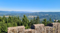
A beautiful hike with stunning views of all the surrounding valleys: the Bruche Valley, Donon, Saint-Dié-des-Vosges, Val de Villé, Sainte-Croix-aux-Mines, Haut-Koenigsbourg, etc.
It is quite difficult due to its length, elevation gain and rough terrain (narrow paths on the edge of the void or muddy forest paths).
The Hang clearing at the foot of Climont
 Tourist office6.95 mi
+860 ft
-876 ft
3h 55
 Moderate
Departure from Bourg-Bruche (Bas-Rhin)
This walk winds through a haven of peace and tranquillity at the foot of one of the valley's legendary peaks: Climont (966 m). The Bruche river rises at an altitude of 660 m and then crosses a vast basin: the Hang clearing. This is where families of glassmakers settled in 1723. Le Hang continued to prosper thanks to the arrival of Mennonite farmers of Swiss origin. They found here a place conducive to their pastoral and community life.
The banks of the Bruche from Saint-Blaise-la-Roche
10.83 mi
+1,155 ft
-1,171 ft
6h 00
Difficult
Departure from Saint-Blaise-la-Roche (Bas-Rhin)
Situated at the bottom of the valley, Saint-Blaise-la-Roche experienced significant population growth during the19th century with the establishment of weaving industries. The village is also situated on the first Strasbourg–Saâles–Saint-Dié-des-Vosges railway line, inaugurated in 1929 by Raymond Poincaré. Numerous engineering structures (including the Fouday viaduct further downstream) made it possible to create the first railway route through the Vosges.
Walks near Gare de Bourg-Bruche
From Salm to the Tête du Coquin
 10.34 mi
+2,963 ft
-2,349 ft
7h 20
Difficult
Departure from La Broque (Bas-Rhin)
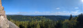
This first stage is probably the hardest day of the route. Beautiful views, pleasant trails and few forest roads. A steep climb at the end of the day explains the "Difficult" rating.
Three days around the Val de Senones with bivouacs
33.33 mi
+5,928 ft
-5,945 ft
3 days
Difficult
Departure from La Broque (Bas-Rhin)
Three days of hiking and camping around the Val de Senones, passing by beautiful viewpoints. Campsites at the Tête du Coquin and the Haute Loge.
 Mountain biking in the Vosges, Day 4: Hohwald - Chatenois (Part 1)
7.84 mi
+840 ft
-1,558 ft
2.5 hrs
Moderate
Departure from Le Hohwald (Bas-Rhin)
This route is the first part of thefourth stage of a seven-day tour of the Alsatian side of the Vosges mountains. Most of the route is on forest roads in good condition. The signage is excellent, consisting of signs with an orange or red mountain bike logo and the letters TMV (Traversée du Massif Vosgien).
Between the Col du Donon, Col du Prayé and Col du Hantz to Saint-Blaise-la-Roche
 14.61 mi
+1,427 ft
-2,444 ft
8h 00
Difficult
Departure from Grandfontaine (Bas-Rhin) (Bas-Rhin)
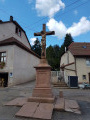
A long hike that will take you from the Col du Donon to Saint-Blaise-la-Roche in the Schirmeck valley, via the Col du Prayé and the Col du Hantz. You’ll follow the old 1871 border between France and Germany along the ridges, which is still marked by several boundary stones. In August, the high moors are dotted with flowering heather, creating a beautiful pink hue that contrasts with the green of the fir trees, the blue of the sky and the white clouds.
Schelmenkopf – Col des Bagenelles
 10.60 mi
+1,818 ft
-1,289 ft
6h 25
Moderate
Departure from Ribeauvillé (Haut-Rhin) (Haut-Rhin)
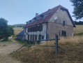
A leisurely second stage, apart perhaps from the total distance. It takes place mainly in the shade on mostly flat paths. You’ll pass beneath the Petit Brézouard and give the Grand Brézouard a wide berth – as it is a wildlife sanctuary – before heading directly to Le Haïcot and then on to the Col des Bagenelles.
Col de Bagenelles – Schupferen
 10.77 mi
+2,694 ft
-1,847 ft
7h 20
Moderate
Departure from Le Bonhomme (Haut-Rhin)
This third day follows the Sentier des Crêtes for the most part, passing through the burnt-out fields with beautiful panoramic views. A walk of moderate difficulty with several opportunities to stop and enjoy a blueberry tart