Country:

 City:
City:


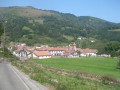
Park in one of the few parking spaces along the street near the school (379 m).
(S/E) Make your way to the top of the village where the tarmac road gives way to two concrete tracks. Take the one on the right, which climbs northwards. After three hairpin bends to the left, you’ll reach a Y-junction.
(1) Continue along the track on the right, heading north-west. This is one of the variants of the Haute Route des Pyrénées (HRP), which crosses the Col d’Atxuela (Atxuelako lepoa in Basque).
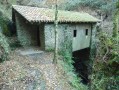
(2) Pass Portillo Arburu, a rocky outcrop overlooking the pretty little valley through which the Artzibiko Erreka flows. Continue along the GR®11, heading north-west along a lovely shaded stretch where you’ll find a ruined hut, Dorreko Borda.
(3) At the junction, you can either continue along the well-marked path or take the standard route to the right; the two paths join a little further on along the ridge. To follow the marked route, turn left. The track curves westwards along the slopes of Atxuela. You’ll reach the pass of the same name, where the tracks cross.
(4) Leave the track on your right and take the small ridge path to climb Larrondoko Kaskoa.
(5) Continue along the ridge and, further on, descend the Col d’Iñaterri (748 m).
(6) Ahead stands Ezkitz, the final peak in the range. Continue along the track to the right. Upon reaching the summit ridge, look to the left of the path for a slab embedded in the ground, slightly sloping and situated on a barely discernible burial mound. These are the remains of a dolmen.
(7) Pass the rocky summit of Ezkitz (also known as Erkiza on some maps, 832 m). There are fine views, particularly over the Baztan valley. To descend, take a short circular loop back to the pass via a path hidden amongst the ferns (GPS guidance required). Return to the Iñaterr Pass.
(6) Take the well-marked path to the right, then follow the track down to the Bagaldeko Erreka stream.
(8) Cross it and continue along the track (Oldaberriko bidea) to the junction you passed on the way up.
(1) Keep going straight on towards the village of Azpilkueta (S/E).
 Association / Club / Walk leader

 Visorando Member
 Easy
Easy  Difficult