


Refine your search for walks in Estany Llong
Estany Llong walks


 Les Etangs des Esquits
 Visorando Member
 7.96 mi
 +1,421 ft
 -1,417 ft
 4 hrs
4 hrs
 Difficult
 Departure from Bolquère (Pyrénées-Orientales)
Snow hike. Snowshoes are recommended for this magnificent tour of the Esquits lakes. In winter, crossing the ski slopes can be tricky (steep slope and high speed of skiers: black run).
 The Étangs des Esquits
3.91 mi
+443 ft
-430 ft
2h 10
 Easy
Departure from Angoustrine-Villeneuve-des-Escaldes (Pyrénées-Orientales)
Easy
Departure from Angoustrine-Villeneuve-des-Escaldes (Pyrénées-Orientales)
A pleasant family outing starting from the Bouillouses listed site. The Esquits circular offers the chance to discover three ponds, including the Pradella, located on the GR®10, where there is also a refuge.
Walks near Estany Llong
Barrage des Bouillouses - Camporells Refuge
 7.75 mi
+3,028 ft
-2,241 ft
6h 10
Difficult
Departure from Angoustrine-Villeneuve-des-Escaldes (Pyrénées-Orientales)
7.75 mi
+3,028 ft
-2,241 ft
6h 10
Difficult
Departure from Angoustrine-Villeneuve-des-Escaldes (Pyrénées-Orientales)
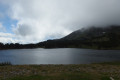
Modification on 12 September 2022: addition of the Petit Péric ascent validated on Thursday 8 September 2022.This first stage of the Tour des Pérics is enhanced by beautiful landscapes.It offers a taste of the mountain scenery that will be encountered during these four days.Vehicles must be left in the free car park. See the practical information section*.In summer, you must take a paid shuttle bus to Lac des Bouillouses. See the practical information section **.
Please note: from (8), you must have the GPX track or a very good sense of direction to attempt the ascent of Petit Peric.
From Les Bouillouses to Le Carlit, then on to the Cabane du Rouzet
8.29 mi
+3,248 ft
-2,434 ft
6h 40
Difficult
Departure from Les Angles (Pyrénées-Orientales) (Pyrénées-Orientales)
Le Carlit is the highest peak in the Pyrénées-Orientales at 2,921 m. It’s a site visited by hundreds of people every summer, but generally most are content to do the Bouillouses–Carlit round trip.
This first stage invites you to include this summit and to finish the stage in the area around the Cabane du Rouzet after walking alongside the large Étang de Lanoux.
Classified as difficult due to the ascent of Puig Carlit and its steep descent on the Étang de Lanoux side.
Refuge des Bouillouses – Refuge d’en Beys
 11.19 mi
+3,077 ft
-3,219 ft
7h 50
Difficult
Departure from Les Angles (Pyrénées-Orientales) (Pyrénées-Orientales)
11.19 mi
+3,077 ft
-3,219 ft
7h 50
Difficult
Departure from Les Angles (Pyrénées-Orientales) (Pyrénées-Orientales)
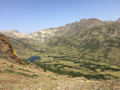
The first day of this route amongst the lakes.
It will take you from Les Bouillouses to the En Beys refuge, passing from one valley to another.
Lac des Bouillouses - Mas de Franc
 11.51 mi
+1,509 ft
-2,989 ft
6h 35
11.51 mi
+1,509 ft
-2,989 ft
6h 35
 Moderate
Departure from Les Angles (Pyrénées-Orientales) (Pyrénées-Orientales)
Moderate
Departure from Les Angles (Pyrénées-Orientales) (Pyrénées-Orientales)
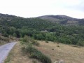
Part of the long (9-day) itinerary around Carlit, hiking from refuge to refuge, based on the Tour des Pérics and using various marked trails.
Crossing from Balcère to Les Angles
4.84 mi
+489 ft
-755 ft
2h 40
Easy
Departure from Les Angles (Pyrénées-Orientales) (Pyrénées-Orientales)
An easy, two-thirds shaded route suggested by a Year 3 class. Superb views to help children from the countryside discover the mountains: lake, forests.
Camporells Refuge - En Beys Refuge
 6.82 mi
+1,562 ft
-2,490 ft
4h 30
Moderate
Departure from Formiguères (Pyrénées-Orientales)
6.82 mi
+1,562 ft
-2,490 ft
4h 30
Moderate
Departure from Formiguères (Pyrénées-Orientales)
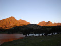
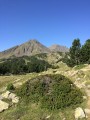
Second stage of the Tour Des Pérics.This stage should only be undertaken in good weather and when there is no fog.Otherwise, you must use the Visorando app or a GPS device to track your route.
⚠️ You are entering the Orlu National Hunting and Wildlife Reserve, where certain regulations must be observed. See practical information.
Camporells Refuge - Lac des Bouillouses via Petit Peric
 7.14 mi
+1,503 ft
-2,267 ft
6 hrs
7.14 mi
+1,503 ft
-2,267 ft
6 hrs
 Very difficult
Departure from Formiguères (Pyrénées-Orientales)
Very difficult
Departure from Formiguères (Pyrénées-Orientales)
Part of the long itinerary (9 days) around Carlit, hiking from refuge to refuge, based on the Peyrics tour and using various marked trails.
The Balcons de la Têt and the Yellow Train
 6.59 mi
+873 ft
-2,398 ft
3h 45
Moderate
Departure from La Cabanasse (Pyrénées-Orientales)
6.59 mi
+873 ft
-2,398 ft
3h 45
Moderate
Departure from La Cabanasse (Pyrénées-Orientales)
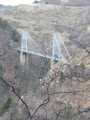
A climb on the Train Jaune from Fontpédrouse to La Cabanasse, followed by a beautiful, tree-lined descent along the River Têt.A lovely walk, partly through the forest; this is a different route from La Cabanasse to Planès suggested by PO Express, with the chance to find a few porcini mushrooms depending on the season, and to pass under the Gisclard Bridge, a true engineering marvel for its time.
Chemin Vauban From Formiguères to Rouze
13.74 mi
+1,286 ft
-3,018 ft
7h 25
Moderate
Departure from Formiguères (Pyrénées-Orientales)
This section of the Chemin Vauban links Formiguères to Rouze, crossing the Capcir and then the Donezan. The route, which is generally easy and pleasant, alternates between forest tracks, sections through the undergrowth, paths along ridges and more open stretches offering beautiful panoramic views. The route runs alongside the Galbe river, crosses the Col des Ares – which marks the border between the Pyrénées-Orientales and Ariège – and then continues through the Donezan region via Carcanières and Le Puch. It also takes you past the magnificent Château d’Usson before reaching the village of Rouze.
Chemin Vauban from Mont-Louis to La Llagonne
2.00 mi
+344 ft
-72 ft
1h 15
Easy
Departure from La Cabanasse (Pyrénées-Orientales)
This section of the Chemin Vauban links Mont-Louis to La Llagonne via an easy and pleasant route. After skirting the ramparts of the fortified town of Mont-Louis, the route crosses the River Têt before reaching the village of La Llagonne. One-way walk: leave a car at La Llagonne (car park near the post office) to return to Mont-Louis.