Erentzazu from the Ibardin Pass via the Col des Abeilles

A walk starting from the Ibardin Pass – very easy, perfect as a warm-up before a meal in one of the pass’s restaurants.

Details

2716973
Creation:
Last update:
Last review:
  • Walking
    Activity: Walking
  • ↔
    Distance: 2.71 mi
  • ◔
    Average duration: 1h 55 
  • ▲
    Difficulty: Easy

  • ⚐
    Back to start: Yes
  • ↗
    Ascent: + 732 ft
  • ↘
    Descent: - 732 ft

  • ▲
    Highest point: 1,381 ft
  • ▼
    Lowest point: 722 ft

Description of the walk

Take the Ibardin Pass road. On reaching the pass, head up to the right and park in the motorhome car park situated on the right-hand side of the road before Les Ventas.

(S/E) Set off to the right onto a track suitable for vehicles that starts at the far end of the car park; stay on this wide track, ignoring the smaller paths branching off to the right. At a left-hand bend, you’ll reach a crossroads of paths.

(1) Turn right, heading due north, onto a path that descends steeply. Follow this winding path as it descends and crosses several streams without getting your feet wet.
In wet weather, this section of the route can become quite muddy, but you can then walk along the side of the track, which remains passable.
After crossing the Ibardingo Erreka, the path becomes passable by vehicle again and climbs back up to the road.

(2) Cross the D404 and take the GR®10, which heads off to the right.

(3) Leave theGR®10and take the path opposite

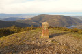
(4) Turn right onto the path that climbs to the summit of Erentzazu. Then continue straight ahead on theGR®10and return to the road

(5) Take the road on the left and head back up to the pass, then turn right to the car park (S/E).

Waypoints

  1. S/E : mi 0 - alt. 1,070 ft - Motorhome car park
  2. 1 : mi 0.28 - alt. 1,089 ft - Path leading down to the right
  3. 2 : mi 1.15 - alt. 801 ft - Cross the road. GR10 to the right
  4. 3 : mi 1.71 - alt. 1,112 ft - Path straight ahead towards the summit. Leave the GR10
  5. 4 : mi 1.98 - alt. 1,312 ft - Turn right towards - Erentzazu
  6. 5 : mi 2.58 - alt. 1,030 ft - Ascent to the pass
  7. S/E : mi 2.71 - alt. 1,070 ft - Return to the car park

Notes

No water source

Worth a visit

The Ibardin Pass is an area with shops and places to eat, but it is also the starting point for a large number of walking routes.

Always be cautious and plan ahead when you're outdoors. Visorando and the author of this route cannot be held responsible for any accidents occurring on this route.

The GR® and PR® markings are the intellectual property of the Fédération Française de Randonnée Pédestre.

Reviews and comments

4 / 5
Based on 3 reviews

Reliability of the description
3.3 / 5
Ease of following the route
3.7 / 5
Route interest
5 / 5
Jjack 64
Jjack 64

Overall rating : 4 / 5

Date of your route : Feb 04, 2026
Reliability of the description : ★★★☆☆ Average
Ease of following the route : ★★★★☆ Good
Route interest : ★★★★★ Very good
Very busy route : No

It wasn't the right season...
Many streams overflowed, making for very difficult or impossible fords and impassable paths. Lots of rain.
But in summer, the route must be lovely.

Machine-translated

sylvie bzh
sylvie bzh

Overall rating : 5 / 5

Date of your route : Apr 21, 2025
Reliability of the description : ★★★★★ Very good
Ease of following the route : ★★★★★ Very good
Route interest : ★★★★★ Very good
Very busy route : No

A very pleasant walk, best avoided in wet weather as there are a few muddy sections; the first part is very shady, whilst the second half runs along the mountainside with superb panoramic views of the bay and La Rhune; you’ll come across pottoks and free-range cows along the way: please keep dogs on a lead.

Machine-translated

rtaji
rtaji
• Edited:

Overall rating : 2 / 5

Date of your route : Apr 28, 2023
Reliability of the description : ★★☆☆☆ Disappointing
Ease of following the route : ★★☆☆☆ Disappointing
Route interest : Not used / Not applicable
Very busy route : Yes

Hello,
We never managed to find point ‘1’, so we weren’t able to follow the described walk, which is a shame. Instead, we walked down to Lake Arrolako Erreka and then retraced our steps – that made a total of 8 km. Kind regards,

Machine-translated

Other walks in the area

For more walks, use our search engine .

The GPS track and description are the property of this route's author. Please do not copy them without permission.