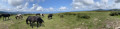
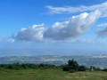
Le Gartzin and the Erentzazu Tower

A circular route starting from Ibardin to climb the Gartzin (also known as Lartzin) and then walk around the Erentzazu.

Details

4348471
Creation:
Last update:
Last review:
  • Walking
    Activity: Walking
  • ↔
    Distance: 3.78 mi
  • ◔
    Average duration: 2h 30 
  • ▲
    Difficulty: Easy

  • ⚐
    Back to start: Yes
  • ↗
    Ascent: + 830 ft
  • ↘
    Descent: - 830 ft

  • ▲
    Highest point: 1,335 ft
  • ▼
    Lowest point: 955 ft

Photos

Description of the walk

Park in the second car park on the right before reaching the ‘ventas’ area in Ibardin.

(S/E) Head back down to the roundabout at the pass and turn right towards Bera. At the first right-hand bend, turn left towards Okalarre and follow the road until you come to a wide track on the right.

(1) Turn onto the track on the right: this is the Haute Route Pyrénéenne. Follow it until you reach the first pidgeon hunting huts.

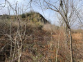
(2) Turn left onto the path heading north to go round the Gartzin.

(3) Turn left towards the south-west to climb up to the bunker.

(4) Return via the same path.

(3) Turn left to continue towards the Okalarre restaurant, passing it on the right. At the T-junction, turn right, then take the tarmac track branching off to the left, towards the Elzaurdia inn, as far as the border, and descend along the ridge to the right for 100 m.

(5) Turn left along the hillside to rejoin theGR®10Pyrenees Crossing.

(6) Turn left to head back up towards the pass, which is overlooked by the Redoute des Émigrés.

(7) Turn right towards the Col d’Ibardin to return to the car park (S/E).

Waypoints

  1. S/E : mi 0 - alt. 1,070 ft - Las Ventas car park in Ibardin
  2. 1 : mi 0.48 - alt. 1,115 ft - Pyrenean High Route - Col d'Ibardin
  3. 2 : mi 1.15 - alt. 955 ft - Path to the left of the line of pidgeon hunting huts
  4. 3 : mi 1.55 - alt. 1,142 ft - Path on the left towards the summit
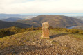
  5. 4 : mi 1.7 - alt. 1,257 ft - Gartzin
  6. 5 : mi 2.76 - alt. 1,145 ft - 350-metre contour line on the ridge
  7. 6 : mi 3.06 - alt. 1,112 ft - The Pyrenees Crossing (GR°°®°°10)
  8. 7 : mi 3.39 - alt. 1,260 ft - Pass overlooking Ibardin
  9. S/E : mi 3.78 - alt. 1,070 ft - Las Ventas car park in Ibardin

Worth a visit

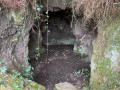
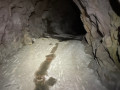
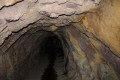
Visit the Peña Rata bunker; the tunnel is clean thanks to a central channel that drains the water.
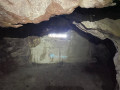
The tunnel is deep, has several exits and leads to a chamber offering a view of the Rhune through a loophole.
A head torch is useful to avoid bumping your head in the narrow passage, which is cramped in places.

Always be cautious and plan ahead when you're outdoors. Visorando and the author of this route cannot be held responsible for any accidents occurring on this route.

The GR® and PR® markings are the intellectual property of the Fédération Française de Randonnée Pédestre.

Reviews and comments

4.2 / 5
Based on 3 reviews

Reliability of the description
4.3 / 5
Ease of following the route
4.3 / 5
Route interest
4 / 5
User 12488982

Overall rating : 4 / 5

Date of your route : Dec 08, 2025
Reliability of the description : ★★★★☆ Good
Ease of following the route : ★★★★☆ Good
Route interest : ★★★★☆ Good
Very busy route : No

good hike with difficult elevation gain on a small section

Machine-translated

JEAN LUC MOUESCA
JEAN LUC MOUESCA

Overall rating : 5 / 5

Date of your route : Sep 08, 2025
Reliability of the description : ★★★★★ Very good
Ease of following the route : ★★★★★ Very good
Route interest : ★★★★★ Very good
Very busy route : No

A very well-explained tour.
Splendid views.
A very positive point: "discovering the tunnel and its arrow slits".
Avoid this hike when wild boar hunting is in progress, which was the case this Sunday. You fear that a wild boar will charge out at any moment as soon as you hear the barking of hunting dogs getting closer!

Machine-translated

Pascal (Arbonne)
Pascal (Arbonne)

Overall rating : 3.7 / 5

Date of your route : Jan 14, 2025
Reliability of the description : ★★★★☆ Good
Ease of following the route : ★★★★☆ Good
Route interest : ★★★☆☆ Average
Very busy route : No

The first section of the route (the Gartzin loop) features numerous muddy sections, which aren’t always avoidable.
The route up to the summit of the Gartzin leads to a cave overgrown with vegetation; it’s impossible to reach the top this way. You’ll need to follow a path a little way beyond the marked route.
Also worth noting is a tricky descent to reach point 5, as it is quite steep and very slippery even with very good footwear, and features fairly large rocks. You need to stay focused on where you’re putting your feet!
Finally, the last descent beyond point 7 across a meadow is also tricky and requires a fair bit of concentration.
I’d recommend doing this walk after a good spell of dry weather so you can enjoy the lovely scenery in peace.

Machine-translated

Other walks in the area

For more walks, use our search engine .

The GPS track and description are the property of this route's author. Please do not copy them without permission.