From Cailhol to Saint-Jean-de-Minervois via Paguignan

A circular route through the heath that will take you from Paguignan towards the road to Saint-Jean-de-Minervois, passing through the Muscat vineyards.

Details

11625295
Creation:
Last update:
Last review:
  • Walking
    Activity: Walking
  • ↔
    Distance: 4.77 mi
  • ◔
    Average duration: 2h 35 
  • ▲
    Difficulty: Moderate

  • ⚐
    Back to start: Yes
  • ↗
    Ascent: + 443 ft
  • ↘
    Descent: - 417 ft

  • ▲
    Highest point: 846 ft
  • ▼
    Lowest point: 427 ft

Description of the walk

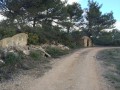
Park behind the Paguignan cemetery.

(S/E) Leaving the hamlet of Paguignan behind you, go round the cemetery and turn right onto the D132 heading north-west, crossing the first bridge.
Cross another small bridge (with a green railing) and continue uphill to the hamlet of Cailhol.

(1) At the wayside cross on the left, leave the road and head down to the right into the hamlet via Rue du Centre. Drinking water point on the low wall. Walk right through the hamlet.
At the end of the hamlet, cross a small bridge and turn left onto the dirt track that leads uphill.
In winter, if the river is flowing, as you pass the picnic table, you can see a small pool with a little waterfall!

(2) At the fig tree on the right, just after passing a large house on the right, continue straight ahead for about 600 metres.

(3) Then take the tiny, barely visible path on the left that leads downhill. Cross a ford and head back uphill along a fairly steep, stony slope.

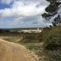
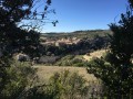
(4) Pass by several viewpoints overlooking the cliffs of La Cessière.

(5) At the vineyard, turn left and walk round it. Pass a partially collapsed shelter and follow the farm track.

(6) You’ll reach another vineyard; turn right to reach a crossroads where six paths meet.

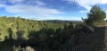
(7) Head right-hand side, then leave the vineyards to pass through the heath. Turn left to pass through the vineyards again.
Turn left to go round a vineyard on the left-hand side.
After 50 m, turn right, keeping a hedge on your left.
At the copse, turn left and then right to go round a vineyard and join the tarmac road.
Watch out for traffic. Walk 500 m along the road and look for a path on the right just before a fork in the road.

(8) Leave the road and follow this track, which joins the farm track to the right; follow it for 1.5 km.
Ignore the track that climbs up to a farm building on the left above. Look out for a cairn (if it hasn’t been destroyed) and take the path on the right which descends and rejoins the crossroads you passed on the way out (fig tree).
''Carrying on straight ahead, you can reach the starting point: Paguignan Cemetery''.

(2) Turn left towards the south-east and follow the route in reverse to reach the car park behind Paguignan Cemetery (S/E).

Waypoints

  1. S/E : mi 0 - alt. 433 ft - Paguignan Cemetery. Towards the bridge at the - Cessière (rivière) - Affluent de la Cesse
  2. 1 : mi 0.46 - alt. 472 ft - Place de Cailhol
  3. 2 : mi 0.85 - alt. 558 ft - Fig tree. Junction of the circular loop
  4. 3 : mi 1.1 - alt. 604 ft - Turn left. Combe Naurèle
  5. 4 : mi 1.31 - alt. 679 ft - Viewpoints
  6. 5 : mi 1.53 - alt. 709 ft - Vineyard on the left
  7. 6 : mi 1.83 - alt. 784 ft - Vigne: turn right
  8. 7 : mi 2.17 - alt. 846 ft - Crossroads of 6 paths
  9. 8 : mi 2.89 - alt. 748 ft - Cairn. Path on the right, heading downhill
  10. S/E : mi 4.77 - alt. 433 ft - Paguigan Cemetery

Notes

(1) The only source of drinking water on the route.
- Take plenty of water with you.
- Remember to protect yourself from the sun: in summer, at the height of the day, temperatures can exceed 35°C in the shade, which is scarce on this route!
- Respect the hunters’ hides!
- From 15 August to early March, watch out for driven hunts. If possible, wear bright colours or a high-visibility vest.

There are no major difficulties on the route.

If possible, use the app to navigate.

Please note that, at present, a large part of the route is in a ‘white zone’ (no mobile network coverage), so remember to let your loved ones know where you’re going and to download the map before setting off.

Worth a visit

In the hamlet of Cailhol, you can visit the cellars of Domaine Gautrand.
After the walk, you could also go and sample (in moderation) the Muscat de Saint-Jean-de-Minervois.
There’s a bakery and patisserie in the village of Aigues-Vives, on Route de Saint-Pons (opposite the co-operative wine cellar).

Reviews and comments

4.5 / 5
Based on 2 reviews

Reliability of the description
4 / 5
Ease of following the route
5 / 5
Route interest
4.5 / 5
jp11
jp11

Overall rating : 4.7 / 5

Date of your route : Dec 07, 2023
Reliability of the description : ★★★★★ Very good
Ease of following the route : ★★★★★ Very good
Route interest : ★★★★☆ Good
Very busy route : No

This walk offers the advantage of choosing between several routes: the one shown on the map, as well as the signposted routes that intersect with it. Once you’re on Route 7, you’re very close to the village of Saint Jean de Minervois. Why not head over to the distinctive, easily visible mill and pop into the nearby wine cellar to buy some Muscat for the return journey (the best in the region, in our opinion)?

Machine-translated

cigale60
cigale60

Overall rating : 4.3 / 5

Date of your route : Mar 20, 2023
Reliability of the description : ★★★☆☆ Average
Ease of following the route : ★★★★★ Very good
Route interest : ★★★★★ Very good
Very busy route : No

A lovely little spring walk; views, flowers, vineyards. I would have included the orange/red and yellow markings we were following. Too hot in the height of summer, but perfect the rest of the year!

Machine-translated

Other walks in the area

For more walks, use our search engine .

The GPS track and description are the property of this route's author. Please do not copy them without permission.