Country:
 City:


Car park located at Place du Champ de Foire, 5–7 Rue des Pungeoirs.
(S/E) Turn right onto Avenue Kléber, then turn left onto Rue des Fossés.
Red and white signposting forthe GR® 37
(1) At the junction, carry on straight ahead, then turn immediately right to pass in front of the post office. Carry on straight ahead along a grassy, downhill path until you reach a road.
Off the route: turn left to reach the Fontaine de l’An II on the banks of the Loysance. A short circular route across the river takes you back onto the main route.
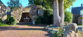
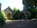
Turn right, then left, onto Rue de Pontorson. As you cross the bridge over the Loysance, look out for the old washhouse and courtyard on the left, restored by the local council.
(2) Follow Route de Pontorson to the left for just under a hundred metres, then turn right onto the D15, Rue de Saint-Ouen. Immediately take the path on the left heading north-east, which leads to a farm track.
(3) Turn right. Cross the D15 and continue straight ahead, veering slightly to the right. At the end of this path, which narrows to a track, you’ll reach the D296. Follow this to the right for 100 metres, then take the road on the left for a few hundred metres.
(4) Turn right and walk through the hamlet. Just past the last house, follow the footpath to the right which, as it descends, leads to the Greenway; take this to the left. Walk alongside the Loysance, first on your right and then quickly on your left.
Through the trees, you can see, on your left, first the Moulin du Rocher and then the Moulin de Folleville.
Continue along the Voie Verte until you reach a stone bridge spanning the Loysance.
(5) Leave the Voie Verte to the right. Follow the path as it loops round to cross the river via the bridge mentioned earlier, then head north-east until you reach a road. Follow this road to the right for 100 metres and continue to the right towards the Moulin de la Chattière and the Bas Manoir.
When you reach the sign for the Moulin de la Chattière, continue to the left and cross the bridge over the Douétel.
Yellow markings for the Loysance route
(6) Just after the bridge, let theGR® head off to the left and carry on straight ahead. Ignore the road to La Pénaie on the left and, at the Corderie junction, carry on straight ahead. Pass through Les Champs Blancs and reach the D155.
(7) Cross it with great care. Carry on straight ahead and, just before the houses, turn immediately right onto a small path running almost due north alongside the departmental road. It then branches off westwards, runs alongside an industrial estate and crosses a road.
(8) Cross a second departmental road , again with great care , and carry on straight ahead. Turn right twice to go round the waste disposal centre, keeping a lake on your right. Continue northwards.
Red and white markings forthe GR® 39
(9) As theGR® 39approaches from the left, carry on straight ahead. Walk alongside La Saudraie, cross Les Fossés and continue northwards along a sunken track until you reach a road. Take the road on the right and carry on straight ahead at the next junction. Continue until you reach a crossroads.
(10) Turn left a few metres before the departmental road and follow it for 500 m. Before the trees on the right, veer right onto a log staircase and cross the departmental road with care to take the path opposite, slightly to the left. Cross the Square du Champ Buffé and continue along the road to the junction.
No signposting
Turn left onto Rue des Pungeoirs and you’ll come to the fairground on your right (S/E).

 Association / Club / Walk leader
 Easy

 Visorando Member