Between the summits of Lure and L’Homme

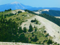
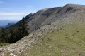
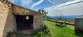
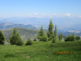
Whilst the Montagne de Lure may not be as well-known, publicised or popular as Mont Ventoux, it is no less interesting for its 360° panoramas and vantage points, offering views of the mountain ranges to both the north and the south.
It is, quite simply, magnificent on a clear day once the morning mist shrouding the surrounding valleys has cleared!
Far off to the north, even in summer, you can catch a glimpse of the eternal snows on certain Alpine peaks.

Details

100408493
Creation:
Last update:
Last review:
  • Walking
    Activity: Walking
  • ↔
    Distance: 7.19 mi
  • ◔
    Average duration: 5h 05 
  • ▲
    Difficulty: Moderate

  • ⚐
    Back to start: Yes
  • ↗
    Ascent: + 2,054 ft
  • ↘
    Descent: - 2,060 ft

  • ▲
    Highest point: 5,971 ft
  • ▼
    Lowest point: 5,151 ft

Photos

Description of the walk

Car park below the summit of Montagne de Lure.

(S/E) Cross the D53 road and take the path that winds its way up towards the mobile phone masts.

(1) Take the track on the right, towards the summit. Go through the fences to admire the view to the north.

(2) Turn back.

(1) Carry on straight ahead and follow the ridge path.

(3) Ignore the path on the left. Leave the GR® / GRP® trails and head straight on along the ridge.

(4) At Les Barres, ignore the path on the left. Join the GRP® again and follow it straight ahead.

(5) Shortly after the Crête des Cavalets, ignore another path on the left. Continue straight ahead on the GRP®.

(6) Ignore the GRP® path on the left. Continue straight ahead along a ridge path to reach the Sommet de l’Homme (elevation 1640).

(7) Return to the car park via the same route as on the way there (S/E).

Waypoints

  1. S/E : mi 0 - alt. 5,735 ft - Car park below the summit of Montagne de Lure
  2. 1 : mi 0.48 - alt. 5,896 ft - Relay station
  3. 2 : mi 0.67 - alt. 5,971 ft - Montagne de Lure (1825m)
  4. 3 : mi 1.57 - alt. 5,656 ft - Junction
  5. 4 : mi 2.06 - alt. 5,259 ft - Junction
  6. 5 : mi 2.56 - alt. 5,554 ft - Junction
  7. 6 : mi 2.96 - alt. 5,384 ft - Junction
  8. 7 : mi 3.59 - alt. 5,374 ft - Sommet de l'Homme (1640m)
  9. S/E : mi 7.19 - alt. 5,735 ft - Car park below the summit of Montagne de Lure

Notes

Mountain hike.

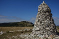
There are no benches, picnic tables or anything else along the route. Just stones and a few cairns!

Please note: for once, the suggested walk is not circular, which means that once you reach the end point, you’ll need to choose a route to get back to the starting point.
The simplest, shortest and least difficult option is to retrace your steps in the opposite direction, as suggested here. All other options are longer and involve greater elevationgainand a longer walking time.
In short: don’t forget to at least double the distance and add up the elevation gain and loss to get back to the starting point.

Another point to bear in mind: the car park at the foot of the Sommet de Lure has absolutely no shade, nor does the route itself. In summer, it’s best to set off at the crack of dawn!

Always be cautious and plan ahead when you're outdoors. Visorando and the author of this route cannot be held responsible for any accidents occurring on this route.

The GR® and PR® markings are the intellectual property of the Fédération Française de Randonnée Pédestre.

Other walks in the area

For more walks, use our search engine .

The GPS track and description are the property of this route's author. Please do not copy them without permission.