Country:

 City:
City:


Park in the Jas des Bailles car park, a large car park situated before the Jas.
(S/E) Follow the GRP® Traversée des Préalpes – Montagne de Lure trail (yellow and red markings) for 200 metres to the left, heading west. Continue until you reach the junction with the Chemin de Sara.
(1) Leave the GRP® and turn right onto the Chemin de Sara, marked in yellow. Cross the Ravin du Grand Vallon, then climb the winding path up the southern slope of the Montagne de Sumiou. You’ll reach a junction below the Pas de Sumiou, where there are signposts.
(2) Continue leftwards uphill towards the Jas de Madame. After a few hairpin bends, you’ll reach a ridge.
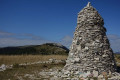
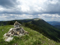
(3) Take the path on the left; further on, you’ll come to the Route Forestière de Sumiou. Follow this almost flat path to a fork marked by a cairn at elevation 1219.
(4) Leave the forest road and take a narrow track that climbs to the right amongst limestone slabs and box trees. Take care here: the path becomes unclear, but it is easy to cut straight across to reach the shoulder of the Montagne de Sumiou.
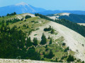
(5) Keep to the right on the ridge and head eastwards towards the summit, the highest point of the hike at an altitude of 1402.
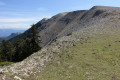
(6) Descend as the terrain suggests, staying on the ridge. The boxwood becomes denser and requires a bit of careful navigation to find a way through. When you reach a track, follow it downwards. After two bends – first left, then right – you’ll come to a crossroads of tracks.
(7) Take the grassy track on the left. You’ll soon reach the paragliding take-off area by the cliff.
(8) Walk along the right-hand side of it and then head for the junction on this ridge which you passed earlier on the way there.
(3) Turn right and retrace your steps along the route you took on the way out to return to the Jas des Bailles car park (S/E).
 Visorando Member

 Very difficult
  Easy
Easy