Country:
 City:
City:


To reach the starting point, on the Route des Grands Crus (D122) at the junction with the Domaine Bonnes Marres, between Morey-Saint-Denis and Chambolle-Musigny, take the tarmac road that climbs up through the vineyards. Once you reach a flat area, you can park there.
Yellow signposting
(S/E) Walk up the path, go through the gate and continue to the first junction (signposted). Follow the path which climbs to the left (marked ‘Parcours Batier, easy variant’). Follow it for about 500 metres to the junction at elevation 405.
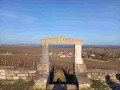
(1) Leave the main path and turn left, following the markings to the edge of the cliffs and the sign for “Sentier Batier”. View of the rolling mill, 30 m (see photo). Climb down to the rolling mill. (Steep, downhill path between two cliffs – proceed with caution). You’ll reach the D122 (climb down).
Cross the road and head down into the Combe opposite. At the bottom, turn left, then take the path on the right which leads uphill. At the top, you’ll find signposting: to the left, marked ‘Difficult section’; to the right, ‘Route de la Chapelle’.
(2) Turn right directly beneath the cliff; for safety’s sake, it is best to have a rope.
Follow the Chemin de la Chapelle and follow the clearly marked signposts. After about 400 m, turn left and descend the Combe to a chapel. Walk past it; the signpost is a few dozen metres to the right.
(3) Turn right, straight up the slope, to the top of the hill; the climb is steep. Turn left and follow the path for about 1 km until you come to a tarmac road. Cross it, then continue straight ahead along the path until you reach a gate and an information sign. Follow the signposts whilst staying on the path, descending into the Combe d’Orveaux (path, scree).
(4) Turn right at the bottom and walk up the valley to the signpost indicating a right turn. Climb a fairly steep scree slope to the top, turn left, then left again. The path goes round the cliffs and descends.
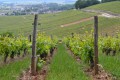
(5) At the bottom, turn left (signposted), then head uphill for about 300 m. At the crossroads, follow the path to the left. On emerging from the woods, continue straight on into the vineyards. After about 500 m (vineyards on the right, woodland edge on the left), a sign on a board reads ‘Clos de Vougeot’.
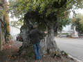
(6) Turn right between the vineyards (wide path). Continue until you reach a path coming from the right (stone table, large cherry tree). Do not take this path; carry on straight ahead for several hundred metres until you reach the D109.
(7) Turn left and follow the road down for about 200 metres. Whilst the Sentier Batier continues to the right, into the woods, carry on straight ahead towards Vosne-Romanée. Walk down the road for about 1.3 km, passing the first vineyards. Ignore the first three vineyard paths on the left and carry on towards Vosne-Romanée until you reach the sign for “Romanée-Saint-Vivant Grand Cru”.
(8) Take the tarmac road on the left which leads, after just over 1 km, to the Château du Clos de Vougeot. Go past the château until you reach the Y-junction and the signposts. Ignore the sign for Vougeot on the right and continue left along the tarmac road until you reach a junction with a path that climbs up through the vineyards. This is theGRP® des Grands Crus.
(9) Turn left onto it and follow it for approximately 1.5 km. Follow it as far as Chambolle-Musigny. Walk straight through the village until you reach the D122h. Cross the road; opposite you’ll see signs for the ‘Sentier Batier – easy route’. Walk straight up the concrete path to the last house, then take the path that leads back to the start (S/E).



 Visorando Member
 Moderate
 Easy
Easy