Country:
 City:
City:


Park in the car park on the Mantuan Forest Road, above Curley. When travelling from Chambœuf to Curlay, you can access this forest road by following the D122H for about 100 m towards Chambolle-Musigny, then turning right.
(S/E) Retrace your steps until you reach the junction with a path branching off to your right, which runs alongside the Mantuan plateau and its woodland.
(1) Follow the track for just over 1 km, passing a track that leads back down towards the fields, until you reach the junction with a track that climbs at a right angle to your right.
(2) Take this path, which climbs through the forest towards the plateau and the high-voltage power line that cuts right across it, until you reach the foot of the power line.
(3) Take the path on the right which passes under the power line until you reach the forest track that runs in a straight line across the Mantuan forest plateau from north to south.
(4) At the junction with the Mantuan Forest Road, turn left onto it, heading due south, for about 200 m.
(5) Turn right onto the first track, which heads south-south-west for about 500 m until you reach the edge of the plateau.
(6) Turn onto the track that runs along the top of the western slope for just over 600 m, until you reach the second high-voltage power line. Enjoy the view from the viewpoint over the Butte de Vergy and the village of Reulle-Vergy.
(7) At the viewpoint, head down the steep path on your right and follow it to Reulle-Vergy town hall.
(8) Take the path leading back up towards the plateau on your right, below the pumping station, then at the top of the climb, walk along the western side of the Mantuan plateau, keeping to the left for about 2.5 km. You will then arrive directly at the car park (S/E).
 Visorando Member
 Moderate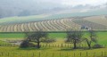
 Difficult