Between Woodland and Orchards in Saint-Hilaire-Saint-Mesmin

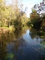
A walk from Saint-Hilaire to Saint-Mesmin where woodland and orchards lie side by side. A very pleasant route where the built environment blends perfectly with nature. The signposting isn’t particularly clear, and after several wrong turns and a few back-and-forths to find the right path, this route proves to be enjoyable.

Details

350383
Creation:
Last update:
Last review:
  • Walking
    Activity: Walking
  • ↔
    Distance: 8.39 mi
  • ◔
    Average duration: 3h 50 
  • ▲
    Difficulty: Moderate

  • ⚐
    Back to start: Yes
  • ↗
    Ascent: + 16 ft
  • ↘
    Descent: - 16 ft

  • ▲
    Highest point: 348 ft
  • ▼
    Lowest point: 315 ft

Description of the walk

Start from the car park at the Saint-Hilaire-Saint-Mesmin post office (maps are available there).

(S/E) Cross the Route d’Orléans and head to the right. Take the first left onto Allée d’Erkeim (primary school). Follow this road and continue straight on
Join Rue de la Franquette and turn left. Continue to the junction with Rue de la Gobette.

(1) Turn right onto it, then, at the road sign, turn right onto Chemin des Buttes.

(2) You’ll come to a sandy track, the Chemin de la Franquette; take it to the left. Go to the end of the track and turn left onto the Chemin du Tonnerre. You’ll reach the tarmac road, which is none other than Rue de la Gobette. Turn right and follow the yellow markings.
You’ll come to the ‘Give Way’ sign.

(3) Continue straight on along the narrow path (Chemin de l’Allée). Pass under the power lines and reach the access road to Folleville Castle.

(4) Turn right onto the wide track towards Les Muids. Take a small forest path on the left, then turn right onto the Chemin du Grand Chêne. When you reach a small junction, turn slightly left onto the Chemin des Ajoncs. At the next junction, continue along the Chemin des Maisons Brulées. You’ll come to another crossroads.

(5) Facing the Chemin des Mazureaux, turn left onto the Chemin des Grandes Charennes. Carry on straight ahead until you reach a large crossroads, ignoring all the paths branching off to the right or left.

(6) Turn left (signposted) onto the Chemin des Marinières. You’ll reach another junction near the A71.

(7) Take the first path on the left, which runs alongside and then away from the motorway. You’ll reach the junction with theGRP® Sentier Historique de la Vallée des Rois.

(8) Follow this path to the left for a few metres.

(9) Leave it on the right, taking the Chemin des Mauridets. Further on, cross Rue de Quincaille.

(10) Finish by turning left onto the Chemin de la Bachelande. You’ll come back onto Rue de la Gobette. Turn right onto it. Continue to the junction with Rue de la Franquette.

(1) Stay on this street, turn left into Rue du Four à Chaux, then left again at the junction.
Walk round the Vergers nursery school and return along Allée d’Erkeim to the starting point (S/E).

Waypoints

  1. S/E : mi 0 - alt. 331 ft - Post Office car park
  2. 1 : mi 0.35 - alt. 328 ft - Stop sign
  3. 2 : mi 0.66 - alt. 331 ft - On the left, Chemin de la Franquette
  4. 3 : mi 1.12 - alt. 335 ft - Give Way sign
  5. 4 : mi 1.7 - alt. 338 ft - Allée du Château de Folleville
  6. 5 : mi 2.84 - alt. 335 ft - On the left, Chemin des Grandes Charennes
  7. 6 : mi 3.82 - alt. 318 ft - On the left, Chemin des Marinières
  8. 7 : mi 5.08 - alt. 328 ft - Path on the left before the A71 motorway
  9. 8 : mi 6.31 - alt. 341 ft - Junction with the GRP
  10. 9 : mi 6.63 - alt. 338 ft - Chemin des Mauridets, on the right.
  11. 10 : mi 7.67 - alt. 328 ft - On the left, the Chemin de la Bachelande
  12. S/E : mi 8.39 - alt. 331 ft - Post Office car park

Notes

Nothing of note

Worth a visit

Orchards, Wildlife, Flora, Woodland

Reviews and comments

4.2 / 5
Based on 3 reviews

Reliability of the description
4 / 5
Ease of following the route
4 / 5
Route interest
4.7 / 5
01143346
01143346

Overall rating : 3.7 / 5

Date of your route : May 22, 2019
Reliability of the description : ★★★☆☆ Average
Ease of following the route : ★★★☆☆ Average
Route interest : ★★★★★ Very good

The walk is very nice, but the directions are sometimes a bit haphazard (path names aren’t signposted). Also, the estimated time is greatly exaggerated.

Machine-translated

debch
debch

Overall rating : 5 / 5

Date of your route : Nov 04, 2017
Reliability of the description : ★★★★★ Very good
Ease of following the route : ★★★★★ Very good
Route interest : ★★★★★ Very good

Brilliant! A really varied walk – we go through woods and across the countryside, and the paths are lovely, although you do have to watch out for the odd reckless cyclist who doesn’t seem to realise there are walkers around...
A few shots fired by hunters gave some members of our group a bit of a fright...

Machine-translated

Patou45
Patou45

Thank you for your feedback. I know that sometimes the signs are missing and, like you, I was only able to find my way thanks to my map
Kind regards
Patrick

Machine-translated

ASPTTrando_ML
ASPTTrando_ML

Overall rating : 4 / 5

Date of your route : Aug 27, 2017
Reliability of the description : ★★★★☆ Good
Ease of following the route : ★★★★☆ Good
Route interest : ★★★★☆ Good

A pleasant route… much of it takes you through the woods, which is lovely at this time of year when the sun is shining. Watch out for the lack of signposting between points 7 and 9… you can find your way using the map… but there are no signs on the ground… which can be a bit of a nuisance.

Machine-translated

Other walks in the area

For more walks, use our search engine .

The GPS track and description are the property of this route's author. Please do not copy them without permission.