Country:
 City:
City:




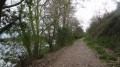

The walk starts from the car park, situated near the Loire on Rue du Château. This road passes in front of the Town Hall of La Chapelle-Saint-Mesmin
White-and-red markings (GR®3)
(S/E) Head down towards the Loire via Rue du Château, then turn left onto the path running along the riverbank, known as the Chemin de la Chapelle à Orléans. Pass Saint-Mesmin Church and follow this well-marked path, ignoring the path leading downhill towards the Loire.
(1) At the fork in the road, just before the bridge over the A71 motorway, keep to the right. What has become the Chemin des Perrières eventually meets the tarmac and some buildings.
No signposting
(2) Turn right downhill towards the Loire just before the chicane and Rue de la Roche on your left. Take the towpath on the right, passing under the motorway bridge again. Stay level with the river, ignoring the paths on the right that lead up the hillside.
(3) When you reach a cross-path, turn left to get closer to the river. The towpath runs alongside a cyclo-cross route on your right and then, 300 metres further on, climbs quite steeply up the hillside.
White-red markings (GR®3)
(4) Once on the hillside, turn right onto the Chemin de la Levée. Continue along this path until you come to a stabilised track crossing it.
(5) Turn right onto the hard-surfaced track and ignore the side paths.
(6) At the junction, do not continue along the road but keep left onto the parallel path, the Sentier du Cèdre. This eventually winds its way up towards the care home. Turn right to go round the large building. When you reach the roundabout, take the first street on the right, heading downhill towards the Loire alongside the Town Hall – Rue du Château – to return to the starting point (S/E)


 Visorando Member
 Moderate




 Difficult