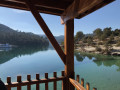
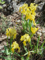
Between Allemagne-en-Provence and Montagnac-Montpezat

A circular walk starting from Allemagne-en-Provence towards Montagnac, passing by the Chapel of Saint Mark, the Puberclaire plateau and Montagnac (which we visit), and returning via the plateau above the north-facing slope of the Montagnac valley.

Details

n°27659634
Creation:
Last update:
Last review:
  • Walking
    Activity: Walking
  • ↔
    Distance: 10.64 mi
  • ◔
    Average duration: 5h 35 
  • ▲
    Difficulty: Moderate

  • ⚐
    Back to start: Yes
  • ↗
    Ascent: + 817 ft
  • ↘
    Descent: - 817 ft

  • ▲
    Highest point: 2,018 ft
  • ▼
    Lowest point: 1,394 ft

Description of the walk

The walk starts in Allemagne-en-Provence, at a small car park at the junction of the D952 (Gréoux-les-Bains / Riez) and the D111 towards Montagnac.

(S/E) Head towards Riez on the D952, crossing the bridge over the stream. After 30 metres, take a track on the right at the small signpost, and follow the narrow path on the right up to the mast.

(1) After the mast, carry on straight ahead along the narrow path leading up to the Chapelle Saint-Marc, pass to the left of the chapel and continue straight ahead along a track until you reach a Y-junction.

(2) Take the track on the right, Chemin de Puberclaire, carry on straight ahead and you’ll come to a field.

(3) Turn left and continue along the main track until you reach a T-junction.

(4) Turn right and carry on straight ahead until you reach a junction (elevation 607).

(5) At the edge of a small wood, in Sabarnaud, carry on straight ahead until you reach a fence.

(6) 2 m past this fence by the cottage, take a small path leading down to the right (the start of this little-used path is hard to spot), then continue along this path until you reach the road.

(7) Turn left onto the road. At the next junction, carry straight on along the uphill road, Chemin des Ferrailles, to the top of the hill.

(8) Turn left, then at the Y-junction, veer right to reach the end of Place de l’Horloge.

(9) Turn right onto Rue Guillaume Aristibe and follow it to the end.

(10) At the bottom of the street, take the second street on the right, Rue de la Banette, then the first on the left, Rue du Puits de l’Hubac, and join the Route d’Allemagne.

(11) Carry on straight ahead along the small road, which turns into a track and joins another small road.

(12) Follow it to the right, then carry on straight ahead along Chemin d’Allemagne and then Chemin des Plaines, to cross the entire plateau and join the D15 or Route de Quinson.

(13) Then take the first road on the right, Chemin de Rumpecuou, and head down to the entrance to the village.

(14) Turn right, carry on straight ahead, then turn right onto Chemin Notre Dame des Grâces, passing by the chapel. When you reach Route de Montagnac, turn left to reach the car park (S/E).

Waypoints

  1. S/E : mi 0 - alt. 1,394 ft - Junction of the D952 and D111
  2. 1 : mi 0.25 - alt. 1,663 ft - Branch
  3. 2 : mi 0.58 - alt. 1,781 ft - St Mark’s Chapel
  4. 3 : mi 1.46 - alt. 1,916 ft - In front of the field
  5. 4 : mi 1.93 - alt. 1,929 ft - Vaugiscle
  6. 5 : mi 3.59 - alt. 1,988 ft - Sabarnaud
  7. 6 : mi 4.04 - alt. 1,988 ft - Closing of the pavilion
  8. 7 : mi 4.35 - alt. 1,808 ft - Chemin des Ferrailles
  9. 8 : mi 4.56 - alt. 1,923 ft - Street beneath Le Barry
  10. 9 : mi 4.68 - alt. 1,952 ft - Place de l’Horloge
  11. 10 : mi 4.73 - alt. 1,916 ft - Rue de la Banette
  12. 11 : mi 4.81 - alt. 1,850 ft - Route d’Allemagne
  13. 12 : mi 5 - alt. 1,962 ft - Chemin d’Allemagne
  14. 13 : mi 9.85 - alt. 1,759 ft - The Quison Road
  15. 14 : mi 10.25 - alt. 1,473 ft - The Conillet neighbourhood
  16. S/E : mi 10.64 - alt. 1,394 ft - Junction of the D952 and D111

Worth a visit

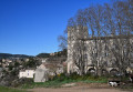
On the way up to the chapel, a view of the Château d’Allemagne.
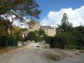
The Chapel of Saint Marc.
The Plaine de Puberclaire plateau with views of the mountains towards Moustier.
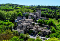
Visit to the village of Montagnac.
Return via another plateau with views of the mountains between Manosque and Sisteron.

Reviews and comments

4.7 / 5
Based on 1 review

Reliability of the description
5 / 5
Ease of following the route
5 / 5
Route interest
4 / 5
manonroro
manonroro

Overall rating : 4.7 / 5

Date of your route : Jan 23, 2024
Reliability of the description : ★★★★★ Very good
Ease of following the route : ★★★★★ Very good
Route interest : ★★★★☆ Good
Very busy route : No

A very easy walk; only the first part, up to the antennas, is relatively steep – the rest is very easy, though it can be a bit monotonous on the plateau. Avoid days when it’s very hot or windy.

Machine-translated

AUDO13
AUDO13

Thank you all

Machine-translated

LAURENT FRANCOIS
LAURENT FRANCOIS

Hello
No, the walk isn’t fully signposted, but it’s easy to follow and doesn’t go through private property
Kind regards

Machine-translated

AUDO13
AUDO13

Hello, is the walk signposted or not? Doesn’t it follow paths on private land? Thank you

Machine-translated

Other walks in the area

For more walks, use our search engine .

The GPS track and description are the property of this route's author. Please do not copy them without permission.